
Help support this site by using our Amazon or Six Moons Design buttons for any purchase
Susan Alcorn's Backpacking Tales and Tips Newsletters 2006
All Newsletters 2020 , 2019 , 2018 , 2017 , 2016 , 2015 , 2014 , 2013 , 2012 , 2011 , 2010 , 2009 , 2008 , 2007 , 2006 , 2005 , 2004Shepherd Canyon Books
25 Southwood Court
Oakland, CA 94611
Toll free number 866-219-8260 email backpack45 at
yahoo.com
Publisher of "We're in the Mountains Not over the Hill--Tales and Tips from Seasoned Women Backpackers."
If you would like me to remove your name from the newsletter e-mail list, please let me know. If you know anyone who wants to be added, please have them send me a message. Thanks.
Susan Alcorn's Backpacking/Hiking Tales & Tips #77 Dec 15, 2006
Dear Friends and Family,
I hope your holidays are filled with peace and joy--and that you can squeeze in
some great hikes between events.
Contents:
1. "Pilgrimage to America" details
2. National Outdoor Leadership School
3. "Climbing for Kids," Bay Area Wilderness Training
4. Yosemite's Tioga Pass closure
5. More trips for 2007
6. Susan's events' calendar
7. Red moon at night...
8. A backpacker's gratitude
#1. American Pilgrim Friends of the Camino has just posted the details of their
conference for 2007 in Williamsburg, VA. Download the registration forms at
their website: www.americanpilgrims.com
"The 10th Annual Gathering of Pilgrims is scheduled for March 9 through 11, 2007
in historic Colonial Williamsburg, Virginia. An added inducement, if one is
needed, is that 2007 is the 400th anniversary of the founding of Jamestown, the
first permanent English settlement in North America, and the
Jamestown-Williamsburg area will be alive with special events."
The 2007 theme will be "Pilgrimage to America". A small sampling of events
includes sessions about boots and backpacks, first aid for pilgrims,
photography, the pilgrimage phenomenon in ancient Greece and Rome, the
pilgrimages that formed early America, foods and wines of Spain and a
presentation by college students who trekked in 2005 and 2006. Performances of
Music of Pilgrimage. Medieval pilgrims and the Crusaders. And this is only a
partial list."
Travel and lodging information, including specific information about the
Williamsburg Days Inn Downtown, the official hotel for the 2007 Gathering, is
available for downloading. When you are ready to register, please download the
registration form and the registration payment form, then complete and mail
them."
On March 6 through 8, immediately before the Gathering, a training workshop for
future volunteer hospitaleros will be held in Williamsburg. Contact Daniel De
Kay for further information. Come join a pilgrimage that leads to Colonial
Williamsburg!"
#2. National Outdoor Leadership School (NOLS) is the "leader in teaching
wilderness skills." They offer 375 courses a year --including teaching the
skills to help you safely explore backpacking, kayaking, rock climbing, etc.
They also teach first aid, CRT, EMT, etc. classes. Go to: http://www.nols.edu/wmi/
The live you save could be your own.
#3. Join the Climbing for Kids Team. Bay Area Wilderness Training, which trains
leaders to get youth out of the city and into the wilderness, is offering
several challenges in 2007. You can climb Mt. Shasta, CA (July 13-16 and July
27-30; Mt. Rainier, WA (Aug., 2007); and Mt. Whitney, CA (April 26-30 and June
8-11, 2007. These climbs are projects of Earth Island Institute. Climbers will
need to raise $3200-$3,500 dollars; they will receive $1,500 of free gear. Also
provided to climbers: weekend training and pre-trip meetings, professional
mountaineering guides, ice axes, crampons, ropes, helmets, mountaineering boots,
food. "Good physical conditioning is required, but no previous mountaineering
experience is required." BAWT: "Getting Youth outdoors" www.batw.org. Info about
the climbs: www.climbingforkids.org
#4. Winter storms and cold weather brought the close of the Tioga and Glacier
Point Roads the last week of November. Snow and icy conditions persist
throughout the winter and often into early summer. While the Tioga Road through
Yosemite's high country will remain closed, a portion of the Glacier Point Road,
from Chinquapin to Badger Pass will reopen with the start of the Badger Pass ski
season. Badger Pass ski area is slated to open December 15th, conditions
permitting.
Ice and snow can exist on park roads at any time. Chains may become mandatory at
any time. Remember to carry chains in your vehicle when visiting the park in
winter. For information on road conditions in the park call (209) 372-0200."
And, there is currently snow on the valley floor.
#5. Marian Marbury of Adventures in Good Company sends the details about three
backpacking trips they have coming up next year. "The average age of our
participants is probably 50."
June 9 - 16, 2007: Backpacking the Appalachian Trail: An Introduction to
Lightweight Backpacking On this trip we backpack along one of the Appalachian
Trail's most interesting sections, from Fox Creek to Wise Mountain, at the
height of the rhododendron and azaleas. This is a perfect trip for beginners:
our moderate mileage leaves time for you to learn everything you need to know to
pursue backpacking on your own. Or if you haven't been backpacking for awhile,
join us to learn about the lightweight revolution. Our lightweight approach
should keep your pack under 30 pounds. $950 (deduct $50 if you register by 2/5)
Maximum group size is 10 M+
June 17 - 24, 2007: Backpacking the Appalachian Trail Section by Section We
continue our section hiking of the Appalachian Trail this year, from Virginia,
to the border of North Carolina. This year's section is one of the most scenic
of the entire trail, with several 5- 6,000-foot mountains and waterfalls only
accessible by foot. Backpacking experience required $950 (deduct $50 if you
register by 2/17) Maximum group size is 10 M+
September 29 - October 6, 2007: Backpacking through Two Billion Years of
Geologic History The Grand Canyon is truly one of the wonders of the world, and
its exploration is not to be taken lightly. Once away from the crowded rim, we
travel primitive paths, gather water from infrequent springs, sleep under the
stars, and experience our own insignificance. This journey is for experienced
backpackers who want to see one of the true wonders of the world from a
perspective that is only available to those who are willing to work for it. $995
(deduct $50 if you register by 5/29)
Adventures in Good Company, 5913 Brackenridge Ave Baltimore, MD 21212,
410/435-1965 or 877/439-4042 (toll free). visit our web site at http://www.adventuresingoodcompany.com
#6. New events on Susan's calendar: Thursday, March 22nd and 29th, 7:00-9:30
p.m. Orinda Community Center, Orinda, CA. "Self-Publishing Basics, instructor
Susan Alcorn. Join this class and learn how to get your book published.
Mainstream vs. self-publishing; how to prepare your manuscript; editing;
illustrations; printers; and launching your book." Class fee $50-$55,
info/register: www.ci.orinda.ca.us/parksandrec. (info only: 925-254-2445).
ARIZONA tour: Tuesday, March 6, 2007. REI Phoenix. 12634 N Paradise Village
Pkwy, Phoenix, AZ 85032, (602) 996-5400. Program with digital slide show on
Spain's Camino de Santiago. Wednesday, March 7, 2007. REI Tempe. 1405 W Southern
Ave., Tempe, AZ 85282. (480) 967-5494. (see Phoenix description).
In addition to the Bay Area events I listed last issue (details on our website
under "calendar"), we will also be doing the Camino program at the Berkeley REI
on Tues. March 20 and the San Carlos REI on Thur. March 15, 2007. All shows are
at 7:00 p.m. and free.
#7. "Red Sky in the morning, sailors take warning. Red sky at night, sailors
delight," according to the Library of Congress is true. The red morning sky may
indicate clouds moving in from the west; the red sky at night (sunset) indicates
clouds are moving away. (Info from Roberta Gonzales, Chron. Dec. 14, 1006, pg.
E8).
#8.From a Backpacker's Perspective: What We Can Be Thankful for This
Holiday Season
Adventures
Backpacks and Books
Companions and Cookstoves
Down Jackets
Eagles
Fleece
G.O.R.P.
Hiking Poles
Insoles
Journals
Kleenex
Llamas
Mountains
Nests
Owls
Purell
Quail
Rivers
Sunsets
Trail Angels and Trail Crews
Umbrellas
Vistas
Wildflowers and Waterfalls
Xeriscape
Yosemite
Zinc Oxide and Zippers
Happy trails,
Susan Alcorn
Susan Alcorn's Backpacking/Hiking Tales & Tips #76 Dec 1, 2006
Contents:
1. "Guest House"
2. Camino Route in Portugal
3. Something that WORKS for plantar fasciitis.
4. Early December Guide to the Sky
5. 2007 Hiking & Backpacking Adventures for you
6. Kilimanjaro or Bust!
7. More about towels
8. Author events in your area
#1. Helena of Portugal (a Camino friend) recently sent the following poem. I
found it quite meaningful and with the holidays upon us, a time that can be
rather hectic and stressful, it seems a perfect opportunity to consider its
message.
Guest House
This being human is a guest house.
Every morning a new arrival.
A joy, a depression, a meanness,
some momentary awareness
comes as an unexpected visitor.
Welcome and entertain them all!
Even if they're a crowd of sorrows,
who violently sweep your house
empty of its furniture,
still, treat each guest honorably.
He may be clearing you out
for some new delight.
The dark thought, the shame, the malice,
meet them at the door laughing, and invite them in.
Be grateful for whoever comes,
because each has been sent
as a guide from beyond.
~ Mevlana Jalaluddin Rumi ~
(1202-1273)
Helena added, "It was sent to a friend of mine by one of the hospitaleiros in
the Camino.
#2. Helena also mentioned that there has been a. a presentation in Astorga (to
all the different Camino associations) on November 22nd about the Camino route
in Portugal (Lisboa-Porto). There will also be a meeting in Lisbon in early
December.
#3. A stretch that REALLY works at preventing, or minimizing the problem of,
plantar Fasciitis. Heel To Heal: New Stretch Relieves Pain from Plantar
Fasciitis A new stretch is proving quite effective to help treat and potentially
cure plantar fasciitis, a condition that affects nearly 2.5 million Americans
each year. In a study recently published in Journal of Bone and Joint Surgery,
researchers found that patients suffering from the painful heel spur syndrome
had a 75 percent chance of having no pain and returning to full activity within
three to six months of performing the stretch. In addition, patients have about
a 75 percent chance of needing no further treatment.
The study is a two-year follow-up on 82 patients with plantar fasciitis, all of
whom were part of an original clinical trial of 101 patients in 2003. The
patients were taught a new stretch, specifically targeting the plantar fascia,
that was developed by Benedict DiGiovanni, M.D., associate professor of
orthopaedic surgery at the University of Rochester and author of the study, and
Deborah Nawoczenski, P.T., Ph.D., professor of physical therapy at Ithaca
College.
The stretch requires patients to sit with one leg crossed over the other, and
stretch the arch of the foot by taking one hand and pulling the toes back toward
the shin for a count of 10. The exercise must be repeated 10 times, and
performed at least three times a day, including before taking the first step in
the morning and before standing after a prolonged period of sitting. More than
90 percent of the patients were totally satisfied or satisfied with minor
reservations, and noted distinct decrease in pain and activity limitations. The
most common cause of heel pain, plantar fasciitis occurs when the plantar
fascia, the flat band of tissue that connects your heel bone to your toes, is
strained, causing weakness, inflammation and irritation. Common in middle-aged
people as well as younger people who are on their feet a lot, like athletes or
soldiers, people with plantar fasciitis experience extreme pain when they stand
or walk. Plantar fasciitis can be a frustrating experience, as the chronic cycle
of reinjury and pain can last for up to one year. DiGiovanni likens it to
pulling a hamstring, and continuing to run without proper stretching. "Walking
without stretching those foot tissues is just re-injuring yourself," he said.
Most physicians will recommend a non-surgical approach to treating plantar
fasciitis, advising a regimen of anti-inflammatory medications, foot inserts,
and stretches. Surgery occurs in about 5 percent of all cases, and has a 50
percent success rate of eliminating pain and allowing for full activity.
"Plantar fasciitis is everywhere, but we really haven't had a good handle on
it," said DiGiovanni. "The condition often causes chronic symptoms and typically
takes about nine to 10 months to burn itself out, and for people experiencing
this pain, that's way too long to suffer through it."
DiGiovanni should know. He's experienced plantar fasciitis first-hand. Deciding
to get some extra exercise on a golf outing one recent afternoon, he carried his
clubs around all 18 holes instead of taking an easy-going ride in a golf cart.
The next morning, he woke up with severe heel pain, which brought the topic of
his study close to home.
"We need to further optimize non-operative treatments prior to considering
surgical options," DiGiovanni said. "If you look at the results of the study, I
think we've succeeded."
Source: University of Rochester Medical Center, November 13, 2006 (This item was
previously sent by John Vonhof. You can subscribe to John Vonhof's ezine by
sending an e-mail to: FixingYourFeetEzine-subscribe@yahoogroups.com
#4. Early December Guide to the Sky: Fall moon December 4., Best Meteor shower
of the year is usually the Geminid shower, December 13-14. However, it is also
usually the COLDEST shower of the year. Look before midnight to avoid the added
light of the moon.
#5. 2007 Adventures ahead: CALL OF THE WILD (www.callwild.com) is offering
several great trips including a Grand Canyon Havasu Mule Pack (April 30-May 5
and a Yosemite Falls from the high country for beginners (July 20-22).
CAL ALUMNI through Cal Discoveries (calDiscoveries.com) is offering "Walking to
Santiago de Compostela, Spain" September 1-11. They will hike (with motorized
support) from Burgos (one of my favorite cities) to Santiago de Compostela on
2-6 hour hiking days. $4245 plus airfare.
The YOSEMITE ASSOCIATION has several snowshoe trips open this year (non-members
welcome). Dewey Point (Sat/ Jam 13); Badger Pass with a Naturalist (Sat. Jan
20); Full Moon Snowshoe (Fri. Feb. 2, a second trip on Sat. Feb. 3). Cost
members $70, non-members $82. Snowshoes provided. www.yosemite.org/seminars. On
Sunday, April 1, they offer a course in how to use hiking poles "to travel
further, faster, and longer on Yosemite's trails." ($64 member/$75 non-member).
SIERRA CLUB outings include many hiking trips. "Across the Dolomites of Italy
(Aug. 29-Sep. 7th;" perhaps the most unusual one is "Ititatrip: Dog Mushing in
Alaska: (Feb. 18-25). www.sierraclub.org/outings/ national or call 415-977-5522.
CALIFORNIA STATE PARK FOUNDATION reminds us that it's Elephant Seal walk season
at Ano Nuevo State Park (south of Half Moon Bay on hwy. 1). Reservations are
required during the season of Dec. 15, 2006-March 31, 2007. 800-444-4445. No
tour on Christmas Day; you have the best chance of getting a reservation for
these three-mile walks to see the elephant seals on weekdays.
Sutter Buttes hikes by MIDDLE MOUNTAIN Foundation. Travelers along highways 5,
20, and 99 have probably noticed these buttes an hour north of Sacramento,
California but until recently exploring them has been next to impossible because
the buttes (the smallest mountain range in the world) are surrounded by private
property. Now the public has been given the opportunity to see not only the
buttes, but also the new state land in nearby Peace Valley (that may become a
state park) by going on hikes organized by the foundation.
"The Hikes are held only during the spring and the fall. The Spring Hike Season
is late February to early May. The Fall Hike Season is mid-October to early
December.
Hikes are $35.00 per person unless otherwise noted. All hikes fill up fast...20
participants are allowed on most hikes. Hikes are provided on a reservations
only basis. You may request to be put on a waiting list for full hikes, in the
event of cancellations."
A day in the Buttes usually begins at 8:30 am and ends around 3:30 pm. Trips are
scheduled to proceed in all but the most severe weather conditions. Participants
in all hikes should be prepared to expect uneven footing, stepping over rocks
and boulders, crossing streams, and hill climbing. Spring hikers are likely to
encounter wet, squishy, ankle-deep grass, while fall trekkers will be contending
with thistles and stickers. Poison oak is abundant, but you will be warned of
its proximity. Rattlesnakes, though common in the warmer seasons, are usually
reclusive and inactive during our hiking seasons." www.middlemountain.org. For
scheduled hikes please contact Karen at: (530) 671-6116, or email her at:
mmfhikes@yahoo.com'
My thanks to Tom Stienstra "Outdoors" columnist for the S.F. Chronicle for
alerting us to this opportunity.
#6. Kilimanjaro or Bust! It's time to announce to the world--at least my corner
of the world--that Ralph, Grace L., and I are planning a trip to Africa early
next year. It all started when Grace wrote to ask if we had ever considered such
a trip. We hadn't, but going on an African safari has always been at the top of
my list as far as destinations go. So we are doing both--the climb, followed by
a short safari in Tanzania.
We're all hoping to keep whatever gains we've made this year backpacking and
hiking and to avoid succumbing to our normal holiday lethargy. Ralph and I are
either hiking or going to the gym six days a week. I alternate between, "What
I've gotten myself into?" and "I can do this!" The information from our trip
leaders explains that the demands are as much mental as physical.
The Tanzanian government requires that groups go with a guide. We did a fair
amount of research before signing up for our tour, and I like the fact that our
provider monitors our oxygen level twice daily, carries oxygen, and has other
emergency equipment. There are five routes up Kilimanjaro and two descent
routes. We are taking the Lemosho route because it starts at a lower elevation,
goes up more gradually than some, and travels through all many different zones
(jungle, heather, glacial, etc.). The distance is between 50-60 miles, elevation
19,340 ft.
If any of you have climbed the mountain, we'd love to hear about your
experience.
#7. Reader Barbara C. sends another suggestion for a lightweight towel. "I
always used cloth diapers. Their loose weave allows them to dry quickly." (ed.:
No word how disposable diapers would work!)
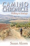
#8. Regional: Bay Area: Author events for "Camino Chronicle: Walking to
Santiago." Final event for 2006: Saturday-Sunday, December 9th and 10th. 10
a.m.-6 p.m. KPFA (94.1 FM) Crafts and Music Fair, San Francisco Concourse, 8th
and Brannan, San Francisco. Susan Alcorn will be signing her books, Camino
Chronicle: Walking to Santiago and We're in the Mountains not over the Hill:
Tales and Tips from Seasoned Women Backpackers, at the Ecology Center booth.
Also on site will be authors Adina Sara and Amy Gorman. www.kpfa.org/events.
2007 Camino shows (more coming soon!):
*Wednesday, January 10, 2007. 7:00 p.m. REI Corte Madera, 213 Corte Madera Town
Center, Corte Madera. (415) 927-1938. Susan and Ralph Alcorn will present a
digital slide show on Spain's famous pilgrimage route, the Camino de Santiago.
Free.
*Saturday, January 13, 2007. Bay Area Independent Publishers Association. BAIPA
meetings are held at the First Congregational Church, 8 North San Pedro Road,
San Rafael, CA 94903. Susan Alcorn will join a panel discussion on
self-publishing. Theme: "Finding inspiration in life's challenges." San Rafael,
CA. Go to baipa.net for program schedule and directions to the meeting place.
Open to the public. $3 members, $5 non-members.
*Wednesday, January 17, 2007. 7:00 p.m. REI San Francisco, 840 Brannan St., San
Francisco. (415) 934-1938. Susan and Ralph Alcorn will present a digital slide
show on Spain's famous pilgrimage route, the Camino de Santiago. Free.
*Wednesday, February 14, 2007. REI Mountain View, 2450 Charleston Rd. Mountain
View. (650) 969-1938. Susan and Ralph Alcorn will present a digital slide show
on Spain's famous pilgrimage route, the Camino de Santiago. Free.
*Friday, February 16, 2007. Sierra Club, Sierra Nevada Group, Seaman's Lodge,
Pioneer Park, Nevada City, CA. Susan and Ralph Alcorn will present a slide
program on Spain's famous pilgrimage route, the Camino de Santiago. In September
2001, Ralph and Susan set out across northern Spain on a 500-mile walk to
Santiago de Compostela.
Come walk with the Alcorns down from the Pyrenees, through the wine-growing
regions of Rioja and Navarre, across the blazing hot meseta, over the Cantabrian
mountain ranges, and into green Galicia. Learn first hand about the refugio
(hostel) system and where to find food and water along the path. Susan will read
short selections from her new book, Camino Chronicle: Walking to Santiago, to
introduce you to an intriguing land of beauty, history, and legend. You'll also
learn how it was to encounter 9-11 in a foreign setting far from friends and
family. Potluck 6:30 p.m., program 7:30-9:00 p.m. Copies of Camino Chronicle:
Walking to Santiago will be available for purchase. Info:
www.motherlode.sierraclub.org/sierranevada
Additional 2007 programs: Please our website for additions and corrections. We
expect to update our schedule with March programs in additional Bay Area REI
stores.
Happy trails,
Susan Alcorn
Susan Alcorn's Backpacking/Hiking Tales & Tips #75 Nov 10, 2006
Dear Readers,
1. Winner of our Camino prize basket
2. A towel for the Camino
3. Madeleine's Sierra 400+ mile trip.
4. Air travel: gels and liquids
5. Great Old Broads Auction
6. Regional: KPFA Art and Crafts Show
7. Regional: Hiking Club
8. Why this newsletter is shorter than usual
#1. The winner in our REI drawing of our basket of goodies--including an
autographed copy of Camino Chronicle: Walking to Santiago, is Bob Carson who
entered the contest at the Concord store. Congratulations to Bob--I'm waiting to
hear from him. Thanks to all who came to our slide presentations and who
participated in our contest.
#2. If you've read "Camino Chronicle" you know that I did not have the perfect
towel. I had cut my packtowel down and was always feeling chilled. Here's a
better idea from a Camino forum contributor (Patricia?): "I bought my camino
towel at the supermarket. It is what the Spaniards use to dry the dishes and it
comes in a package with the name 'ballerina' written on it, it is yellow and
costs 1 or 2 Euros.... it is very tiny but very absorbent and I saw many
pilgrims with this type of yellow dish cloth as a towel."
Other recommendations: +a cotton 'pareo' or 'sarong' for use as a towel, scarf,
blanket and skirt. +a sleeping bag to guarantee a clean bed. +showering with
clothes on and letting them dry the next day on the back of her backpack. (My
personal +approach is to drop my clothes on the floor of the shower and stomp on
them while I'm showering. Most things will get dry overnight--with the exception
of socks. ) +vapor rub on my feet to prevent blisters. +"cardio pants, the ones
I wear when I work out...easy to wash and very little space in the backpack."
#3. Madeleine's 400+mile Sierra backpack with her thoughts about going solo.
Hi Susan,
"... I only had 2 hours of rain in 49 days of hiking... climbed Mt. Whitney the
day after I turned 51, met a lot of back country rangers, had tons of flowers in
the first 3 weeks (bugs too) and altogether had a wonderful trip. ... I
certainly didn't meet any creepy people out there, so that was cool. Nearer to
big trail heads of course things were more crowded and there were day hikers,
but all in all, great people all the way!
I learned I love hiking alone, though actually wound up only being alone half
the time. others wanted to not only re supply me but join me, so that was cool.
Now I know I can do it any time...It was cool to go in one direction and look
back from the high passes and know I'd been way back there! 10 miles a day was
plenty for me as it kept me walking most of the day--get up in sun, stopping for
pictures, to meet people and take long lunches. But there still did not seem to
be enough time to swim and just hang out enough even at that pace!
...I saw 3 bears, though none were after my food, or me. It really became a
walking meditation on the parts where I was alone. Now I'm processing it all...
stay tuned.
You can read Madeleine's newspaper account by cut and paste:
nuggetnews.com
(About the article, she adds: "The major error is, the entire PCT is over 2600
miles, not 1900.)
#4. Some of us fly to distant places to start a long hike or backpack trip (or
to visit the relatives, etc.) Here is an update on: how to carry gels and
liquids: "...those vaunted Transportation Security Administration security
checks - the other major reason experts are urging travelers to get to the
airport as early as possible. During the holidays a lot of people fly who
usually don't. So many may be confused about what the TSA will and will not
allow on board."
For instance, did you know that some liquids and gels are now allowed? But they
have to be in three-ounce containers inside a single QUART-SIZED sealable
baggie, not gallon- or a sandwich-sized. All lighters are banned, but you can
bring on four books of matches. TSA's website, at www.tsa.gov, details these
rules and is a must-see for anyone who hasn't flown in recent months."
To make it more understandable to people we've launched a campaign called
3-1-1," says Ellen Howe, a TSA spokeswoman. "It's a reminder of three ounces or
less, one quart-sized bag, one bag per traveler, and that bag needs to be pulled
out of your carry-on and placed into the bin."
#5. Great Old Broads for Wilderness is having their annual auction. A wonderful
opportunity to find great values and to support the Broads' activities to
preserve wilderness. "With 150+ items to bid on, from whitewater rafting to
guided hikes to wonderful vacation getaways to lots of great outdoor gear and
clothing, and fabulous artwork and books, this is one auction you don't want to
miss!" www.greatoldbroads.org
#6. Regional: S. F. Bay Area:
KPFA Arts and Crafts Fair
Sat., Sun., December 9, 10 a.m.--6 p.m.
Susan will be sharing an authors' table with the Ecology Center. Adina Sara "100
Words Per Minute" at www.adinasara.com Amy Gorman "Aging Artfully" at
www.goldenbearcasting.com Susan Alcorn "Camino Chronicle" & "We're in the
Mountains Not over the Hill" www.backpack45.com
The KPFA (94.1 FM) fair is the major, non-air fundraising event for the station.
It's a juried fair and "a holiday destination for shoppers with a social
conscience who come back year after year for high-quality original work." $9
adults, $6 seniors and disabled, free for under 17. www.kpfa.org/craftsfair
Transportation: Free Shuttles will pick up passengers from the Civic Center BART
Station at the 8th & Market MUNI bus stop every 20 minutes all day. Information
is available from 8 am to 8 p.m. Saturday & Sunday at 1.800.660.4287
Our friends at the San Francisco Bicycle Coalition will provide VALET BIKE
PARKING! Check out the SFBC's bike parking page:
http://www.sfbike.org/valet
#7. East Bay Casual Hikers:
I just learned of another area hiking group, East Bay Casual Hikers "The East
Bay Casual Hiking Group is an informal co-ed group of adults who meet regularly
to go hiking. Our hikes generally range from 3-9 miles in length, or 2-4 hours,
timewise. What started back in the Fall of 2003 with less than half a dozen
members, today continues to grow at a rate of between 30-50 new members each and
every month!"
Our membership is diverse, not only in terms of hiking ability, but also in age.
Some of us are pretty experienced, speedy, "trail blazer" hiking types, while
others prefer to walk at a slower pace. Some are just getting started in this
thing called "hiking". The bulk of us, though, probably fall somewhere in
between. Age-wise, we are the young and the young at heart! Mostly, we are 20-,
30-, 40-, and 50-somethings."
There is no per hike fee or yearly membership fee to join our group. We hike on
public trails around the Contra Costa County area, so membership is and will
always be FREE!"
Their next hike is: Mt Diablo Foothills - Clayton Side "Sunday, November 12,
2006 @ 11:00 AM NOTE: We will hike a little way up Donner canyon and Median
ridge, gaining approx. 700 ft elevation, and then return along back canyon, with
a detour over to the Mitchell canyon staging area. I'm estimating the distance
covered at 6-7 miles. Mist and intermittent sprinkles will not cause me to
cancel the hike. Heavy rain will."
Their website also has an extensive listing of Bay Area hiking groups. Info
from: http://hiking.bondon.com Or
contact Jon Bondon (925) 210-2242 or email: JBondon2@BrwnCald.com
#8. This newsletter is shorter, and earlier, because our offices will be closed
Nov. 13-17. Ralph and I are taking a welcome break by going on a Zydeco dance
cruise out of New Orleans--ports of call in Mexico, Guatemala and Belize.
Have a wonderful Thanksgiving, and don't forget to get in some hikes during the
holidays. We didn't need scientists to tell us that exercise reduces stress,
improves our mental and physical health--we experience it every time we go for a
walk. Some parts of the U.S. may be having days of rain, or inches of snow, but
in the S.F. Bay Area, we are enjoying cooler, but sunny days, and all is
brightened by leaves turning brilliant shades of red or yellow.
Happy trails,
Susan Alcorn
Susan Alcorn's Backpacking/Hiking Tales & Tips #74, Nov 1, 2006
#1. Episode on the Camino de Santiago
#2. Slide shows at REI
#3. Pilgrim's arrival in Jerusalem
#4. .. don't need no fancy sports drink!
#5. John Vonhof's foot care blog
#6. American Pilgrims Hike report
#7. New book on the San Andreas Fault
#8. Sky Guide
#9. Women on Common Ground
#1. Because on this year's Camino trip Ralph and I were able to hike the 60-mile
section of Spain between Leon and Ponferrada, we were finally able to see
Astorga and some of other Maragato regions. As "Camino Chronicle" explains in
greater depth, the origins of the Maragato people is unknown. What we do know is
that until recently they lived an insular life. They did not intermarry with
"outsiders," and they tried to minimize contact with outsiders. They originally
were muleteers--making their living by hauling goods from the ocean to the
interior with mule teams.
Having such physically demanding work, it is easy to understand how they came up
with the traditional meal called Cocido Maragato. Ralph and I had been warned
that the meal would be a heavy one. How substantial, we didn't realize until we
tried it. In Astorga, we went to a restaurant that specializes in this meal.
We were first brought a large clay serving dish filled with large chunks of
meat--sausages, beef, chicken, pork--seven types in all. We ordered some red
wine and the waitress also served a plate of flavorful, sliced tomatoes and a
basket of french bread. The stew had been cooked for hours and was very tender.
We chose pieces of meat carefully because neither of us is a fan of pig's feet,
pig's ear, or solid chunks of fat. But since the dish held enough protein for a
week, and what we tasted was delicious, we were soon feeling stuffed.
While we were trying to make our way through this enormous amount of food, the
waitress continued to stir the contents of a large clay pot that was sitting on
the counter. From time to time she would pour in more alcohol using a large
ladle. Flames would rise then higher from the pot.
After the first course, we thought we were through eating. Maybe a bit of
dessert. But no, we were just getting started. Next came a platter of chickpeas
and cooked cabbage flavored with broth from the meats. Fabulous combination!
Another plate of sliced tomatoes was served.
The came a chicken and pasta soup--once again with the meat broth base. Then
dessert--sort of a vanilla pudding that hasn't jelled.
And finally, the piece de resistance: the waitress brought us cups full of the
drink she had been so carefully tending-- queimada--the mystical potion that the
Maragato traditionally savor along with stories, spells, and incantations. It
was actually quite tasty; Ralph compared it to brandy with honey added.
#2. Ralph and I have given our Camino de Santiago slide show at several REI
stores lately and our final event of the REI season will be next Tuesday,
November 7, at 7 p.m. in Concord at 1975 Diamond Blvd. (925) 825-9400. (If you
plan to come, be sure to vote first!) We've had a wonderful time with the
programs. They have been well attended with appreciative audiences and great
questions and comments. We will do the drawing for the "goodie" basket after
that show and let everyone know who the winner is.
#3. Brandon's Arrival in Jerusalem
Hi Sue:
I thought you and your readers might be interested in this final update on my
2700-mile pilgrimage trek for peace from France to Jerusalem. It was an
incredible journey assisted by "angels" all along the way.
At long last Jerusalem came into sight yesterday and I entered through Jaffa
Gate into the Old City. After five months of trekking across ten countries and
4350 kilometers (2700 miles) I arrived as other pilgrims and knights have done
over the past millenniums.
This past month has been some of the most difficult hiking I've ever done.
Turkey was incredible and I was amazed by the kindness of the people every day.
However the 40-58 kilometer daily treks though 85-95 degree weather was a daily
challenge as well. Reaching Antalya, I discovered that the boat now leaves from
Alanya some four days east, so I set off again. The crossing to Cyprus was swift
and I was happy to be able to walk across this beautiful landscape--even across
the notorious Green Line and stay in some traditional villages. Next, I caught a
cargo ship to Haifa and walked the National Trail 200 km. to the outskirts of
Jerusalem.
Although I was disappointed not to have been able to cross Syria, this Antalya
crossing was similar to one made during the Crusades and also allowed me more
time in Israel to visit places like Akko (Acre).
All along the way I have been able to continue discussions with ordinary people
about peace: talking as an alternative to bombing. I have found their response
universally positive and hope that I have been able to remind them that we have
more similarities as "brothers" than we have differences.
So now that the trekking is at an end, I return to Maui. Something tells me that
this journey will continue as I write my book and continue the journey on
paper--and in my heart.
Cheers,
Brandon
Brandon Wilson, author of the new DEAD MEN DON'T LEAVE TIPS: Adventures X Africa
and the IPPY award-winning YAK BUTTER BLUES: A Tibetan Trek of Faith [Brandon is
writing a book about his recent adventures and you can follow that journey's
progress at his website: www.pilgrimstales.com.]
#4. Recipe for sports hydration drink. While we were recently at Sierra Club's
Clair Tapaan at Donner Summit, we tried a sample of Blue Sky, Blue Sport, which
is a new product billed as a "natural thirst quencher." We tried the Lemon-lime,
which was good, but since it only comes in liquid form, not powder, it isn't
practical for long-distance hikers. When Ralph and I hiked in Northern
California in August, when temperatures were often in the triple digits, we
carried plenty of water, but we also carried a mixture of sugar and salts to
avoid dehydration, etc. The "recipe" (which is also posted on our website:
www.backpack45.com) is as follows:
ELECTROLYTES-REHYDRATION HOMEMADE DRINK
Kaiser's Health Handbook has the following "recipe" for making your own
rehydration drink. To one liter of water and 1/2 teaspoon baking soda, 1/2
teaspoon table salt, 1/4 teaspoon salt substitute (Lite Salt), 3 to 4
tablespoons sugar. Do not give to children under 12! Ralph and I carry the
baking soda, table salt and Lite Salt in 3 separate ziplocks and on hot days
will add it to our Tang [which contains sugar] in pinches i.e. two pinches of
soda & table salt, one of Lite.
#5. To subscribe to John Vonhof's e-zine on footcare, send a message to:
FixingYourFeetEzine-subscribe@yahoogroups.com. John is an expert on footcare for
athletes and others.
#6. I just received notice of what looks like an interesting book for hikers and
other techies: "Field Guide to the San Andreas Fault: See and Touch the World's
Most Famous Fault," by David K. Lynch, PhD, http://www.thulescientific.com (310)
455-3335. David writes, "Hello Fellow Hikers - I thought you'd like to know
about my new book. It has hundreds of GPS coordinates, mile-by-mile road logs,
hyperaccurate fault coordinates and much more. Also, please pass this message on
to your members and to anyone else who you think might be interested."
#7. This past Sunday, Ralph and I went on an incredibly wonderful hike with
local members and supporters of the American Pilgrims on the Camino. About a
dozen of us gathered at the S. F. Ferry Building to start out. The hike was
organized and led by Lin Galea who did an outstanding job of providing us with
background information on what we were seeing.
I'm including Lin's description of the hike in case anyone is looking for an
excellent city hike. It wouldn't be the same as when we had the benefit of Lin's
commentary, but it is well worth doing on your own. We accessed Coit Tower by
cutting through the Levi Strauss plaza and climbed several flights of stairs on
Telegraph Hill to reach Coit Tower. Along the way, we saw dozens of the parrots
that were made famous by the film, "The Parrots of Telegraph Hill." We stopped
at the S.F. Art Institute to view one of Diego Rivera's murals.
Lin's details: "There are several places in the Ferry Building that sell
take-out coffee, espresso and wonderful pastries. Frog Hollow Bakery is my
favorite. At 9:30 we will depart along the Embarcadero, up to Coit Tower,
through North Beach, Russian Hill and the Marina District to the Presidio. We'll
stop at the new Lucas Campus for coffee and a break. From there we will cross
through the Presidio over the Golden Gate Bridge to the Marine side of the
Golden Gate National Recreation Area.... [then along] the Parade Lawn of East
Fort Baker. >From there, it is a short walk down into Sausalito for a ferry ride
back to San Francisco. [Currently, the last ferry from Sausalito back to S.F.
leaves at 6:20 p.m. on weekends]
The Ferry Building is easily accessible by public transportation: BART
(Embarcadero Station) (www.bart.gov); CalTrain (exit at the San Francisco end of
the line, then North Judah to Embarcadero Station or 15-20 minute walk around
the Embarcadero to the Ferry Building). (www.caltrain.com); Ferries from Vallejo
(www.baylinkferry.com), Larkspur Landing (goldengateferry.org/schedules) and
Alameda (www.transitinfo.org) Parking is available at several lots within two
blocks of the Ferry Building."
Note: If you are interested in the Camino de Santiago and/or meeting those who
have walked it, go to www.americanpilgrims.com
#8. The upcoming Full Moon, on November 5, is called the Hunter's Moon. The
Algonguin called it the Beaver Moon; the Natches called it Bison Moon, and the
Osage, the Raccoon Breeding Moon. (Cal Academy of Science Member Publication,
Fall 2006.
#9. Regional (S.F.): East Bay Regional Park District Naturalist Programs: Women
on Common Ground, Winter 2006 - 2007. This is only a partial listing. If you
want more programs or directions to the parks, contact Sunol-Ohlone Regional
Wilderness PO Box 82, Sunol, CA 94586 (925) 862-2601, or svisit@ebparks.org For
EBRPD info: www.ebparks.org or (510) 635-0135).
Women on Common Ground is a series of naturalist-led programs for women who love
to hike, camp, or otherwise play in the out-of-doors, but whose concern for
personal safety keeps them from enjoying the wonders within their own parklands.
Activities celebrate natural and cultural history and are designed to help women
reclaim the joys of wild places by day and night. Wear sturdy shoes with
textured soles for hiking on slippery slopes, dress in layers, wear sunscreen
and a sun/rain hat and bring water and a trail snack to share. Parking fees may
apply. We meet RAIN or SHINE, but will moderate our adventure to accommodate the
weather. We encourage and can often help arrange carpools. Be prepared with
change or small bills for new parking fees and/or machines at park gates. Please
confirm directions with a map!
POINT PINOLE REGIONAL SHORELINE, Saturday, November 18, 2006 2:30pm- 6pm.
"Dynamite Hike." Once the site of an explosives and gunpowder plant, Pt. Pinole
is now a popular shoreline park along San Francisco Bay. Join us as we hike to
the point and enjoy a meal while the sun slips beneath the water. Our route will
change for fog or wind. Bring a trail dinner with something to share. Meet at
the park entrance on Giant Highway for our flat, 3 - 4mile, round-trip hike.
Reservations required. Call 925-862-2601 by noon, Thursday, November 16.
Naturalists Katie Colbert and Linda Yemoto
TILDEN NATURE AREA. Saturday, December 16, 2006 10am-12:30pm. "Holiday
Decorations." In our annual workshop, we'll create holiday decorations for the
Women's Drop-In Shelter of Berkeley, and your home too. Bring a pair of small
hand-clippers and a bag lunch if you plan to continue the day on our Early
Winter Hike (see reverse of flier). Fee: $15 (non-res. $17) Res. required.
Please call 510-636-1684. Course #: 13445. Naturalists Linda Yemoto and Katie
Colbert
SUNOL-OHLONE REGIONAL WILDERNESS. Fri., Feb. 2, 2007. 5:30pm -- 8pm."Groundhog
Moon." If the moon pops out of a cloud, is spring just around the corner? We'll
look for sleepy Punxsutawney Squirrels and our own moonshadow on this easy,
hardly muddy, two-mile hike up to Little Yosemite. Bring a trail snack and dress
warmly. Reservations required. Please call 925-862-2601 by noon, Thursday,
February 1. Naturalist Katie Colbert
______________________________________
Happy trails,
Susan Alcorn
Susan Alcorn's Backpacking/Hiking Tales &Tips #73, Oct 16, 2006
"The distance is nothing, it is only the first step that is
difficult."
Marie Anne du Deffand (1697-1780) source: Ladies' Homes Journal, January 2006, pg. 140
Contents:
1. Of France's Camino and a trail angel
2. American Pilgrims' S.F. hike
3. Dry Footsies
4. Read Me!
5. Meteor Shower Oct. 21
6. Calendar of Events
1. The accommodations' picture in France is different than in Spain. One of the
major differences is that the French "gites" (hostels) can be used by
anyone--not just pilgrims--and reservations can be made in advance. In Spain,
the refugios are for pilgrims--a pilgrim's passport must be presented--and
reservations can't be made.
Therefore in the French hostels, one meets not only pilgrims, but also hikers
out for a weekend and even tourists who have arrived by car or taxi. When Ralph
and I hiked in France on the GR65 last year and the year before, we noticed this
was happening, but we managed to find accommodations each night without problem
(with one exception). This year, however, we experienced difficulties many
times.
Since setting out for a week's walk through the country is a relatively popular
activity for the French, we met up with many small groups who were hiking on the
GR65. The groups frequently were slack-packing--using a taxi service to carry
the bulk of their luggage and offering a ride between points if the traveler got
tired of hiking. At the start of each day, the travelers and the taxis knew
where they would be staying at day's end--reservations for the length of the
trip had already been made. These services, " Transbagages," and others, provide
a wonderful service to many people. Unfortunately, the system works against
those who want to hike the distance and carry their own pack--in this case,
Ralph and me. Because we were on foot, we couldn't be sure where we would be as
far in advance.
This year we had to be more flexible. Because there was a glut of travelers, we
could not often get our first choice, not even always our second choice of
accommodations. On a few occasions, we had to change our route.
One night, we had to be even more creative--and that is how we met a trail
angel. We were leaving Navarrenx and wanted to hike our usual distance, about 12
miles. It so happened that the trail split at that point, and there were three
variations we could follow. But we could find no place to stay on any of the
routes. Finally Ralph came up with a plan. We would walk to a farmhouse (Ferme
Bohoteguia) that offered rooms. Once there, we would ask them to call a host in
the city of Saint Palais, which was in the vicinity, and he would come out to
the farmhouse and pick us up. St. Palais was too far for a day's walk and off
the trail to boot. We asked the host where we were staying to call both places
and arrange this.
We left for our day's walk. When we reached the farmhouse, an old lady came to
the door. With our limited French and her limited English, we could not explain
our situation. She finally turned us over to a young woman. Her English was also
somewhat limited, but we eventually managed to tell her that we understood that
they had no vacancies, but that we needed a phone call made to the host in St.
Palais. (We never did figure out what happened to the original person who had
taken our call). She made the phone call, but did not get any answer. I could
tell that she was uncertain: did Ralph and I really have a place to stay? Had
she misunderstood us, or had we misunderstood the arrangements?.
We asked if there was a taxi service available. "No," she replied. She asked if
we would like something to drink--water? soda? beer? She brought us some
beverages. Then she asked if we minded if she finished having her lunch. "After
that," she said, I'll drive you to town myself."
We sat on the comfortable porch and waited while our rescuer finished lunch with
her paying guests. Then she came out and lead the way to her car. Ralph climbed
into the back--I started to. She objected, "I don't want to feel like a taxi." I
climbed into the passenger seat and we were off.
As we zipped along, we talked steadily even though it required work on all
sides. She talked about life in the countryside. "I don't have to lock my car; I
can leave my keys in the ignition and money on the dash and nothing will be
taken." I admitted we usually have to lock things where we live, but she agreed
that even in Paris such freedoms would not be possible. We talked about the
differences in the size of villages and towns in France. In France, these are
usually quite small. A "village" or "hamlet" can be one or two houses; "towns"
can be a couple dozen homes. Whereas in the U.S. we envision a town having at
least a corner market or a gas station with a convenience store, in France,
there may be no services available (although sometimes you can knock on a door
and find help).
We arrived in St. Palais (about 8-10 miles distant), which is an important
Basque city. Our driver located the street. It was a one way street, so we
offered to get out at the corner and walk to the place where we wanted to stay.
She would have none of it; she insisted on circling the block so that she could
let us off directly in front of the place. Once there, she jumped out of the car
and rang the bell. She was not going to let us go until she was certain we were
in safe hands. The host answered the bell. Since he hadn't expected us to call
until late afternoon, he had turned off the phone and taken an afternoon nap.
We tried to give our angel some payment for the ride. "No," she replied, "it was
my pleasure." And then Ralph and I entered our Chambre et table d'hôte, La
Masion d'Arthezenea, which turned out to be the most hospitable and beautiful
place we were to encounter on this year's trip. More on that later.
#2. S.F Bay Area Pilgrim Walk from the Ferry Bldg. to Sausalito, Sunday, October
29, 2006, 9:30 a.m. Meet at the San Francisco Ferry Bldg. Plaza @ Statue of
Ghandi. Bring your lunch and something to share
Lin, of the American Pilgrims, writes:
"Hola Amigos y Peregrinos,
Join us for another beautiful walk from the SF Ferry Bldg. to Sausalito,
returning to San Francisco via Ferry service. Meet for coffee and chat 8:30 ?
9:30 a.m. at the statue of Ghandi on the bay side of the Ferry Bldg. There are
several places in the Ferry building that sell take out coffee, espresso, and
wonderful pastries. Frog Hollow Bakery is my favorite. At 9:30 we will depart
along the Embarcadero, up to Coit Tower, through North Beach, Russian Hill and
the Marina District to the Presidio. We'll stop at the new Lucas Campus for
coffee and a break. From there we will cross through the Presidio over the
Golden Gate Bridge to the Marine side of the Golden Gate National Recreation
Area. We will stop for a picnic on the Parade Lawn of East Fort Baker. From
there, it is a short walk down into Sausalito for a ferry ride back to San
Francisco.
The Ferry Bldg is easily accessible by public transportation: Bart (Embarcadero
Station) (www.bart.gov/) CalTrain (exit at the SF end of the line, then N Judah
to Embarcadero Station or 15-20 minute walk around the embarcadero to the Ferry
Bldg.). (www.caltrain.com) Ferries from Vallejo (www.baylinkferry.com/),
Larkspur Landing & (goldengateferry.org/schedules/) & Alameda (www.transitinfo.org/)
Parking is available at several lots within two blocks of the Ferry Bldg.
Dress in layers, wear good walking shoes.
Questions and RSVP: contact Lin Galea (415-441-5951) or
lin@lingalea.com"
You can find more about the activities and services of the American Pilgrims at
their website: www.americanpilgrims.com .
#3. Backpacker.com hint: When you go backpacking bring two narrow, Lexan type,
half-liter bottles backpacking--not just for water, but for drying socks at
night. Fill the bottles with boiling water and roll your wrung-out socks over
them. "The odors unleashed might make a skunk gag, but by morning your socks
will be dry."
#4. This issue's book recommendation: George Meegan's, "The Longest Walk," was
recommended to me by someone who knows that I like to both read and hike. "The
Longest Walk" is Meegan's story of his hike--at times accompanied by his wife
(Yoshiko)--from Tierra del Fuego (the tip of South America) to Prudoe Bay (the
tip of North America). And because he wanted to be sure the distance he walked
would indeed by the longest walk, he added thousands of miles by making a huge
swing over to the east coast of the United States and then heading west across
the U.S. and Canada. His walk and adventures took seven years! Very interesting
reading. The book was published in 1988; I had to order it on Amazon Marketplace
because it's apparently out of print.
#5. October 21st is the peak of the Orionid meteor shower, with 20-25 meteor per
hour. Because this is also the night of the New Moon, conditions will be ideal
because moonlight interferes with viewing. (People on the East Coast may see the
New Moon listed as occuring on the 22nd).
#6. Susan and Ralph's upcoming book events:
. Saturday, October 21, 2006. 9:00 a.m. - 2 p.m. "Self-Publishing Basics,
instructor Susan Alcorn. Join this class and learn how to get your book
published. Mainstream vs. self-publishing; how to prepare your manuscript;
editing; illustrations; printers; and launching your book." Orinda Community
Center, Orinda, CA. Class fee $50-$55, info/register: www.ci.orinda.ca.us/parksandrec
. (info only: 925-254-2445).
. Tuesday, October 24, 2006. "Armchair Travelers," Delta College, Stockton, CA.,
2:30 p.m. More details TBA. A slideshow presentation by Ralph and Susan Alcorn
on the Camino de Santiago with readings from Camino Chronicle: Walking to
Santiago.
. Thursday, October 26, 2006. 7:00 p.m. REI Santa Rosa, 2715 Santa Rosa Ave.,
Santa Rosa, CA. (707) 540-9025. Susan and Ralph Alcorn will present a slide
program on Spain's famous pilgrimage route, the Camino de Santiago. In September
2001, Ralph and Susan set out across northern Spain on a 500-mile walk to
Santiago de Compostela. Come to REI to walk with the Alcorns' down from the
Pyrenees, through the wine-growing regions of Rioja and Navarre, across the
blazing hot meseta, over the mountains of Cantabrian, and into green Galicia.
Learn first hand about the refugio (hostel) system and where to find food and
water along the path. Susan will read short selections from her new book, Camino
Chronicle: Walking to Santiago, to introduce you to an intriguing land of
beauty, history, and legend. You'll also learn how it was to encounter 9-11 in a
foreign setting far from friends and family. Free.
. Friday, October 27, 2006. 7:30 p.m. Laurel Bookstore, 4100 MacArthur (at 38th
Ave.), Oakland, 510-531-2073. Book reading and discussion of Camino Chronicle:
Walking to Santiago. This is a very welcoming independent bookstore.
. Tuesday, October 31, 2006. 7:00 p.m. REI Fremont, 43962 Fremont Blvd.,
Fremont, CA. (510) 651-0305. See Santa Rosa description above.
Saturday & Sunday, November 4 & 5th, 2006. 10 a.m. - 5 p.m. Orinda Holiday
Bazaar, Community center, Orinda, CA. Susan Alcorn will be sharing an authors'
table with other local authors.
Tuesday, November 7, 2006. 7:00 p.m. Concord REI, 1975 Diamond Blvd. Concord,
CA. (925) 825-9400. See Santa Rosa description above.
Susan Alcorn's Backpacking/Hiking Tales &Tips #72, Oct 7, 2006
Contents:
#1. Camino de Santiago success story
#2. Thread on Women's safety on the trail:
#3. Tales & Tips from Kathy Morey
#4. American Pilgrims gathering and request
#5. Hail or Sleet?
#6. Feet Fact
#7. Pacific Crest Trail Assoc. Open House
#1. You may be wondering why you haven't seen a newsletter for a while--that's
because Ralph and I have been hiking in France and Spain for the past three
weeks. Now we are back home and are celebrating our completion of France's LePuy
to Saint Jean Pied de Port (GR65) and of Spain's Camino de Santiago (St. James
Way). As many of you know, 9-11 affected our Camino hike in 2001. Not in any
dramatic way, but because we weren't certain about flights home and wanted to
get back to our departure city (Madrid), we bussed about 60 miles of the trail.
Now we have walked the section that we bussed between Leon and Ponferrada.
In France, we were completing the GR65 from where we left off last year, in Aire
Sur L'Adour. We hiked about 110 miles from there, which took us up and over the
Pyrenees through St. Jean and down to Roncesvalles, which is where our 2001 hike
began. The total mileage from LePuy to Santiago de Compostela is about 940
miles--which's another reason we are celebrating!
But how do you celebrate when you've already rewarded yourself with such trips?
It's pretty hard to come up with anything new--after all, for more than three
weeks, we've been eating everything in sight, exploring new countryside and
cities, and putting our work schedules on hold!
Since I am still feeling the effects of jet lag, I am going to relate only a
story or two, but I will tell more about our Camino trip in an upcoming issue.
When people consider making a pilgrimage on the Camino, one of their first
decisions is where to start their walk. Those who want to walk a shorter
distance, tend to start in Sarria. Those who want to complete the entire route
across Spain traditionally start in either St. Jean (France) or Roncesvalles
(Spain). Ralph and I made the decision in 2001 to start in Roncesvalles because
starting in St. Jean would have entailed a 16-mile day over a 1,400-meter pass.
Starting in Roncesvalles allows you to start out going downhill out of the
Pyrenees.
But now that we have made the climb over the Pyrenees, I realize that those who
start in Roncesvalles miss one of the most beautiful and spectacular parts of
the trail. So my advice from here on out--start your hike in St. Jean if
possible. Of course after saying that, I should add that the pass can be rainy
or foggy and then might not be fun at all; it could even be dangerous. Let me
tell you about our experience.
After spending the night in St. Jean, we hiked about six miles to a new, clean,
attractive refuge-auberge at Orisson and spent the night. (Since the French
refuges ("gites"/albergues/hostels) accept reservations, we had called ahead.)
Six miles is not a tremendous distance, but during those miles you have climbed
a couple of thousand feet and you have reduced the miles of the next day. The
refuge is alongside one side of the road; a cantilevered eating area with
beautiful views of the surrounding peaks and of the towns below was on the other
side of the road. The refuge also had a bar and served meals (there's nothing
else in the area). Dinner was at a long line of tables with about 20 people of
various nationalities. Luckily, we had people near us from Holland and Belgium
who spoke English fluently. We were joined by a couple traveling on horseback
who also were doing the Camino. Most of the hikers had just started the trail
that day and there was great excitement about the adventures to come.
Ralph and I slept in bunk beds in a room with four other people (there were two
or three rooms); there were also about a half a dozen tents available outside
and a couple of those were occupied. During dinner it had started to rain, and
then we began to see flashes of lightning followed by claps of thunder within
seconds. We began to wonder what tomorrow would bring. The storm continued until
the wee hours, but when we awoke the next morning, we found the skies were still
filled with dramatic clouds, but the rain had stopped. We were able to go. After
the standard breakfast of french bread, butter, yogurt, jam, and coffee, we all
set off.
It was green all around. At first, we could look back down the mountain and see
various towns, but as we climbed we entered a world of GREEN--grasses, heather,
broom. Occasionally we'd see a farmhouse; most often we'd see sheep. No longer
were they sheared, in fact one flock had particularly long coats that resembled
a bob. They'll need their heavy coats during the winter.
Because everyone had started at about the same time, we pretty much kept running
into each other. One group would take a break, or we'd stop to shed jackets,
then we'd all reach a monument of interest and everyone would be there. We were
all enjoying the sense of camaraderie. In spite of all the warnings we had read
about how difficult this climb would be, it was not particularly strenuous, it
just required the endurance to keep moving uphill for hours.
After reaching the summit, there were three alternatives for descending into
Roncesvalles. Most of those we'd set out with decided to take the road route;
"it's recommended," they announced (though in French). We wanted to take the
wooded route, which had been described as the most spectacular. Since the
weather was good, it seemed a safe choice. And it was amazingly beautiful: a
very steep downhill start which soon took us through a forest of chestnuts. The
sunlight streamed between the trees. Nothing anchored us to the 21st century; I
thought about the pilgrims of the middle ages making their way through this more
remote route hoping to avoid the bandits that plagued travelers on the lower
route. I wondered how many wolves survive in Spain today; this was a place they
once roamed in great numbers.
When we reached Roncesvalles, we were struck by the contrast between now and
then. When we started there in 2001, it was dark and gloomy and the scene at the
refugio was chaotic and stressful (as my book describes). This time, it was
sunny and glowing. The refugio has been moved across the road and in the new
location, beds are assigned. A note at the entrance reads something to the
effect, "no switching of beds allowed." The bus that arrived with the pilgrims
was nearly empty--so different from our earlier experience. Perhaps it was less
crowded because it was now mid-September; in 2001, we were there on September 1.
#2. One of the questions I am often asked at the presentations we give on both
the John Muir Trail and the Camino de Santiago is how safe is it to travel on
your own--particularly for women. I usually say that it's recommended to have a
companion, but there are many people who like to hike solo.
Recently the PCT forum had a thread about the topic and here are some
suggestions:
L-Rod: "I was in the habit of telling people who asked me if I was hiking alone,
"for the moment; there is a group of northbound PCT hikers that are my friends
who are also on the trail and we leapfrog each other." This was a backhanded way
of saying that someone could come along at any minute and I'm really not alone.
You could make up a fictitious group or person if you wanted, like, "my husband
is behind of me and should catch up any minute." "Sweet Goat Mama" (Carolyn
Eddy) suggests: "Trust your gut. Don't require yourself to be polite, just leave
the vicinity." "Be extremely vague as to your camping plans." If someone asks,
you can say, " I haven't decided, I might make another 5 miles today." "Another
ploy is to pull out a cell phone and talk on it, even if it's dead, it will make
someone think twice about accosting you."
The Confraternity website states that the Camino de Santiago is safe. They
comment that the pilgrim is respected in Europe. We also have met dozens of
women traveling alone and they invariably report feeling very safe. Many who
travel solo do so as a preference and many join up with others for
companionship.
#3. Kathy Morey, author of "Sierra South," and more, from Wilderness
Press, sends these hints:
a. In marmot country, hang any laundry from trees, shrubs, or a line. Don't put
it on a rock. Last weekend, I lost a good pair of socks and a hanky to
SOMETHING, and marmots are the most likely "villains." This was at Blue Lake out
of Lake Sabrina.
b. When something that's supposed to hold liquids, like a water bag, instead
springs a leak while you're in the backcountry, try pine sap as an emergency
leak-stopper. It's worked on my water bag when duct tape, strapping tape, and
super glue all failed. Sap even works when the item is wet. Gather it and apply
with a clean stick, of course.
#4. 10th Annual Gathering of Pilgrims, College of William & Mary, Williamsburg,
Virginia (a real colonial town). March 9 - 11, 2007. Kathy Gower of the American
Friends of the Camino would like to find people in the S.F. Bay Area who have
hiked the Camino to add to their mailing list. Please send me a note if you are
not on their mailing list and would like to know what about pilgrim activities
in the U.S. and what's happening on the Camino.
#5. John Vonhof, author of "Fixing Your Feet," always has helpful suggestions
and information about foot care in his newsletter and news articles:
Did you know:
"Business Wire, a source of news on the Internet, ran a study done by BizRate
Research study this past summer. Responses by 997 online buyers answered
questions about their feet. The results were interesting. Women account for 90%
of all operations performed to correct common foot disorders-mostly attributed
to the high price they pay for fashion."
#6. Hail or Sleet: What is the difference between hail and sleet? (by Roberta
Gonzales: S.F. Chron, 11/18/04). Hail forms from snowflakes in the middle of a
cloud that freeze into pellets. Hail can vary in size. Sleet develops under
specialized atmospheric conditions (making it difficult to forecast). It starts
as rain, but freezes when it passes through an area of freezing air. Sleet is
consistent in size.
#7. The Pacific Crest Trail Association announces an Open House. They have
recently remodeled and expanded their office in Sacramento. Friday, October 27,
2006, 5:00 to 9:30 p.m., PCTA Office, 5250 Date Avenue, Suite L. Sacramento, CA.
This is their first Open House and will provide the opportunity of meet the
board members and staff. Light refreshments. There will be a slide show
presentation by Robert Francisco of his 2006 PCT thru-hike. RSVP to info@pcta.org
or 916-349-2109 ext. 10 (not required, but appreciated.)
Happy trails and Buen Camino
Susan Alcorn
Susan Alcorn's Backpacking/Hiking Tales &Tips #71, Sept 1, 2006
Libby of Great Old Broads for the Wilderness sent the second line of this quotation: "Life is sexually transmitted . . . and is a terminal condition."
Contents:
#2. Rewalking John Muir's 1868 Trip from San Francisco to Yosemite.
#3. Ferreted information
#4. Sequoia Natural History Assoc. AND a story
#5. Blistershield
#6. Sierra trails website
#7. Yogi's guide to the Continental Divide Trail (CDT)
#8. U. S. events
#9. Regional events: S.F. Bay Area
#10. Susan offers adult ed class
#11. Moon report
#12. Just for fun.
#2. Peter and Donna Thomas will present a program of their hike, "Rewalking John Muir's 1868 Trip from San Francisco to Yosemite, " in LeConte Memorial Lodge, Yosemite Valley on September 23 at 8:00. It is free and open to the public. Generally the programs last about 1 hr. If you have any additional questions please contact: B. Gisel, Curator.
Contact: bjgisel at inreach dot com
They will also be in San Jose, CA on October 5, 2006. Billed as, "A Conversation with Peter & Donna Thomas" A Trans-California Ramble: Re-walking John Muir's 1868 Trip from San Francisco to Yosemite" Sponsored by SJSU Special Collections & Archives 7 pm. San Jose Martin Luther King Library Room 550, Fifth floor. 150 E. San Fernando Street. San Jose, CA 95002. Contact: Danelle.Moon at sjsu dot edu
#3. The Black-Footed Ferret
The black-footed ferret is a rare and intriguing animal. For a while it was considered extinct, but in 1981 they were found again--when a dog named Shep found a dead one and brought it home. Shep's owners didn't know what it was. Scientists identified it and then located a colony of 139. Unfortunately, only a fraction of the total could reproduce. Scientists began a breeding program and ten years later were able to release 2,000 into the wild in Montana, Wyoming, South Dakota, Utah, Colorado, New Mexico, and Arizona, and Mexico. There are now about 660 living in the wild; the black footed ferret remains on the endangered species list.
Black-footed ferrets are about two-feet long, including the tail); weigh just over two pounds, have black feet, a black tip on the tail, and a black mask. It's illegal to own a Black-footed Ferret, but most states (not California or Hawaii) allow people to own domestic ferrets as pets. They come in a wide range of colors--white, black, silver, and brown. Note that they do okay with dogs and cats, but not mice and hamsters (the ferrets tend to eat them). A ferret can do a "Happy Dance": "it opens its mouth, wiggles backwards, twists its body, and jumps into the air."
The main reason that the black-footed ferret has become endangered is that its depends on the prairie dog for its food supply and home. It eats the prairie dog and takes up residence it its burrow. When the range of the prairie dog decreases, the ferret loses its food supply and home. In addition, ferrets have only one litter per year, their lifespan is only two years, and they are prey for such animals as coyotes, bobcats, owls, and hawks. (information from "The Mini Page" from the Oakland Tribune, 8/14/2006, Business pg. 4).
#4. I spent last weekend at a wonderful event held by the Sequoia Natural History Association in Sequoia/Kings Canyon Ntl. Park. They had asked several authors, Eric Blehm, Amy Racina, Louise Jackson, Steve Stocking, and myself to come and do book signings. The setting was beautiful, the weather perfect, the people welcoming and interesting. I enjoyed meeting the other authors and I shared a campsite with Amy Racina.
Amy and I walked over to the Visitor's Center at Lodgepole one afternoon and on the way back we noticed a sign posted by the campground's entrance kiosk that read, "Number of bear incidents in the last 7ays: 3." I went up to the ranger at the kiosk and asked what constituted a bear incident. "A bear incident is one where there's injury or property damage." Then he proceeded to tell us about the most recent one. "A young man put his wetsuit on his picnic table to dry. He was awakened in the middle of the night by noise in his campsite. When he looked out, he saw that the bear had ripped apart his wetsuit. That was a first. I guess we're going to have to add another line to our flyer about avoiding bear problems."
#5. I was interested in getting Blistershield powder or roll-on for foot care in small quantities and Dawn wrote back with the following. "Use Blistershield powder since it keeps your skin waterproof... sweat does not get to socks and cause friction and blisters. The roll on (Sportshield) works on body areas where you chafe. Both use non-toxic silicon." The liquid which is in the roll-on is also available in a pocket towelette foil pack, and so it the powder. Packs are $1.29 each. If you can't find this product at your local backpack store or center carry them, contact Marilyn Parpan at 866-924-7847 in Dublin, NH. She can help your area retailers to carry these."
#6. Website of interest: I meet Bill Finch at the Sequoia weekend, He has a website with information on lots of Sierra trails to explore. www.sierrahiker.
#7. Yogi's (Jackie McDonnell) new CDT guide. Yogi is an accomplished hiker. She has completed the AT, CDT, and Pacific Crest Trail. She published a guide to the Pacific Crest Trail a couple of years ago. Now she has published one about the Continental Divide. What I like about Yogi's PCT book is that she tells you what to expect in the towns along the way--whether you'll find a new supply of Poptarts and fuel, or if you'll be stuck with nothing more than white bread and canned fruit cocktail. The CDT guide offers similar practical info. and also tells you where to get maps, forums, and other information about this much more remote trail. www.pcthandbook.com
#8. Events:
American Long Distance Hiking Association - West. The annual gathering will be Sep. 29- Oct. 1, 2006. near Portland, OR. (Camp Arrah Wanna, Welches, Oregon: between Portland and Mount Hood. Register by Sep. 15 for discount. $25-$89. www.aldhawest.org
Womens Adventure magazine sent word about Iron Girl and other women's events: It's Your Turn to run, walk, etc. with Iron Girl this fall. The remaining events in the 2006 RYKA Iron Girl National Women's Event Series will be held in Columbia, Md., Seattle, Wash., Bloomington, Minn., Clearwater, Fla., and Tempe, Ariz. www.IronGirl.com
Women's Quest: From the Rocky Mountains, to the hills of New England, to the shores of Hawaii, it's time to treat your mind, body, and spirit. Womens Quest offers retreats to push and excite you in the wonderful, adventurous, outdoor world. Discover yourself! Find success stories and the perfect trip for you at www.womensquest.com.
Women's Specific: When the mission is to ensure everyone has FUN it is an event not to miss. This Sept.9 in Austin, TX two women's teams will run, walk, ride, and splash their way through the Women's Race adventure course. For more details and to see the funny pictures from past years go to www.womensrace.com. http://womenspecific.com/directory to find a clinic for yoga, climbing, biking and more!
Oct. 6 - 8, 2006 Appalachian Long Distance Hikers Association (ALDHA) 25th Annual Gathering, Pipestem, WV
Oct. 12 - 14, 2006. National Land Conservation Conference Rally, Nashville, TN
March 23 - 25, 2007 Pacific Crest Trail: PCT Trail Fest, Annual Meeting, Trail Workshops, Awards Dinner, Outings, and PCTA Board of Directors meeting*, Seattle, WA.
Southern Yosemite Mountain Guides offers "Half Dome in a day!" "Come hike to the top of a California classic. We can design a 4-day backpack trip or a long 1-day trip to the top of the world's most famous monolith. September is the best time to do it. $395.00/day Includes 1-6 hikers. http://www.symg.com
Please visit our award winning website and feel free to call the office anytime 1 800 231-4575 to discuss these trips or any others you may have in mind. We look forward to seeing you in the mountains with us this year and beyond. Thank you for your interest and time. Ian Elman, President Southern Yosemite Mountain Guides email: info@symg.com phone: 1-800-231-4575 web: http://www.symg.com
Southern Yosemite Mountain Guides, Inc operates under special use permits in Sierra National Forest, Inyo National Forest, Stanislaus National Forest, Yosemite National Park, and Sequoia/Kings Canyon National Parks; is a bonded and licensed fly fishing guide service with the CA Department of Fish & Game and is an AMGA Accredited Guide Service & Rock Climbing School.
#9. Regional Events: San Francisco Bay Area: Bay Area Ridge Trail (3 upcoming events): 1. Ridge Trail Cruz. Sat. October 7, 2006. Ride horseback or mountain bike, or hike in the Santa Cruz Mountains in Sanborn Skyline County Park. $30. Attendance limited. Registration required.
2. Rock to Rock, starts September 8th. Hike 4 days and 65 miles. Join Bob Siegel for all or part of this new event showcasing the longest continuous section of the Ridge Trail, from Mussel Rock in Daly City to Big Rock in Marin County. Sign up by August 22nd to ensure a spot.
3. Work Day at Hood Mountain, Saturday, September 23, 2006, 9:00 am - 1:00 pm Please join the Ridge Trail Council for a fun and productive workday on Hood Mountain in Sonoma County. Park staff will be on hand to supervise and in case of emergencies. Gloves, water, Gatorade, and a wide variety of snacks will be provided. The project will involve either touch-up work after the heavy equipment has gone through (removing berms, laying back slopes, scattering other debris) or actually cutting in new sections of trail. Please wear long pants and dress in layers. Good sturdy shoes are recommended. This event is limited to 8 volunteers, so sign up on our website today! Connie Shapiro, Interim Executive Director Bay Area Ridge Trail Council http://ridgetrail.org 415.561.2595 1007 General Kennedy Avenue, Suite 3 San Francisco, CA 94129-1405 email alerts and notices: enews@ridgetrail.org main office email: info@ridgetrail.org
Susan Alcorn's Book events with digital slide shows of Spain's Camino de Santiago Reminder and invitation:
1. Tuesday, September 5, 2006. 7:30 p.m. Black Oak Books, 1491 Shattuck Ave., Berkeley, CA 94709. (510) 486-0434. This is going to be a fun event. It'll be an evening with some slides of the Camino, short readings from Camino Chronicle: Walking to Santiago, and lots of conversation about Camino adventures.
2. Wednesday, September 6, 2006. 7:00 p.m. REI Sacramento. 1790 Expo Pky., Sacramento, CA (916) 924-8900.
3. Thursday, September 7, 2006. 7:00 p.m. REI Folsom. 2425 Iron Pt. Rd, Folsom, CA 95630. (916) 817-8944.
Check our calendar page for information on our October events in the Bay Area.
#10. New! Saturday, October 21, 2006. 9:00 a.m. - 2 p.m. Orinda Community Center, Orinda, CA. "Self-Publishing Basics, instructor Susan Alcorn. Join this class and learn how to get your book published. Mainstream vs. self-publishing; how to prepare your manuscript; editing; illustrations; printers; and launching your book." Class fee $50-$55, info/register: www.ci.orinda.ca.us/parksandrec. (info only: 925-254-2445).
#11. Full Moon September 7, 2006. Higher tides than usual. A partial lunar eclipse can be seen from the other side of the earth--centered on India.
#12. Reporters interviewing a 104-year-old woman: "And what do you think is the best thing about being 104?" the reporter asked. She simply replied, "No peer pressure."
Happy trails,
Susan Alcorn
Susan Alcorn's Backpacking/Hiking Tales & Tips #70, August 15, 2006
"Life is sexually transmitted." from Switchback on the PCT-l forum.
Contents:
1. Another heat tip
2. Bear tales
3. Wildfires impact hikers here and abroad
4. American Friends of the Camino gathering
5. Pacific Crest Trail Trailfest
6. Chaparral demystified
7. Destination: Catalina Island
8. Mosquito/Insect repellents
9. Regional: Regional: Bay Area: West Point Inn
10. S.F. Bay Area: "Camino Chronicle" Events
11. Regional: Bay Area: Women on Common Ground
#1. Another heat tip:
Peter wrote in response to last issue's heat tips, "alternate socks at every rest break; that helps avoid blisters in the strong heat." Ralph and I often take off our shoes and socks during such hot hikes. Alternating socks is also highly recommended--especially after you've just waded through a creek.
#2. Bears! Bears! They're everywhere! They're everywhere! What's the world coming to? Used to be that our black bears were quite content with being hunter-gatherers (eating an occasional squirrel and filling up on salmonberries and blackberries). Then they turned to junk food--breaking into cars and summer cabins to chow down on french fries and hamburgers. Now, they turn up their noses at doughnuts and head for the buffet table for salmon, tri-tip, and cherry ice cream. A couple of weeks ago, a bear made his/her way into the empty food court at the Lake Tahoe Shakespeare Festival at Sand Harbor at Incline Village, Nevada. And even though Nevada Dept. of Wildlife biologist Carl Lackey set up a trap with doughnuts as bait, the bear ignored that and proceeded to the food vendors' storage lockers and snapped off the locks to partake of the gourmet foods. (Aug. 8, 2006 The Oakland Tribune, pg. 5)
#3. Wildfires impact hikers on the Pacific Crest Trail and on the Camino de Santiago (Spain). Fires by their very nature are unpredictable, so trail conditions also change. When planning a trip, or when enroute, keep track of trail closures ahead. On Saturday, August 12, Steve (on the PCT-I forum) reported that "Due to the Lake George Fire, the PCT has been closed from McKenzie Pass (Highway 242) to Santiam Pass (highway 20). If fire behavior increases the plan is to close Highway 242 as well. [ed: This is in Oregon, north of the Three Sisters Wilderness and northwest of Bend.]
In Spain, there have been more than 100 fires in Galicia, some near the Holy City of Santiago de Compostela. Police have made some arrests for arson reports Grant Spangler. Some of the pilgrimage refugios (hostels) in the area have been pressed into service to accommodate firefighters (some from other countries). For the current situation, check the pilgrim website: http://www.caminosantiago.com/web_ingles/foroperegrinos.htm
#4. For those who like advance planning, it's not too early to write in the details: Coming in early 2007, a gathering organized by American Pilgrims on the Camino: "Pilgrims, past and future, mark your calendars. 10th Annual Gathering of Pilgrims, March 9 - 11, 2007, College of William & Mary Williamsburg, Virginia." (www.americanpilgrims.com)
#5. Also in early 2007, will be the Pacific Crest Trail (PCT) Trailfest. It is slated for March 23-25 in Seattle, Washington.
#6. Chaparral demystified: "Of all the distinct, natural communities in California, only one is found throughout and only one can be said to represent the state's most characteristic wilderness: chaparral, a semi-arid, shrub dominated association of plants shaped by summer drought, winter rain and intense, unforgiving wildfire. It is within the chaparral where California will find its best and perhaps last chance to reclaim its wildness and preserve the quality of life made possible by the region's natural, open spaces." The foregoing is from the website of the California Chaparral Field Institute (wwwicaliforniachaparral.com) where you can view beautiful photographs and find facts rather than myths about one of California's most valuable natural resources.
#7. Destination: Catalina Island. Twenty miles off the coast near Los Angeles lies Catalina Island. Once owned by Wrigley (yes, of chewing gum fame), the island offers hiking, biking, kayaking, snorkeling and Jeep ® Eco-Tours to enjoy the natural side of Catalina. Some history of the island from the Catalina Island Conservancy website: www.catalineconservancy.org, " The Bannings planned to develop the Island as a resort, and much of the initial development of Avalon took place during their ownership. When William Wrigley Jr. acquired a majority interest in the Santa Catalina Island Company from the Bannings in 1919, the destiny of the Island began to change forever. This now-historic event cast the die for permanently preserving substantially all of Santa Catalina Island in its natural state. During the next 56 years, various conservation practices were initiated by the Wrigley-led Santa Catalina Island Company, including much-needed animal controls, protection of watersheds and reseeding of overgrazed areas." The Conservancy has numerous volunteer and educational opportunities. (One example is a five-day workweek for $130, which includes food, lodging, and island transportation.)
#8. Mosquito and Tick repellents: Consumer Reports reported recently (June 2006) on the effectiveness of various repellents and found that the hours of protection correlated with concentration of DEET. Top rated was "Off Deep Woods For Sportsmen I." It contained an active concentration of 98% deet and keep adees (can carry dengue fever) mosquitoes off for 12 hours; culex (can carry West Nile virus) mosquitoes for 13 hours. "3M Ultrathon" a cream with a 34% concentration was found to be effective for 7.3 hours/11.5. Both kept ticks away for more than 10 hours. In contrast, "Cutter Advanced Sport" with Picaridin 15% concentration, kept mosquitoes off for 1 hour/4.8; ticks away for 11 hours. The U.S. EPA has fond DEET safe when used as directed (not under clothing, on open sores, or with sunscreen).
My personal choice is to spray our clothing beforehand when going into areas where mosquitoes are likely to be found and then to apply heavy-duty DEET when bombarded. The spray we've used is "Sawyer Premium Insect Repellent," which contains 0.5% Permethrin; I noticed, on our last trip, that the mosquitoes were not landing on my clothing.
Kathy Morey wrote recently with her comments on the effectiveness of DEET and Picaridin insect repellents [basically: Deet works, Picaridin doesn't). Her personal observations are much the same as Consumer Reports' findings. "I can get a good 8-10 hours of protection from one application of near-100% liquid DEET, especially when applied to clothing so it won't be perspired away. As far as we're concerned, DEET still rules, love it or hate it. We both find the cream preparation of DEET (34%, I believe) less objectionable than the near-100% liquid preparations. The cost of the cream (high) compels us to limit our use of it to the face, where the liquid in high concentrations is most objectionable (lips go numb, taste is carried into mouth while eating, etc.).
#9. Regional: San Francisco Bay Area: A hidden gem on Mount Tamalpais. I reecently saw Brad Newsham (author of "Take Me with You" and founder of Backpack Nation). Brad gave a recommendation for inexpensive, rustic lodging in Marin County. West Point Inn, which is on the upper south slope of Mt. Tamalpais, in Marin County, was built in 1904 as a stopover and restaurant on the Mill Valley/Mt. Tamalpais Railway line. It has incredible views of the East Bay, San Francisco, the Marin Headlands, and the Golden Gate Bridge.
West Point Inn consists of a lodge (with rooms upstairs) and five cabins (including one that is wheelchair accessible). No electricity. Guests must bring their own sheets and towels. There are sinks in the rooms; some have toilets. Additional toilets, and shower stall, are in the lodge. The lodge (with gas lights and heat) also has a fully equipped communal kitchen, a large living area with fireplace, and a deck.
To reach the Inn, you hike in two miles on a dirt road. Overnight parking is at the Pan Toll or the east peak parking lot. Special arrangements can be made for anyone in a wheelchair or otherwise handicapped. Weekends get rather hectic because of heavy use by hiker and bicyclists using the nearby trail. During the week it is much less crowded and the evenings are extremely peaceful. Cost is $30 per person. For general information call (415) 388-9955, the West Point Inn Association. For reservations call (415) 646-0702.
#10. Susan Alcorn's upcoming "Camino Chronicle: Walking to Santiago" slide and/or book discussion programs*: 1. TOMORROW evening: Wednesday, August 16. 5:30 p.m.- 6:30 p.m. Susan Alcorn will read and discuss Camino Chronicle: Walking to Santiago at this Left Coast Writers' book launch event. Monticello Inn, 127 Ellis St. San Francisco. (866) 544-6868. Free. Refreshments. Left Coast Writers is an amazing support and informational group for writers, publishers, editors, and others who love the printed page and celebrating the literary life. www.leftcoastwriters.com
2. Tuesday, September 5, 2006. 7:30 p.m. Black Oak Books, 1491 Shattuck
Ave., Berkeley, CA 94709. (510) 486-0434. This is going to be a fun event. It'll be an evening with some slides of the Camino, short readings from Camino Chronicle, and lots of conversation about Camino adventures.
3. Wednesday, September 6, 2006. 7:00 p.m. REI Sacramento. 1790 Expo Pky., Sacramento, CA (916) 924-8900. Susan and Ralph Alcorn will present a slide program on Spain's famous pilgrimage route, the Camino de Santiago. In September 2001, Ralph and Susan set out across northern Spain on a 500-mile walk to Santiago de Compostela. Come to REI to walk with the Alcorns down from the Pyrenees, through the wine-growing regions of Rioja and Navarre, across the blazing hot meseta, over the mountains of Cantabrian, and into green Galicia. Learn first hand about the refugio (hostel) system and where to find food and water along the path. Susan will read short selections from her new book, Camino Chronicle, to introduce you to an intriguing land of beauty, history, and legend. You'll also learn how it was to encounter 9-11 in a foreign setting far from friends and family. Free.
4. Thursday, September 7, 2006. 7:00 p.m. REI Folsom. 2425 Iron Pt. Rd, Folsom, CA 95630 (916) 817-8944. See REI Sacramento listing above
5. NEW! Thursday, October 26, 2006. 7:00 p.m. REI Santa Rosa, 2715 Santa Rosa Ave., Santa Rosa, CA. (707) 540-9025. See above.
6. NEW! Friday, October 27, 2006. Laurel Bookstore, 4100 MacArthur (at 38th Ave.), Oakland, 510-531-2073. Book reading and discussion of Camino Chronicle. This is a very welcoming, independent bookstore.
7. NEW! Tuesday, October 31, 2006. 7:00 p.m. REI Fremont, 43962 Fremont Blvd., Fremont, CA. (510) 651-0305. See above.
8. NEW! Tuesday, November 7, 2006. 7:00 p.m. Concord REI, 1975 Diamond Blvd. Concord, CA. (925) 825-9400. See above. *More programs listed at website: www.backpack45.com
#11. Naturalist led programs with Women on Common Ground: For information: Sunol-Ohlone Regional Wilderness PO Box 82, Sunol, CA 94586 (925) 862-2601, svisit@ebparks.org For EBRPD info: www.ebparks.org or (510) 635-0135 Women on Common Ground is a series of naturalist-led programs for women who love to hike, camp, or otherwise play in the out-of-doors, but whose concern for personal safety keeps them from enjoying the wonders within their own parklands. Activities celebrate natural and cultural history and are designed to help women reclaim the joys of wild places by day and night. Wear sturdy shoes with textured soles for hiking on slippery slopes, dress in layers, wear sunscreen and a sun/rain hat and bring water and a trail snack to share. Parking fees may apply. We meet RAIN or SHINE, but will moderate our adventure to accommodate the weather. We encourage and can often help arrange carpools. Be prepared with change or small bills for new parking fees and/or machines at park gates. Please confirm directions with a map! We'd like you to receive Women on Common Ground program information earlier and now send announcements via e-mail where we have an address. If you would like to add your e-mail address to the list, or if you would rather continue receiving paper copies, please call 925-862-2601 or drop us a note at svisit@ebparks.org. MORGAN TERRITORY REGIONAL PRESERVE Wednesday, July26 7:30 - 10:30pm NIGHT SKY OVER MORGAN On this relatively flat hike we'll stop to pick out summer constellations and to spy the wee sliver of the waxing "Women's Moon". Meet at the staging area. Reservations required by noon, Wednesday, July 26. (925-862-2601) Naturalist Katie Colbert
SUNOL-OHLONE REGIONAL WILDERNESS Saturday, September 23 1:00 - 4:30pm, EQUINOX HIKE AND BACKPACK PLANNING MEETING We'll test our endurance with a spirited hike up Flag Hill, explore basic backpacking skills and equipment, and plan our September 30 backpacking adventure. Recommended for all backpackers, but required for beginners. Other women welcome to join today's hike even if not backpacking. Meet at the Old Green Barn. Reservations required by noon, Thursday, September 21. (925-862-2601) Naturalist Katie Colbert
BLACK DIAMOND REGIONAL PRESERVE Saturday, September 30, 1pm - Sunday, October 1, 2pm, BEGINNING BACKPACK TRIP We're taking it to the trail! With our home on our backs and new skills stuffed in our sacks, we'll hike 3 miles to a wild and cozy campsite and enjoy the sound of starlight (or fog fall) far from barking cars and loud street lights. Beginning and experienced backpackers welcome. Beginners must attend planning meeting on Saturday, September 23, 1-4:30pm at Sunol Wilderness. More program information will be mailed with registration confirmation. Fee: $33 (non-res. $37) Reservations required. (510-636-1684) Course number: 12863 Reservations accepted until noon, Thursday, September 28, but minimum number of participants must be registered by noon, Monday, September 25. Naturalists Katie Colbert and Sabrina Dussau
SIBLEY VOLCANIC PRESERVE Friday, October 13 7:00 - 9:30pm, LUCKY FRIDAY NIGHT HIKE We'll count our auspicious stars and explore the mysteries of a moon dark night on this 2-3 mile hike through a long-gone volcano. Meet at the staging area. Reservations required by noon, Thursday. October 12. (925-862-2601) Naturalists Katie Colbert and Linda Yemoto Directions: To reach Morgan Territory: From Hwy. 580 in Livermore, exit onto N. Livermore Ave. and turn north. Shortly after N. Livermore turns to the west, turn right onto Morgan Territory Rd. and follow it to the parking area. Please confirm with a map. To reach Sunol-Ohlone Regional Wilderness: From Hwy 680 near Fremont, drive north on Hwy. 680 and exit at Calaveras Rd. (near the town of Sunol.) Turn right on Calaveras and proceed about four miles to a left turn onto Geary Rd., which leads directly into the park. The Old Green Barn is the first left once inside the park. >From Hwy 680 near Pleasanton: Drive south on Hwy. 680 and exit at Calaveras Rd/ Highway 84 just south of the Sunol exit. Turn left on Calaveras and proceed as above. Please confirm with a map. To reach Sibley: From Hwy 24 take the Fish Ranch Rd. exit just east of the Caldecott Tunnel. (If you are eastbound on 24 you must use the right-hand bore of the tunnel.) Take Fish Ranch Rd. uphill to Grizzly Peak Blvd. Turn left onto Grizzly Peak and continue to Skyline Blvd. Turn left on Skyline and proceed to the park entrance on the left. Please confirm directions with a map.
Happy trails,
Susan Alcorn
backpack45
Susan Alcorn's Backpacking/Hiking Tales & Tips #69, August 2, 2006
"Life should NOT be a journey to the grave with the intention of arriving safely in an attractive and well preserved body, but rather to skid in sideways -- Chardonnay in one hand -- chocolate in the other -- body thoroughly used up, totally worn out and screaming, "WOO HOO, What a Ride!" (submitted by Chris MacKay).
1. Predator kill by any means?
2. Section "N" of the Pacific Crest Trail
3. Surviving the Heat
4. Very good news: new sunscreen approved
5. Q & A Session
6. Regional: Delta Sierra Club outings
7. Susan's upcoming book event in S.F.
***More about item #1.
#1. A Great Old Broads Action Alert. Responses must be RECEIVED by August 7th.
"Mon, 17 Jul 2006. Wilderness Alert - Proposed Predator Killings in Wilderness
New Policy would Allow Poisons, Aircraft Landings, ATVs and Snowmobiles in
Wilderness to "Control" Predators. 'One of the most insidious invasions of
wilderness is via predator control' (Aldo Leopold, 1949) The sweeping changes
being proposed for predator control in wilderness are shocking and significant.
KEEP IT WILD FOR FUTURE GENERATIONS! Key changes include: * allowing the use of
poisons including cyanide M-44 devices in wilderness * allowing aircraft
landings and use of motor vehicles for predator control in wilderness * killing
local predator populations instead of targeting only offending individual(s) *
allowing predator control as a tool for achieving game management purposes *
greatly undermining the USFS' decision-making role; the new policy would turn
significant decision authority over to the federal Wildlife Services program,
State agencies, and unidentified "collaborative groups." Highlights of the
Proposal The Forest Service (USFS) is proposing to revise its national policies
regarding predator control in designated wilderness. The changes would weaken
the USFS' role regarding how and if predators should be killed to protect
livestock or boost popular game species such as deer or elk. Decision-making
authority would be turned over to the federal Wildlife Services program and to
State Fish & Game agencies, neither of which have much understanding or concern
for protecting wilderness values. Under the new policy "predator control"
wouldn't be limited to species typically targeted like coyotes, wolves, mountain
lions or bears. It could also include the wholesale killing of ducks, cormorants
or other birds that eat game fish, as is currently proposed in the West Sister
Island Wilderness in Ohio! Comments must be received in writing by August 7th,
2006 SEND TO: E-Mail: PDM@ fs.fed.us (must capitalize PDM) Fax: 202-205-1145
Mail: Forest Service, USDA Attn: Director, Wilderness and Wild and Scenic Rivers
Resources 201 14th Street, SW Washington, DC 20250" [Editor] More detail on the
Predator Killing proposal is at the end of this newsletter.
#2. Ralph and I have just finished Section "N" of the Pacific Crest Trail and
are celebrating having completed 1,000 miles of the trail, which extends from
the Mexican border to the Canadian one. Section "N" a 130-mile stretch from
Belden to Burney Falls, CA. Because of its reputation for heat, scarcity of
water, rattlesnakes, and poison oak, I have been dreading it for almost a year
(ever since we left off at Section "M."
Though it WAS hot and difficult at times, it was not nearly as bad as I had
feared. In fact, like every other trail, it had its rewards. The section starts
in the tiny town of Belden at 2,000' and quickly climbs to 7,000,' Luckily those
first miles are in the forest; that means that, though it is hot and muggy,
there is shade. The only "problem" we encountered that day was having to go back
downhill a mile-and-a-half because I left my sunglasses where we had taken a
break.
As the days continued, and the ascents and descents, we traveled through areas
of forest and lakes. My favorite lake was Lower Twin Lake. When we arrived, I
was hot, dirty, and tired. The mosquitoes weren't horrid, but they were
annoying. I decided to jump in the lake--clothes and all. Lo and behold, the
water was perfect for swimming--the temperature that of a bathtub. I emerged
clean once again. The slight breeze kept the mosquitoes away while I sat on the
bank drying.
On Day 6 we entered Lassen National Park. We took a short walk off trail to see
Terminal Geyser (which was actually a fumerole). Much more exciting was Boiling
Lake--a beautiful aquamarine-colored, small lake of bubbling waters. We passed
Drakesbad Resort--which is a wonderful place to stay for an hour or a week, but
it was too early for lunch. (We have been there before while hiking and will
probably visit there again).
Day 7 brought us to Old Station where we stayed at the Old Station Resort (Old
Station has trail angels who are reportedly quite wonderful, but we were longing
for real beds). The next morning we set out for the 30-mile waterless stretch
that goes up and over Hat Creek Rim. This is the part that I had most dreaded. I
expected we would be walking on black sands and lava flows with no vegetation
and triple-digit temps. Luckily, the reality was far different.
It WAS hot, but it was also beautiful. It was the kind of rangeland that cowboys
of old loved so much. Lots of grasses, sagebrush, paintbrush, Cowboy fried eggs.
Because the area has burned in recent years, there are not many trees, but there
are enough. As night approached, we set up our tent and then enjoyed watching
nighthawks swoop and call. The stars were amazing, the Milky Way awesome. It was
one of the few places I have been where we could see no light other than that
provided by the stars.
The next morning it was noticeably warmer by 8:30 a.m., but we continued on. We
came upon a cache that trail angels had stocked with jugs of drinking water.
They had also provided a bench and shade (sort of like a ramada). We were
grateful for place to rest. Finishing the hike on the rim and descending to the
more recent lava flow areas, the temperatures continued to climb, but we took
breaks during the hottest part of the day and managed.
On Day 10, we reached Burney Falls State Park (near Redding, CA). That was
Saturday, July 30th and the temperatures in much of the state had dropped 20
degrees. It was perfect. We indulged in sodas, hot dogs, and ice creams and
found a "primitive" campsite for $1 per person. The coin operated showers were
warm and provided an opportunity to wash clothes at the same time.
On Sunday, our personal trail angels, Craig and Sandy, drove THREE hours to pick
us up at Burney Falls. We walked down to the falls (named one of the wonders of
the world by Teddy Roosevelt). They are spectacular. The falls are made of two
main cataracts of plunging white water, but in addition, across the basaltic
face of the cliff, thousands of rivulets pour through the rock from underground
aquifers. In the mist above the basin of water below the falls, we could see a
rainbow of colors. As you can tell, it's something I think you should see. Then
our friends took us back to their home where they proceeded to spoil us by
providing hot showers, a soft bed, and wonderful meals with such treats as fresh
fruit, chili, french toast, beer and wine. We loved every minute we spent with
them.
#3. How We Survive the Heat: When we arrived in Burney Falls, we saw a newspaper
for the first time since we had left Belden. We read that 134 (by some accounts)
people in California had died of heat-related causes. How did Ralph and I
survive in such difficult conditions?
1. We carried, and drank, a LOT of water. When we had the opportunity, we
started our days by drinking a liter of water. When we started the 30-mile (and
later 12-mile stretch) with no natural water source, we were carrying about 15
liters of water. A liter of water weighs about 4 pounds, so we carried as little
else as possible.
2. We rested often; on a couple of days we spent an hour or so waiting for the
mid-day heat to abate.
3. We added table salt, "lite" salt and baking soda to our Tang in order to
replace the salts lost by sweating.
4. We wore light colored clothing, and well-ventilated hats. Some of the time I
wore white cotton gardening gloves.
5. We used sunscreen.
6.We used our umbrellas when no other shade was available.
AND, we had some lucky breaks. On the rim there was a good breeze, which lowered
the effective temperature. Though trees were scarce, they were abundant enough
to provide occasional shade. The cache we found midway was helpful, and allowed
us to cook dinner rather than have a cold meal, but we had made it a point to
not count on caches furnished by others. An option some hikers used was to place
their own water supplies (caches) ahead of time. Because we planned to carry all
that we needed, we didn't need to do that.
#4. "Sunscreen advances help combat rising cancer rate" reads the headline in
the Oakland Tribune (7/06). The FDA has recently approved the Anthelios SX
formula, a sunscreen that protects against both UVA AND UVB. The Anthelios SX
formula is now sold by L'Oreal over the counter. Most sunscreens, until now,
have not protected adequately against UVA--the longer, deeper penetrating rays
that cause sun damage--including wrinkling and skin cancers.
The article also notes that most people do NOT apply enough sunscreen, nor do
they apply it evenly enough. "As a general rule, a pea-sized amount is only
enough to cover a palm-sized area on the skin." And, obviously, if a patch of
skin is missed, that area of the skin is not protected.
#5. Q & A Doctor. This is from Chris Mackay (a Camino friend from Scotland).
Q. I've heard that cardiovascular exercise can prolong life; is this
true?
A. Your heart is only good for so many beats, and that's it...don't waste them
on exercise. Everything wears out eventually. Speeding up your heart will not
make you live longer; that's like saying you can extend the life of your car by
driving it faster. Want to live longer? Take a nap. [ed. note: So why was Chris
hiking across France the last time I saw him?]
#6. Regional: The Delta Sierra Club (CA) offers a variety of hikes/backpack
trips, gorge scrambles, and other outings. The following is just a sampling. Go
to the Delta Sierra Club's website for more info: http://www.motherlode.sierraclub.org/deltasierra/index.htm)
August 5, Saturday - Gorge Scramble to Euchre Bar on the North Fork of the
American Wild and Scenic River Canyon (Level 3). We will descend the Euchre Bar
Trail and take it all the way to Humbug Bar and gorge scramble back to Euchre
Bar. There is 1600 feet of elevation gain on the hike out. Bring lunch and an
air mattress. This is Trip 4 shown at our website at http://www.motherlode.sierraclub.org/deltaSierra/index.htm.
Just click on Gorge Scrambling Section in the sidebar menu. Meet at 8 am at
Roseville Square. Leader, Paul Plathe at (209) 476-1498.
August 5 to 13, Saturday to Sunday - Pioneer and Tulley Basin in the John Muir
Wilderness Area Backpack (2C). This is an advanced level trip with cross-country
ridge travel providing superb scenery starting at the Rock Creek Trail Head off
Highway 168. Please meet at the Bishop Ranger Station by 10:30 am. Great views,
abundant wildflowers and spectacular sunsets await you on this one. Leader: Dan
Gargas at (916) 995-5222. Best calling times are weekday evenings after 7:30 pm
or contact him at dgargas@lanset.com.
August 12 to 13, Saturday to Sunday - Gorge Scramble on the Middle Fork of the
Yuba River Canyon (Level 3). We will be doing the Gates of the Antipodes and Box
Canyon #1. This trip offers an excellent wilderness experience, beautiful pools
and nicely sculpted gorges. It is a rather high outing at 5000 feet with no
poison oak, but expect cold water! A wetsuit and air mattress are highly
recommended. Bring overnite gear wrapped for floatation. Cook your dinner on an
open fire. For more information and photos visit our Gorge Scrambling webpage
and see Trips #11 and #12. Meet at Roseville Square at 8 am. Leader: Paul Plathe
(209) 476-1498.
August 19, Saturday - Machado Postpiles Day Hike (1A+). We will see how glacial
activity affected the surface of the Sierra Nevada granite as we hike to Machado
Postpiles, a unique volcanic formation near Silver Lake. This is a 4-mile hike
with about 500 feet of elevation gain. 300 feet of that gain is in the last �
mile as we approach 7900 feet. This hike is easy with a few strenuous sections,
but may not be appropriate for children under the age 12. Bring lunch, water,
and footwear for rocky climbing. Due to the fragility of the area, this hike is
limited to a maximum of 10 people. We will leave Stockton at 7:00 am. The hike
will start at 9:30 am from the Camp Minka parking area on the east side of
Silver Lake, 3.5 miles east of Silver Lake Dam. Contact leader Dale Stocking by
phone at (209) 948-5478 or by email at dalehiker@comcast.net.
August 19 to 24, Saturday to Thursday - East Emigrant Wilderness Backpack (2C).
The Trail Head is Leavitt Lake south of Highway 108 near Sonora Pass. This is a
beautiful area and is a medium to advanced level trip on maintained trails.
Leader: Dan Gargas. Contact him by message/phone at (916) 995-5222. Best calling
times are weekday evenings after 7:30 pm, or by email at dgargas@lanset.com.
#7. Susan's next book event: All are invited. BOOK LAUNCH: Wednesday, August
16th. 5:30 p.m.- 6:30 p.m. Susan Alcorn will read and discuss "Camino Chronicle:
Walking to Santiago" at this Left Coast Writers' book launch event. Monticello
Inn, 127 Ellis St. San Francisco. (866) 544-6868. Easy access from BART. Free.
Refreshments. Left Coast Writers is an amazing support and informational group
for writers, publishers, editors, and others who love the printed page and
celebrating the literary life. www.leftcoastwriters.com
Happy trails,
Susan Alcorn,
Publisher
Shepherd Canyon Books
Oakland, CA 94611
"We're in the Mountains Not over the Hill: Tales and Tips from Seasoned
Women Backpackers.
"Camino Chronicle: Walking to Santiago"
Orders only: 866-219-8260.
****
More on Item #1. Great Old Broads HOT FLASH on predator control proposal
continued: "Significant policy changes include: * Allows poison baits, including
cyanide-filled M-44 devices, eliminating the USFS' long-standing policy
prohibiting such use. * Allows aircraft landings and use of motor vehicles in
wilderness for predator control. Such motorized access represents a radical new
shift in wilderness policy! * Eliminates the criterion that lethal control can
be authorized in wilderness only if it was taking place prior to wilderness
designation * Allows the killing of entire "local populations," thereby
eliminating the current policy's focus on targeting only "the offending
individual." * Eliminates a current provision that requires case-by-case
approval from the Regional Forester for any lethal control actions. The proposed
policy would allow APHIS-WS, State fish and game managers, and unidentified
private individuals to determine when lethal control should occur. * Allows
predator control as a tool to achieve State Fish & Game goals for popular game
species. * Allows unidentified "collaborative groups" to set predator control
objectives for wilderness. This is a radical change from existing policy, and
would enable livestock interests and other local interests traditionally hostile
to predators to set predator control agendas. * Eliminates the requirement that
control must be "necessary." Instead, public health, threatened and endangered
species, livestock protection, and game management goals are re-worded to be
pro-active "objectives" of predator control. What the policies should say:
Poisons of any kind, including baits, M-44's, and livestock collars containing
poison, are inappropriate in wilderness and are prohibited. 2. What the current
policy says about aircraft and motor vehicles for predator control: The landing
of aircraft, use of ATV's, snowmobiles, motor vehicles and other means of
mechanical transport have never been allowed in wilderness for predator control
under past or current USFS policy. What the proposed policy says: Landing of
aircraft and use of motorized equipment and mechanical transport to facilitate
implementation of predator damage management activities in wilderness areas may
be allowed if authorized by the Regional Forester upon a determination that
these uses are necessary to meet minimum requirements for the administration of
the area. What the policies should say: Landing of aircraft, motorized
equipment, motor vehicles and other means of mechanical transport are not
allowed for predator control activities in wilderness. 3. What the current
policy says about pre-existing predator control: Predator control is permitted
in wilderness only when it was used prior to wilderness designation. What the
proposed policies say: Removes the limitation on when predator control can
occur. What the policies should say: Predator control is incompatible with the
untrammeled character of wilderness as places where natural processes prevail.
Control actions should be extremely rare in wilderness, and only approved upon
written documentation of grave necessity. 4. What the current policy says about
identifying the animals to be killed: Focus control efforts on offending
individuals and under conditions that ensure minimum disturbance to the
wilderness resource and visitors. What the proposed policy says: Predator damage
management control measures shall be directed at the offending animal or local
population and shall not jeopardize the continued viability of predator
populations in the ecosystem (emphasis added). What the policies should say:
Control efforts will be limited to the offending individual(s). Predator control
projects will only be approved if strong evidence exists that removing the
offending individual(s) will not diminish the wilderness character of the area.
5. What the current policy says about Forest Service decision-making authority
regarding predator control: The Regional Forester may approve predator control
programs on a case-by-case basis where control is necessary. What the proposed
policy says: The Forest Service recognizes that APHIS-WS and State agencies have
authority and expertise to conduct predator damage management on national forest
lands, including wilderness, and that APHIS-WS, State agencies and private
individuals may perform predator damage management on national forest lands. The
Forest Service shall coordinate and cooperate with States and private
individuals when predator damage management is conducted under State authority.
NOTE: The proposed policy would alter the decision-making role of the USFS,
suggesting that its only specified duty is to "participate" in the formation of
annual "work plans", which presumably will contain programmatic authority for
implementing predator control. The new policy dispenses with the cautious "case
by case" approach. Thus predator control in wilderness, which currently requires
targeting of an individual animal, will be transformed into a continuous program
of dispersed killing of whatever number of predators may fall under the
"objectives" that have been chosen by local collaborative groups and written
into the work plan (see # 7 below). What the policies should say: Any proposed
predator control activities in wilderness must be approved by the Regional
Forester on a case-by-case basis. 6. What the current policy says about the
criteria used in approving predator control: Predator control may be approved if
necessary to: a. Protect threatened or endangered species b. Protect public
health and safety, c. Prevent serous losses of domestic livestock. What the
proposed policy says: The objectives of predator damage management in wilderness
are to: a. Protect public health and safety. b. Protect threatened or endangered
species c. Achieve management goals and objectives for wildlife populations,
including game species d. Prevent serious loss of domestic livestock What the
policies should say: Predator control may be approved only after all feasible
non-lethal methods have failed and only if necessary to: a. Protect threatened
or endangered species b. Protect human health c. Lethal control for livestock
protection in wilderness should be extremely rare and may be authorized only if
(1) a livestock producer is utilizing all feasible non-lethal livestock
protection techniques, and (2) severe losses have been documented, and (3) the
producer is not financially compensated by any entity for the losses. d.
Predator control will not be used to enhance visitor safety. e. Predator control
will not be allowed in wilderness as a tool to achieve game management
objectives 7. What the current policy says about who has authority to establish
objectives for predator control in wilderness: The Forest Service is responsible
for determining the need for control, the methods to be used, and approving all
proposed predator damage control programs in wilderness. What the proposed
policy says: An objective of predator damage management in wilderness is to
achieve management goals and objectives for wildlife populations as identified
for wilderness in forest or wilderness plans, or through other collaborative
processes. What the policy should say: Same as current policy. NOTE:
Unidentified "collaborative groups" should not be setting "management goals and
objectives for wildlife" that include using predator control as a means to
achieve those goals! Conclusion: The proposed policy contains sweeping changes
that dramatically increase the conditions under which predators may be killed in
Wilderness. The changes that permit collaborative groups to set objectives for
predator control in wilderness constitutes a radical change in Forest Service
wilderness policy; this change is all the more dramatic when combined with the
proposed flexibility to target entire predator populations instead of
individuals and to use poisons, cyanide M-44's and motorized vehicles and
aircraft inside wilderness for predator control activities. Unlike poisons,
aircraft, traps and motor vehicles, the native wildlife that inhabits wilderness
have an intrinsic place in wilderness. Killing native predators to benefit
livestock grazing or to boost populations of popular game species fundamentally
violates the spirit and intent of the Wilderness Act and the very meaning of
Wilderness! The changes proposed in this new policy are so major and significant
that the full analysis of an EIS is needed prior to adopting these changes as
national policy. Great Old Broads for Wilderness 1911 Main Avenue Suite 272 PO
BOX 2924 DURANGO CO 81301 970-385-9577 Fax 970-385-8550 E-mail: broads@greatoldbroads.org"
Susan Alcorn's Hiking/Backpacking Tales & Tips #68, July 15, 2006
Contents:
1. Joseph Epstein quotation
2. Treatment for West Nile?
3. Ladybug bits
4. Date change: Women's Outdoor Institute
5. Wildfire Safety
6. Bear Diets
7. Hike up, hike down
8. Call of the Wild trips: for Women
9. S.F. Bay Area Events
10. Susan's author and travel events
#1. Worth remembering: Joseph Epstein, essayist and author wrote, "All men and
women are born, live suffer and die; what distinguishes us one from another is
our dreams, whether they be dreams about worldly or unworldly things, and what
we do to make them come about... We do not choose to be born. We do not choose
our parents. We do not choose our historical epoch, the country of our birth, or
the immediate circumstances of our upbringing. We do not, most of us, choose to
die; nor do we choose the time and conditions of our death. But within this
realm of choicelessness, we do choose how we live."
#2. I'm definitely not a medical expert, or qualified to give medical advice,
but the following information seemed worth considering, so I'm passing this on.
Dr. David Moskowitz, chief medical officer of GenoMed Inc., was recently quoted,
"'People might be less worried this summer if a safe, reliable treatment already
existed for West Nile virus encephalitis. We believe one does.'" (Oakland
Tribune, Aaron Swarts, 7/10/06). According to Moskowitz, it's not the West Nile
Virus that is so dangerous, it's the reaction of your white blood cells. The
white blood cells, in their attempt to fight off the virus, overload the brain.
His findings have been published in medical journals and he encourages people to
share his protocol (which can be downloaded) with their family physician.
www.genomed.com or call his office at (314) 983-9938.
#3. Ladybug bits: Ladybugs chew from side to side instead of up and down. During
hibernation, ladybugs exist on stored fat. Ladybugs don't fly until the
temperature reaches 55 degrees or greater. Ladybugs don't taste good to birds
and other predators. The average lifespan of the Asian ladybug is 2-3 years. The
spots on a ladybug fade with age. [ed.: Interesting, mine seem to be increasing
with age!] (from geocities.com)
#4. Women's Outdoor Institute has changed the date of their next gathering. Ann
Foley, Director, writes, "Hello all, Thank you to all who’ve responded about our
gathering on July 29th! I’ve decided to postpone our get-together however. With
summer being such a busy time, I’ve received several responses saying that they
wish they could come, but summer plans are already in place. I’d like to be able
to make this happen at a time when more can attend (even though our numbers were
at 20ish) after all, it’s about getting everyone together to meet each other and
to say a great big thank you! I’m going to reschedule for an autumn gathering,
so, Saturday, October 21st is the new date. Please RSVP, I hope this is a better
date.
Women's Outdoor Institute
Publisher, Women's Outdoor Magazine
PO Box 534, Brinnon, WA 98320
360-796-0533
www.opwomensoutdoor.org
#5. With wildfires in the news, this seems like an opportune time to provide
some tips to those of you planning long hikes or backpack trips. Know where the
fires are:
www.nifc.gov/firemaps.html (or Google). Check with the BLM, Park
Service, or National Forest personnel in the area where you are going. Register
where you are going. Leave word with people back home about your intended route.
CHANGE your plans if the area is unsafe. If you are already in an area, and it
becomes smoky: use a cell phone to try to figure out where the fire is, or ask
other hikers for information. If the fire is a threat: leave by the safest
route: fire tends to travel uphill, but wind and fuel can change its path. Go to
the largest area free of vegetation: a lake or rock outcropping.
#6. "Cub hops into car for pizza and drinks," is the headline to a S. F.
Chronicle article (7/5/06. B3). It seems a Lake Tahoe, CA neighborhood invited a
bear for a spicy-chicken-and-jalapeno pizza dinner lately. The bear, running
through a parking lot, smelled the pizza, which was sitting on the floor of a
vintage, red Buick convertible. The cub hoped in the backseat of the car, and
started munching away. The car horn began to blast away because the bear's
rummaging around was banging the car seat into the steering wheel. That didn't
seem to bother the bear, however, he just washed down the pizza with beverages
from a cooler ("Jack Daniel's mixer, Absolut vodka and tonic, and beer," it was
reported!).
#7. When you hike uphill, go slow and steady (like the turtle), and don't take
too long a stride; when you hike downhill, take small steps and keep your knees
bent. The foregoing will help allow you to use your muscles, not your joints.
#8. Call of the Wild, which is "the longest-running women's adventure travel
company in the world," has several U.S. national park trips and Latin American
trips scheduled for late summer and fall. Some destinations:
for the 23rd year, a women's summit of Mt. Whitney (Aug. 12-19);
Machu Picchu/Amazon Rainforest (Sep 9-27);
Oaxaca, Mexico (Oct. 25-Nov 3.)
For more information on these and other trips, go to www.callwild.com
or contact Carole Latimer at: trips@callwild.com or (510) 849-9292.
#9. Amy Racina, author of "Angels in the Wilderness" has some readings lined up:
Wed., July 26, REI Reno, 2225 Harvard Way, Reno, NV. (775) 828-9090; Tue., Aug.
1, REI Roseville, 1148 Galleria Blvd, Roseville, CA, (916) 724-6750; Wed., Aug.
9, REI Sacramento, 1790 Expo Pkwy, Sacramento, CA, (916) 924-8900; Thu., Aug.
10, REI Folsom, 2425 Iron Pt Rd, Folsom, CA (916) 817-8944. All are free and
start at 7:00 P.M.
#10. My unabashed self-promotion: Susan's Complete Bookstore and Hiking Events
Schedule: For bookstore readings, backpacking clinics, John Muir Trail Slide
shows and Camino de Santiago slide shows contact Shepherd Canyon Books at
866-219-8260. Out of the San Francisco Bay Area presentations will be
considered.
Monday, July 17th. 5:30 p.m. Five Left Coast Writers read short selections on
TRAVEL. Susan Alcorn will read and discuss "We're in the Mountains Not over the
Hill: Tales and Tips from Seasoned Women Backpackers." Book Passage, Ferry
Plaza, San Francisco. Free. After the readings, we'll all go over to the local
watering hole and celebrate.
BOOK LAUNCH: Wednesday, August 16th. 5:30 p.m.- 6:30 p.m. Susan Alcorn will read
and discuss "Camino Chronicle: Walking to Santiago" at this Left Coast Writers'
book launch event. Monticello Inn, 127 Ellis St. San Francisco. (866) 544-6868.
Free. Refreshments. Left Coast Writers is an amazing support and informational
group for writers, publishers, editors, and others who love the printed page and
celebrating the literary life. www.leftcoastwriters.com
Saturday, August 26, 2006. Sequoia-Kings Canyon. Sequoia Natural History
Association Annual Picnic at the Beetle Rock Education Center in Giant Forest
featuring author signings, etc. Susan Alcorn will be signing and discussing
"We're in the Mountains, Not over the Hill: Tales and Tips from Seasoned Women
Backpackers". Also at this event will be Amy Racina, author of Angels in the
Wilderness, Eric Blehm, Steve Stocking, and Louis Jackson. Limited to 125
attendees, members only. By reservation only; some camping may be available.
Contact: Dayna Higgins, www.sequoiahistory.org
Tuesday, September 5, 2006. 7:30 p.m. Black Oak Books, 1491 Shattuck Ave.,
Berkeley, CA 94709. (510) 486-0434. This is going to be a fun event. It'll be an
evening with some slides of the Camino, short readings from "Camino Chronicle:
Walking to Santiago," and lots of conversation about Camino adventures.
Wednesday, September 6, 2006. 7:00 p.m. REI Sacramento. 1790 Expo Pky.,
Sacramento, CA (916) 924-8900. Susan and Ralph Alcorn will present a slide
program on Spain's famous pilgrimage route, the Camino de Santiago. In September
2001, Ralph and Susan set out across northern Spain on a 500-mile walk to
Santiago de Compostela. Come to REI to walk with the Alcorns' down from the
Pyrenees, through the wine-growing regions of Rioja and Navarre, across the
blazing hot meseta, over the mountains of Cantabrian, and into green Galicia.
Learn first hand about the refugio (hostel) system and where to find food and
water along the path. Susan will read short selections from her new book,
"Camino Chronicle: Walking to Santiago," to introduce you to an intriguing land
of beauty, history, and legend. You'll also learn how it was to encounter 9-11
in a foreign setting far from friends and family. Free.
Thursday, September 7, 2006. 7:00 p.m. REI Folsom. 2425 Iron Pt. Rd, Folsom, CA
95630 (916) 817-8944. Susan and Ralph Alcorn will present a slide program on
Spain's famous pilgrimage route, the Camino de Santiago. Susan will also be
reading short selections from her new book, "Camino Chronicle: Walking to
Santiago." (See details of Sacramento program above.) Free.
Tuesday, October 24, 2006. "Armchair Travelers," Delta College, Stockton, CA.,
2:30 p.m. More details TBA. A slideshow presentation by Ralph and Susan Alcorn
on the Camino de Santiago with readings from "Camino Chronicle: Walking to
Santiago."
Susan Alcorn's Backpacking/Hiking Newsletter #67 July 1, 2006
"What counts is not necessarily the size of the dog in the
fight--it's the size of the fight in the dog." (attributed to Dwight D.
Eisenhower)
I am very happy about the wonderful reviews that have been posted for "Camino
Chronicle: Walking to Santiago. You can check them out on amazon.com or on our
website www.backpack45.com
1. Running of the Nudes
2. Shuttle service near Walker Pass (PCT hikers)
3. Rattlesnake Opportunities
4. Have you ever sunburned your feet?
5. Update on Lyme Disease
6. Ken and Marcia Powers are where?
7. Foreign currency exchange
8. Regional (S.F. Bay Area) Amy Racina
9. Regional: Hiking in Berkeley
#1. People for the Ethical Treatment of Animals is hosting "The Running of the
Nudes" on July 5, in Pamplona, Spain to protest the city's famous Running of the
Bulls, which will be held two days later. The PETA event is expected to draw a
thousand naked and near-naked activists (Outside Mag.).
www.runningofthenudes.com I guess wearing red scarves is allowed?
#2. Tom B. on the PCT forum wrote that there is a new commercial option,
Ridgecrest Taxi at (760) 793-7374, for hikers wanting to travel between
trailheads in the Walker Pass [Southern California] vicinity.
#3. The S.F. Bay Area, as much of California, is seeing rattlesnake numbers
greater than normal. Experts point out that our greater amount of rain, more
grasses and seeds for mice and other rodents, followed by hot days can lead to
the increase in rattlesnakes.
The rattlesnake is the only venomous snake in the Bay Area and it should
definitely be considered with caution and common sense. However, its occurrence
should not be regarded with panic. In the U.S. there are thousands of snake
bites annually (and a disproportionate number of those are usually young men
(acting macho on occasion??)), but the death rate is usually less than six.
Nevertheless, no one wants to experience a snakebite - which is quite painful
and can lead to serious injury. Therefore, when hiking: * stick to paved paths,
cleared routes, or use a hiking stick to "sweep" ahead. * wear hiking boots, or
sturdy shoes with socks (even gaiters). * don't allow children to go barefoot,
in sandals, jellies, or flip-flops. * keep dogs under control. * watch where you
put both your hands and feet. Don't step carelessly over fallen logs, reach over
rocks, or sit down without looking first.
If bitten: keep the injured person as calm as possible. Keep the affected part
of the body lower than the heart. Do not cut, or tourniquet, the limb. Call
9-1-1.
#4. John Vonhof reminds us, in his free monthly newsletter about foot care, that
sunburned feet are NO fun. If you are hiking in sandals, don't forget that your
feet need sunscreen just as much as the rest of your skin. John writes, "My
recommendation is a waterproof sunscreen. Rub it on well, down between your
toes, around the sides of your feet, and over the tops. Reapply it as per the
directions." You can subscribe by going to Yahoo Groups FixingYourFeetEzine. (
http://groups.yahoo.com/group/FixingYourFeetEzine ). The ezine is hosted by
Yahoo Groups and is an "opt-in" group, meaning you must respond to the request
to be added to the ezine.
#5. More not-so-cheery news:
An article by Christie Aschwanden, June 2006 on Backpacker.com informs us that
Lyme disease is an expanding problem [ed.: in some regions]: most cases are
still clustered in the Northeast and Midwest. [The Center for Disease Control
has the statistics]. There are three stages. Stage 1 occurs 3-32 days "after a
bite from an infected tick." In 80% of the cases, there is a red rash that
resembles a bull's eye. Patients may also experience some of the following,
"fatigue, headache, fever, chills, muscle or joint aches and pains." The GOOD
news is that Lyme disease can be treated with antibiotics at this stage.
Stage 2 is more severe. The bacteria can spread to joints, nerves, and heart.
The symptoms are can be much more severe including meningitis and arrhythmia.
Antibiotics may be effective, but symptoms may linger. Stage 3, which may occur
if the disease is not treated or not treated enough, may cause arthritis,
"numbness or tingling in hands and feet, diminished reflexes." Better news: even
with no treatment, most cases eventually improve.
Removing a tick: Use tweezers and grasp the tick near your skin and pull it out
in one piece. Christie states, "Don't worry if its mouthparts remain in your
skin. Once the tick's body is gone, it can no longer transmit disease. If you
inadvertently crush the tick, wash your skin with soapy water or alcohol."
#6. Ken and Marcia Powers, the Grand Slam (Triple Crown plus ADT) Hikers:
AT, PCT, CDT, ADT, are presently at HOME. Not having exhausted the possibilities
of seeing our country even with their thousands of miles on foot, Ken and Marcia
recently decided to take a "short" bike ride to Utah. They left their
Pleasanton, CA home on June 7 and finished the 787.65 miles to Circleville, UT
on June 18. Other than the expected flat tires and a few mechanical problems
with their bikes, their journals indicated the trip went well. (www.gottawalk.com).
I did see the word WIND appearing with great regularity.
#7. Exchange fees can be quite costly when traveling internationally. The fees
that credit card companies, banks, and merchants charge travelers keep
multiplying. According to Kathleen Pender ("Net Worth" San Francisco Chronicle,
6/25/06), both Visa and Mastercharge charge banks 1% on debit and credit card
transactions that require a currency conversion. Most card companies pass this
on to consumers AND add another 1-2% on their own. The exception, at the moment,
is Capital One Financial. Capital One adds ZERO fees. Other credit card issuers
such as Target and American have fees that are in the 1-2% range.
There is also a range in fees charged for ATM withdrawals, but because these
fees vary, and change, I won't post them here. It just pays to be aware if your
bank charges an extra fee if the ATM machine is not part of its alliance. Note,
however, that "most experts agree that it is still better to ask for your bill
in local currency (rather than U.S. dollars) and let the credit card company do
the conversion once."
Bay Area Regional:
#8. Ralph and I recently went to hear Amy Racina reading from her popular book
Angels in the Wilderness at REI. Although we had already read the book, we
enjoyed hearing the story firsthand. Amy will soon appear at: REI Berkeley, 1338
San Pablo Ave (510) 527-4140, Tuesday, July 18, 7 PM. and REI San Francisco, 840
Brannan St, (415) 934-1938 Wednesday, July 19, 7 PM "In July 2003, solo
ultralight backpacker Amy Racina set out on a trip of a lifetime-a challenging
170-mile loop in Kings Canyon National Park. Near the end of her journey, while
traveling off-trail across a ravine in remote Tehipite Valley, she fell 60 feet,
shattering both legs. Hear...how she survived four days and nights, alone in the
backcountry and severely injured, and how this near-death experience shaped her
life." www.AngelsintheWilderness.com
#9. Berkeley Path Wanderers Association has some pleasant walks in the upcoming
weeks: July 5: Wednesday Walk - Creeks and Gardens Walk Leader: Susan Schwartz
(848-9358 F5creeks@aol.com) Meet on the north side of the North Berkeley BART
station for an easy walk to creeks and gardens. Length of walk will depend on
weather and mood of participants. Do-able by wheelchair or stroller, with a
couple of short detours.
July 8: Saturday Walk - History of Southwest Berkeley Walk Leaders: Charlie
Bowen (540-7223 charlie_paths@comcast.net) and Susan Schwartz (848-9358
F5creeks@aol.com) Meet at 10 am Saturday, July 8, at the corner of Channing and
10th (one block west of San Pablo) to explore Southwest Berkeley with its
fascinating industrial and working-class history, buildings that have been
"recycled" in imaginative and architecturally exciting ways, and an urban
greenway a-borning. Wear comfortable shoes, bring water, and dress for sun or
fog on this level but fairly long walk. It's wheelchair accessible with patience
and a few short detours.
*****************
Happy 4th of July!
Susan Alcorn,
Susan Alcorn's Backpacking/Hiking Tales & Tips #66. June 15, 2006
Good morning to friends, family, and hiker community,
1. Blister prevention/chafing avoidance.
2. Shuttle for the east side of the Sierra
3. Elderhostel Trips for Women Only
4. Intrepid hikers are now bicycling
5. Black Bear population growing
6. Backpack trip with Cal Academy of Science
7. Section "O" of the PCT with Geolyn
#1. We always enjoy a pat on the back. And we like letters with useful product
information. Dawn's letter contains both: "I am 60, born in '45 and hike and
swim and garden. I use a great product for feet and body to prevent blisters and
chafing on body: Blistershield Foot Powder (water proof and softens calluses and
good for street shoes too.) and Sportshield Anti-chafing stick and roll-on for
body (those areas that can rub together). Here is the link:
www.blistershield.com They were invented by a triathlete in his 50s and he is
also a surface chemist. They are non-toxic! I hope to hike in Spain and your
site (www.backpack45.com) will help. I am happy to see a site where women are
not over the hill in 50s- 80s!"
#2. Finding a shuttle service to trailheads on the east side of the Sierra can
be challenging: here's a one recommended recently on the PCT forum:
www.WilderHouse.com - Email: wilder@wilderhouse.com voice: 760-878-2119 fax:
760-878-2320 Call Skip or Kitty at 1-888-313-0151 "Wilderhouse Shuttle Service
Any Time, Any Where Independence, CA: Close to Mt. Whitney and the Alabama Hills
#3. Elderhostel Trips for Women Only. This not-for-profit organization has three
women-only programs lined up: "Costa Rica: Women in Nature," "France:
Impressionist Inspirations," and "Switzerland: Walking Women--Alpine
Aspirations." (Trip numbers are: 13149AC; 14252AC; 14255AC). You can get
additional information at www.elderhostel.org; call (877) 426-8056; toll-free
fax (877) 426-2166.
#4. Ken and Marcia Powers, the couple who have now completed the PCT, AT, CDT,
and ADT are not content to rest on their laurels. They write, "It is time for
another adventure. We are heading out at dawn tomorrow (June 7th) to bike with
friends along a southern route (not the ADT) from our Bay Area home to
Circleville, UT. You can follow our ride at http://www.trailjournals.com/entry.cfm?trailname=4455
We plan to be back home on July 5th."
#5. Climbing Everest -- at home. This item is not recent, but now that summer is
here, it might be a great time to consider how you might scale a few mountains.
S. F. Bay Area's Dinesh Desai's (in 2002) came up with a unique way to climb Mt.
Everest without stepping aboard a plane bound for Nepal or China. He calculated,
and then climbed nine Bay Area peaks in nine days. The combined, total elevation
gain: 32, 400 feet -- is well above Everest's 29,029-foot elevation.
This is the list of the peaks in the Bay Area; those interested in similar
climbs in their area will have to plan their own peak-bagging trips.
Mount Diablo (state park), 3,849-foot peak, 12-mile hike; Mount Tamalpais (state
park), 2,571-foot peak, 13-mile hike; Mission Peak (regional preserve),
2,517-foot peak, 10-mile hike; Montara Mountain (McNee Ranch State Park),
1,898-foot peak, 12-mile hike; El Sombroso (Sierra Azul Open Space Preserve),
2,999-foot peak, 16- mile hike; Black Mountain (Monte Bello Open Space
Preserve), 2,800-foot peak, 12- mile hike; Mount Sizer (Henry Coe State Park),
3,216-foot peak, 15-mile hike; Rose Peak (Ohlone Regional Wilderness),
3,817-foot peak, 20-mile hike; and Loma Prieta (Uvas County Park), 3,791-foot
peak, 12-mile hike.
You can find out more at Desai's website: ladesai.home.att.net or by googling
his name. Paul McHugh, Chronicle Outdoor Writer writes (5/9/2006) "Climbers [of
Mt. Everest] face extreme exposure to frostbite, dysentery and altitude
sickness. Death by freezing, hypoxia, being crushed or falling is possible."
Hope to see you soon on Everest!
#5. "Sightings of black bear becoming more common" reads the headline in the Los
Angeles Day News. And that should come as no surprise continues reporter Eric
Leach because California's black bear population has grown from 5,000 to nearly
35,000 since 1985. Increasingly the bears are moving into the Southern
California's Ventura and Los Angeles County. Last month a small one was found
stuck in a drainage pipe near Thousand Oaks. It only becomes a problem,
generally, when the bear learn that getting into garbage, pet food, or hanging
out in orchards is less work than getting their food in the wild (ants, berries,
acorns, grasses), but apparently students and other members of Westlake High
School were unnerved when a bear climbed the walls of a nearby condo complex in
April.
#6. Trinity Alps in Northern California is the spectacular destination of an
upcoming backpacking trip offered by the California Academy of Sciences. August
2-7. The guides are both wilderness-safety certified outdoor educators. Your
trip will take you "through rugged landscapes dotted with alpine lakes en route
to Caribou Lake." 20 miles roundtrip, for experienced backpackers. Trip limited
to nine participants. (415) 321-8000. #325 members/#350 non-members.
#7. Treacherous conditions face season's first successful PCT hikers through
Section "O." Geolyn, who does the funny cartoons featuring "Boots," an intrepid
backpacker, is a dauntless backpacker herself. She and two of her friends
recently set out on a hike in the notorious Section "O" (Burney Falls to Castle
Crags) of the Pacific Crest Trail. I have condensed her notes somewhat and hope
you enjoy this sampling of the group's adventure.
"Section "O" Sh*t
May 28--June 3, Burney Falls to Castle Crags.
Saturday 27th
A fun 9 hour drive from LA to Burney Falls State Park in Northern California
found Maureen, Jo and I at the park gate trying to explain to the ranger we
wanted to park our car and camp in the hiker/biker site. Being Memorial Day
weekend he wouldn't let us in without a reservation. So we reluctantly drove to
a turn out on the highway where the PCT crosses the road. After packing our
gear, in a light drizzle we walked down the trail then veered off into the woods
to camp thumbing our noses at the ranger."
Jo was the least experienced so had the heaviest food bag, Maureen and I dumped
her rations out on the wet ground and went through it with her. Immediately M
squeezed half her peanut butter tube out, dumped Gatorade powder and we all
began eating from her snack bags to lighten them. This sounds a bit militant but
every ounce has got to count. We then walked down to incredible Burney Falls,
over 100 feet high and not only does it flow over the cliff, but right out the
sides of the canyon. Walking back to our camp it rained on us. There would be
some adjusting to the dampness."
1-Sunday 28th 14ish miles On the trail by 7am we walked through damp mossy
forests much different than down in Southern California and the Sierra Nevada.
Fog hung over Lake Britton through the trees reminding me of the Beatles song
"Blue Jay Way". Late morning we ran into two guys that had camped at Peavine
Creek, our destination for the night. They explained there was snow there and
camping was cold. They had turned back. Soon after came 2 more guys who said the
same. We stopped for lunch and hung our tents out to dry."
Planning this trip had not been without apprehension. We knew there would be
snow but how much? There was only one way to find out. Next a middle-aged couple
came along sadly disappointed to hit snow so early on there hike. They were
section hikers planning to go to Grizzly peak. The two men we had seen earlier
were their sons. They didn't have poles or any gear for snow so were heading
back to Burney Falls. Our hearts sank at the proposition of turning back but we
reminded ourselves that we had crampons, poles, GPS, and maps with waypoints
every quarter to half mile in areas above 4,700ft. We would check it out for
ourselves and could turn back if we felt it unsafe. Before dropping into the
Peavine Creek area we picked a campsite where the trail follows an old logging
road. It was flat between two snow banks and we knew it wouldn't be as cold. The
late afternoon rain came and went insuring that everything remained wet..."
2-Monday 29th 11.8ish miles Down in Peavine Creek valley it was snowy like the
hikers had said but the opposing south facing ridge was patchy so we continued.
The route was somewhat obscure but there were ribbons tied to foliage that
generally went the right direction so we followed them up the ridge to huge
powerlines. They crackled so loudly the sound bounced off the ground. It came
from above and below. Very strange. We hustled from underneath them. Soon on a
steep slope we hit our first ice patch. Donning our crampons we easily crossed
it, happy to feel the tremendous difference in traction"
"On the shoulder of our ongoing ridge M found a snow free place to camp. The
skyline was dominated by Mount Shasta, which we referred to as "The Mother
Ship". One of our biggest worries was camping on the snow. We were excited to
pitch our tents on the warm dirt. Maureen made a small fire and we watched the
sunset beside the great Shasta. Being from much further south we were amazed at
the length of the day. It took from 9 to 9:30pm for the sun to go down."
3-Tuesday 30th 8ish miles "...back into the snow we went. Between anxious
thoughts of what obstacles may lie ahead we enjoyed deep blue skies, levitating
clouds and the yellow snow blanketing our surroundings. Pollen had accumulated
on top of the snow discoloring it and giving us extra traction. Of course it was
a reminder of that old Frank Zappa song 'Watch out where the huskies go and
don't you eat that yellow snow.'" "we broke through the snow at times and would
get caught up in the overgrown willows with our packs, particularly frustrating
when we're off course. Back on the right road we saw momma and baby bear tracks
in the snow. Soon the road climbed the ridge and the slope became extreme enough
to put on our crampons. Toward the crest the slope became even hairier. M walked
ahead with her 8 point crampons to check it out. She advised Jo and I to cut up
to the top of the ridge through the trees and she would do the same where she
was. Soon after, out of sight I heard her yell. My heart raced. I called her
name twice. I wasn't sure if it had been a "Whoohoo!" happy, or had she fallen
off the mountain? M exclaimed, "I'm on the top!" I was relieved but the
adrenaline was already pumping through my body. I was shaky. At this point we
made the line-of-sight policy."
4-Wednesday 31st 10ish miles "After a good night's rest we moved on to our next
obstacle. On the map it's a small bump with the road and the trail running along
the steep north face. With the high snow they disappeared leaving the narrow
crest as the only possible passage, a rocky crag on the left and snow that
corniced on the right. M who naturally became the fearless leader cut steps up
the snow until it was almost vertical then moved into the rocky brush. Jo and I
followed and we all removed our crampons and strapped our poles to our packs.
From this point we pulled ourselves up with the brush and gingerly navigated the
rocks. To our left was an almost sheer drop-off."
"We spent most of the day walking on top of the ridge along the edge of the
manzanita then cutting down when ever the trail was clear on the south face. We
wore bandanas around our necks covering the lower portion of the face to protect
from the reflecting sun and they also worked quite well to keep the black flies
off. Jo asked the profound question, "If we weren't here what would the black
flies be doing right now?" It really is gross to feel them bite then see your
own blood. They're small but they have big teeth."
"The formidable Grizzly Peak was now in view... On the road to Grizzly we
descended to catch the trail that seemed mostly clear. Running into snowdrifts,
I didn't have my crampons on so attempted to walk below and around one but the
ground was steep, muddy and very slippery. I fell into the snow bank trying not
to slide away. I stuck my five fingers of both hands straight into the snow like
a cat. It held me up. I put my crampons on after that and stayed on top of the
snow."
"Once again the trail disappeared and the terrain was becoming too steep so back
up to the road we went. The only option left was to hike the road up and over
Grizzly Peak. "...'We have to climb that thing? Where's the road?' It was late
afternoon. I wanted to rest and eat dinner but that was not going to happen
anytime soon. From where we stood it looked impossible. But like we should have
learned from all the other obstacles you have to get a closer look. M pulled me
aside, "What are our other options?" My mind was spinning. 'If the cell phone
works we can call someone to get descriptions and GPS waypoints down the Grizzly
Peak road leading to the highway.' No reception, we were truly on our own. M
came back saying it wasn't so bad and asked us if we were ok with going ahead.
.. M rushed us a little knowing if we thought about it too long we would freak
ourselves out."
If there were a road under there we'd never know it. The snow came straight up
to the rocks and the rocks dropped off into oblivion. All those books I'd read
about Zen and the meaning of life amounted to zero. I felt like nothing more
than a mass of adrenaline that just wanted us to get the hell over the mountain
without dying. M gave us a quick lecture I will never forget. "Put your hat down
tight or take it off. If it blows off your head let it go. If a fly gets in your
face don't swat at it." She's a no-nonsense girl. At the base of the rocks we
grabbed onto the brush climbing sometimes against the side of the snow sometimes
in the bushes. Soon we came to where the crag jutted up vertically. M was ahead
and would stop to guide us. There were good handholds, I had a flash that as a
kid I would have loved to climb this rock."
M pulled herself over the edge of what looked to be the top with a "Holy Shit!"
As I clung to the rock I thought, 'God, I hope she's kidding.' But she doesn't
curse so I was worried. I yelled, 'How's it look?' She was standing now. 'It's
fine...' She had come over the top of the rock facing the 3,000+ drop-off and
thought she had climbed a pinnacle, then saw to her right a nice flat path
leading to the top of the mountain. Climbing over I couldn't look. I knew it
would be an awesome view but I had to focus on my immediate space. All safe, the
three of us walked up to the summit. I think we were too humbled to celebrate
our achievement. Our egos were gone at that moment, no room in our packs. I
couldn't imagine telling anyone back home what we had experienced, just no words
for it."
Seeing a jeep road on the south shoulder of the mountain we decided it was a
good place to camp. As we set up Jo was talking a mile a minute. This is how she
processed her fear. I on the other hand felt like whimpering. There was the
emotion I had pushed aside to handle business. It was starting to percolate. M
was quiet, but said, "Now we have our post trauma." There was a lot of unwinding
to do. They were hungry but I couldn't eat much. That evening we were blessed
with the most fantastic sunset with Mt. Shasta and the flying saucer clouds
starring in the production."
5-Thursday June 1st 18miles. 6 a.m. The weather was kind to us with mild
temperatures. The last hurdle was getting off the mountain and to find the PCT.
Now in the snow free zone we picked up the pace. It was thick mossy green forest
with blooming Dogwoods and mushrooms large enough to feed a family of six. We
loved it! Never mind our wet shoes and feet and the insects or miles of poison
oak we walked through. None of these were life threatening so they hardly even
qualified as a nuisance. We were on the PCT and knew exactly where to go. It
felt like the trip was almost over after such high adventure but the reality was
we had almost 40 more miles to hike."
At Butcherknife Creek we ate lunch and did laundry, unfortunately it began to
rain. We didn't mind but knew our laundry and shoes would never dry. In thick
forest with the occasional fuzzy green rock outcrop the trail traveled around
and through every gully, which had it's own creek for us to walk through. There
was no rock hopping, as M put it "They're slippery as snot." After a twelve-hour
day we came to abandoned Bald Mt road, the only flat spot around. It had stopped
raining so M put up a clothesline. To support it she used a stick; it looked
like old Appalachia. Perhaps because I'm a musician there is a song for every
occasion. We revised a little Willy Nelson, "On the road again. I just can't
wait to camp on the road again..." Pulling off our nasty wet socks to let our
bare feet air out, even the mosquitoes wouldn't land on them!"
6-Friday 2nd 15.5miles "... Jo had an upsetting moment when she dropped her only
pair of clean underwear onto poison oak. They were known as the poison or
contaminated undies after that. We had lunch at the Squaw Valley Creek bridge
where we penned the new PCT version of 99 Bottles of Beer on the Wall. '99
gulches on the PCT, hike one down, follow it around. 99 gulches on the PCT.'
Pretty accurate really. Jo complained that her toe was hurting she thought she
had 'jungle fever.' 'Do you mean jungle rot perhaps?'"
...Another wonderful view of Shasta dominated the skyline. In this area the
trail was generally quite narrow and the slope steep... "We had our last fire
and reflected on our trip realizing we were blessed with a much more stunning
and profound journey than the average thru-hiker would have hiking section "O".
They deal with the bugs, heat and the fact that they are no longer in the
breathtaking Sierra. We on the other hand would not walk out the same women that
walked in so many days earlier."
7-Saturday 3rd 9.5miles Down, down, down the ridge we went, seeing metallic
mushrooms from outer space, and the cute little orange cups, and my personal
favorite looked like a pile of regurgitated tapioca pudding. I think it was a
fungus? There were awesome views of the Castle Crags straight across the valley
and we could hear the sounds of civilization, Interstate 5. Happy, we reached
the Sacramento River about 10:30am. We were to meet our ride, JoAnn, at 1pm so I
called her up. She said, 'Far out! I'll be there in about an hour.'
Sitting on the bridge on Soda Creek Road I pulled out my food bag and grazed. A
man with a horse came by and inquired where we had come from and asked if we had
seen anyone. We replied, "No." Then he told us of a missing solo hiker who had
been gone for eleven days. Our hearts sank. We couldn't imagine being alone out
there in those conditions. It took all of us together and all our power to get
through the hike. It was a 45 year-old woman. We really hoped she had turned off
onto one of the many logging roads and not gotten lost in the snow. Another man
came by in a truck and asked us about her. It was big news for the locals and
apparently they had 100 people out looking for her. JoAnn showed up so happy to
see us. She had heard the news, so was of course concerned about "her girls".
She suggested we head up to the Mt Shasta ranger station to talk with them since
we were the first to make it through section "O".
All at once we were in a car racing up I-5 to Shasta City. We burst through the
double doors of the station with JoAnn in the lead. "These girls just came
through the area where the missing hiker is!" She exclaimed loudly. It felt like
she was our lawyer and we were the clients. I said to the pony-tailed ranger
behind the counter, "You have no idea what we went through." He responded,
"Yeah, I have a pretty good idea." One look and I knew he really did. As we
waited for the head ranger we ran over to the book section. Jo went for the 'How
to hike in snow book,' I grabbed the Tick book (I know, but there were some
weird looking ticks up there) and Maureen went for the Mushroom picture book. I
said, "Try and find that mushroom that looks like a pile of Tapioca?" The woman
behind me at the copy machine said, "Oh, Celu-bla-bla-bla." She immediately knew
the name. I thought to myself, "Mount Shasta is cool!" The head ranger came in
and asked a few questions then asked if we minded going to the station in
McCloud. Then she pulled out her radio and said, "I've got three women hikers
here. I'm going to bring them round." I detected the slightest sense of pride in
her voice when she said 'women'."
Pulling up to the McCloud Station we saw a very heavyset man on the porch
smoking a cigarette, not quite as hip as Shasta. They wrote down our information
then told us they thought they had found her and she was alive. They just had to
verify it was her. So back to Burney Falls we went to our car. As we said
goodbye to JoAnn, Search and Rescue pulled up and said they had found the woman.
What a crazy ending to our crazy hike. Now for that motel and a shower...
*Note-Using the topo program to estimate we hiked 28 miles of snow. As of this
writing not one of us has gotten poison oak. Miraculous!"
********************
Happy trails everyone!
Susan Alcorn
Susan Alcorn's Backpacking/Hiking Newsletter #65. June 1, 2006
Dear Hiking Community,
"Give a man a fish and he will eat for a day. Teach him how to fish, and he will
sit in a boat and drink beer all day." (PCT-l forum item)
Contents:
1. Hike for Discovery "Team in Training"
2. Peregrine Falcons' nesting activities in downtown S.F.
3. More about Ralph and Susan's "Section C" hike in May
4. Knee care
5. Yosemite High Passes 7-day Loop Backpack
6. Regional events (S.F. Bay Area).
7. Author event (Oakland, CA)
#1. Diane, a school nurse who lives in N. California, has been training for a
hike in Yosemite (Glacier Point to Wawona Tunnel) to benefit Leukemia and
Lymphoma Society. She sends word that she has also achieved her fundraising goal
of $3,200. She encourages other readers to consider joining the Team in
Training's "Hike for Discovery" next year.
Volunteering to hike to raise money for the society in the name of an honoree
who has or has survived leukemia or lymphoma has really motivated Diane. Besides
being ready for the Yosemite fund-raiser, she has also become fit enough to take
on a challenging Sierra Club backpacking trip next month.
#2. As reported here previously, last year a camera was set up to view a
peregrine falcon nest on the Pacific Gas & Electric Company headquarters
building in downtown San Francisco. A pair of peregrines created a nest on the
33rd floor ledge of the building, producing four offspring, three of which
successfully fledged in 2005. This year the falcons have moved across the street
to the Equity Office building at 201 Mission where the camera has been placed
near the new nest. Last year George and Gracie laid four eggs, all of the eggs
hatched, three fledged successful. This year, a young male falcon fledged
successfully at 10:40 AM PDT on May 26, 2006!!! Baby Wilson's has already grown
some feathers and been banded.
You can watch this year's activities and read the observations at
http://www2.ucsc.edu/scpbrg/peregrine_cam.htm. This webcam is brought to you
from the University of Calif. Santa Cruz Predatory Bird Research Group. Staff
biologists from the U.C. Santa Cruz Predatory Bird Research Group, who have
worked with peregrine falcons for 30 years, have cooperated with PG&E to install
the nestbox and cameras.
#3. More about Ralph and Susan's "Section C" (Hwy 10 to Cajon Pass) hike on the
Pacific Crest Trail May. This year's backpacking trip had a lot more news than
most. Last issue, I reported on the death of Ray "No Way" Echols and told you
the story of the dog encounter. This issue has both good and bad news:
a) As you recall, last year was also a heavy snow year for California. Many
backpackers, including us, when in a particularly hazardous section known as
Saddle Junction/Fuller Ridge (in the San Jacinto Mountains of Southern
California) cut their risks by dropping in elevation to the small town of
Idyllwild. About a week before Ralph and I were there, concern was growing about
a hiker, John Donovan, a 60-year-old Virginia man who was missing.
Many searches were launched, but no sign of John or his backpacking gear was
found. This year, a new story broke: Two hikers, Brandon Day, 28, and Gina
Allen, 24, of Dallas, who were in Palms Springs at a convention, went on the
Palm Springs Aerial Tramway, which takes riders up into the San Jacinto
Mountains. It's unclear why they were left behind, but it is not uncommon for
tourists to take the tram up the mountain and then hike back down.
But Day and Allen became lost that Saturday, May 6. On Monday, Day and Allen
found Donovan's makeshift camp and used some of his clothing to keep warm and
the matches from his backpack to light a signal (brush) fire. They were found by
search and rescue and taken to the hospital for dehydration, bruises, and bumps.
The Riverside County Sheriff's Department is planning another search for John
Donovan.
b). While hiking this year, we heard numerous reports about an unusually large
number of rattlesnakes south of us. This was just north of the previously
mentioned Fuller Ridge area (before Cabazon). Ralph and I saw four rattlers on
our trip, but this incident beat them all: "Ladybug" was hiking in an area of
tall grass when she found herself surrounded by
rattlesnakes--dozens--everywhere. She scrambled onto a large boulder, grabbed
her cell phone, and was airlifted to safety.
We weren't too sure if this was a rumor, or what, but the story was verified by
Donna Saufley the famous "trail angel" who runs the Hiker Heaven in Agua Dulce.
Donna writes, "for some context: Ladybug is an AT completer, and not at all a
stranger to passing rattlesnakes on the trail, and also not the hysterical sort
who might exaggerate a hazard. She is also moderately hearing impaired, which
she thinks may have allowed her to not hear the snakes' warnings. Hikers using
headphones could be in the same boat. At minimum, hikers should use extra
caution when going through the tall grass in this stretch, and pay close
attention not only to the trail, but to the shelves at body level as well."
c) Ralph and I were nearing a road and encountered a hiker met us going south.
He warned us about a swarm of bees ahead on the trail. The bees had stung one
person 14 times, and another hiker a couple of times. He suggested we detour
around the electrical sub-station ahead, which we did. I have since read that
there is larger than usual number of bees in the Coachella Valley this year. A
swarm reportedly killed a dog. There is speculation that these are the more
aggressive "killer" or Africanized bees. Warnings include the advice: Don't swat
at them, cover your face.
d) continuing OUR story: as we were approaching the road where we were going to
detour around the bees, we smelled smoke. At first that didn't seem strange--we
were walking through an area that had previously burned. But it seemed too
fresh. A bit farther, we rounded a curve and saw the road, saw grass burning on
both sides of the trail, and several fire trucks pulling up. We stopped to
access the situation and then were directed to leave the trail in order to
bypass the hazard.
e) "May 15, 2006. PINE VALLEY - Hikers found the body of a 70-year-old Minnesota
man Saturday on the Pacific Crest Trail. The man has been identified as Richard
Joseph Menke of Lake Prior, Minn., according to the county Medical Examiner's
Office. The cause of his death has not been determined. Officials said Menke had
planned a 500-mile excursion alone on the West Coast trail. No other details
were available yesterday."
#4. Caring for your knees. When I injured my knees more than twenty years ago
while skiing, I thought my hiking days would be limited. However, I have used a
number of the following suggestions and found that we are able to take ever
increasing long-distance hikes: a. Conditioning. You need to strengthen not only
muscles, but also supporting ligaments and tendons. Numerous books, Internet
sites, and physical trainers can help you select appropriate exercises, but the
point is you need to strengthen the area surrounding the complex knee joint.
While you are sitting reading at your computer right now (or when watching TV),
you could also be doing this simple strengthening exercise. Sit straight in your
chair, keep one foot on the floor, raise the other leg to a horizontal position
and hold till the count of 20. Do both; repeat.
b. Conditioning with increasing length, elevation change, and weight. Every
athlete will have to determine how fast to make these changes, but basically,
start "where you are." Add to your mileage gradually--every other day to allow
time for repair--add elevation if possible; start carrying increasing amounts of
weight in your backpack.
c. Glucosamine has not been ruled out as an aid; I still think it is worth
trying. Many people swear it has benefits.
d. Keep hydrated.
e. Try Vitamin "I" Ibuprofen--if your stomach can handle it. Always take
ibuprofen with food or lots of water. Reduces swelling. f. Knee supports: they
help stabilize the joints.
g. Hiking poles. Takes pressure off lower body. We find that hiking poles
provide stabilizing support for our ankles and knees and allow us to wear trail
runners rather than heavy boots.
h. Tiger Balm (or similar) and there are non-smelly versions--stimulates nerve
endings aiding healing.
#5. Received news about some backpacking trips from Southern Yosemite Mountain
Guides: "The Yosemite High Passes Loop is quickly becoming one of our most
popular trips. At 7-days total this Monday-Sunday moderately paced and priced
backpack trip travels a loop through the remote Southern corner of Yosemite
National Park over the famous Clark Range. Another of their hikes, the
Trans-Sierra Trail to Mt. Whitney, is a 10-day classic crossing of the High
Sierra." In addition, all summer long "SYMG for the past 16 years has been
designing and planning horse-packed adventures into the wilderness areas of
Yosemite." A trip for those who want to hike in and camp but have mules carry
the gear and food. "SYMG has been selected as Yosemite outfitter by Leukemia and
Lymphoma Society's Hike For Discovery Program." Southern Yosemite Mountain
Guides, Inc. | 621 Highland Ave. | Santa Cruz | CA | 95060 email: info@symg.com
phone: 1-800-231-4575 web: http://www.symg.com
#6. Regional (S.F. Bay Area): Sue sends info on the Berkeley Path Way Assoc.
event: "HELP US INSPECT EVERY PATH IN BERKELEY!. Saturday, June 3, 2006
(National Trails Day), 1 to 4 p.m. (Meet by the Rose Garden sign on Euclid
Avenue)
Their goal is to get "current information about every path in Berkeley. We want
to pinpoint the ones most in need of cleaning and repairs and identify those
with interesting features, like artwork, benches, and attractive gardens. After
a brief training session, you will be sent to assess several paths and fill out
an inspection form for each. After two hours, we will return to the Rose Garden
to have refreshments and tally our results. Contact Charlie Bowen, Path-Building
leader, at Charlie_paths@comcast.net or 540-7223"
Berkeley Pathway local hikes: June 7 and June 10. Meet at 10 am Wednesday, June
7, at the bus stop on the west side of Euclid Avenue near the Rose Garden. Pat
DeVito, one of the four co-founders of BPWA, will lead us on some of her
favorite paths -- down to Live Oak Park and back to Codornices Park, stopping
along the way to see Codornices Creek burbling at Congregation Beth El, the
Berkeley Art Center, and the main part of Live Oak Park. Saturday, June 10 Meet
at 10 am Saturday, June 10, for a moderate, mostly flat walk to discover local
history and architecture of the Willard Park area. Get a taste of the itinerary
and walk leader Ron Sipherd's wonderful knowledge of local history at http://www.well.com/~ronks/pix/willardplus/.
Meet at Russell Street by the streetcar bend near Regent Street. Ron suggests
you bring your BPWA map. (We'll have them on sale if you don't have the latest
one.)
#7. Your editor: If you live in the vicinity, I hope you will come of the book
launch of my new book, Camino Chronicle: Walking to Santiago, on Thursday, June
15, 2006. 7:00 P.M. A Great Good Place for Books, 6120 LaSalle Ave., Oakland, CA
(510) 339-8210. I will be sharing stories from the 400-mile hike Ralph and I
made across northern Spain on the ancient pilgrimage trail known as the Camino
de Santiago. Refreshments will be served. Free admission.
NOTE: We do not share names with anyone. We do not receive payment for
items we run. We DO enjoy hearing about your trail adventures and
advice. Send messages to backpack45 "at sign" yahoo.com
Happy trails,
Susan Alcorn
author of "We're in the Mountains Not over the Hill: Tales and Tips
from Seasoned Women Backpackers" and "Camino Chronicle: Walking to
Santiago." $14.95 ea.
Shepherd Canyon Books
25 Southwood Ct.
Oakland, CA 94611
Book orders to: 866-219-8260 or www.backpack45.com
Susan Alcorn's Backpacking/Hiking Newsletter #64, May 20, 2006
"Experience is something you don't get until just after you need
it."
(backpacking light forum by Gary Roberts)
Contents:
1. Book Launch for my Camino Chronicle
2. Author readings in S.F.
3. My podcast interview by Robert Butler
4. Sad news about a PCT hiker
5. Author Amy Racina's Bay Area appearances
6. Preventing Knee Pain
7. Feminity on the trail--your opinion requested
8. "My Skirts" for athletics
9. PCT conditions in the High Sierra
10.Book recommendation
11.Dog encounter
12."Song of the River"
#1. BOOK LAUNCH: Thursday, June 15, 2006. 7:00 P.M. Camino Chronicle: Walking to
Santiago. A Great Good Place for Books, 6120 LaSalle Ave., Oakland, CA (510)
339-8210. Susan Alcorn will share stories from the 400-mile hike she and her
husband Ralph made across Northern Spain on the ancient pilgrimage trail known
as the Camino de Santiago. Free.
Wednesday, August 16th. 5:30 p.m.- 6:30 p.m. Susan Alcorn will read and discuss
Camino Chronicle: Walking to Santiago at this Left Coast Writers' book launch
event. Monticello Inn, 127 Ellis St. San Francisco. (866) 544-6868. Free.
Refreshments. Left Coast Writers is an amazing support and information al group
for writers, publishers, editors, and others who love the printed page and
celebrating the literary life. www.leftcoastwriters.com
#2. Monday, July 17th. 5:30 p.m. Left Coast Writers read short selections on
TRAVEL. Networking. Susan Alcorn will read and discuss "We're in the Mountains
Not over the Hill: Tales and Tips from Seasoned Women Backpackers." Book
Passage, Ferry Plaza, San Francisco. Free
#3. Archived on-line Podcast (trailcast #26, dated April 5, 2006) on Robert
Butler's website: www.trailcast.org. Susan Alcorn describes her process of
writing about women's backpacking for her book We're in the Mountains Not over
the Hill: Tales and Tips from Seasoned Women Backpackers, and the hikes she and
Ralph have completed that have gone into her upcoming book, Camino Chronicle:
Walking to Santiago.
#4. The reason that this newsletter is late is because Ralph and I just returned
from a 130-mile hike on the Pacific Crest Trail in Southern California. A LOT
happened during the week and a half we were out there, but I am going to save
the rest of the stories for the next issue and focus on the following incident:
the death of well-known, experienced hiker, "No Way" Ray Echols, who fell from
the trail along Deep Creek Canyon (in San Bernardino County). Ray, aged 63, of
Mariposa was hiking just a short distance behind his wife Alice when he slipped
and fell.
This morning I sent this letter to the PCT-L forum:
"Dear Community,
Although we had read No Way's comments on this forum for a long time, we had not
met Ray and Alice until the Friday before his death. I want to share a couple of
short stories because they seem so typical of his love for the PCT community and
of the outdoors.
Ralph and I are section hikers; we were most recently doing the Section C (Hwy.
10 to Cajon Pass) and stopped in Big Bear City for the night. Staying at the
Motel 6, we were invited to join a group--which grew to about 20--of mostly thru
hikers to go to Thelma's (of course!). In the group were Cucumber Boy, Aaron and
Natalie, Zack, Spare Parts, Detour, Ray and Alice (sorry I don't know all the
others names!). I sat next to Alice so got to know her a bit. Ray was trying to
figure out how to pay for some of the other hikers' beers, but the poor waiter
was already having a hard time dealing with all the separate checks, so Ray said
he'd "find another way" to treat the others. The dinner was a highlight of the
trip for me; I love the camaraderie, the enthusiasm, the caring, the stories,
the mutual respect within the hiker community... but onward.
Sunday morning Ralph and I were packing up from our dry camp just before Cougar
Crest Trail. Our camp had been on a ridge overlooking Big Bear Lake on the one
side and forest on the other--probably the most beautiful of our 12 nights out.
Ray and Alice came hiking by, stopped when they saw us, and asked about our
night. "It was wonderful!" we replied. "Did you have a group of coyotes run
through camp last night?" they asked. "No," we answered.
"We had a bunch of them sitting no further away than where you are now standing,
serenading us last night." Then we said the usual "see you later," and they
moved along."
#5. I recently went on a Pt. Reyes hike with Amy Racina who for the last issue
had sent a story about an aggressive squirrel in Grand Canyon. Amy, of course,
assures us she doesn't beat up squirrels with her hiking poles--she just keeps
them at bay. Amy is also the author of "Angels in the Wilderness: One Woman's
Extraordinary Story of Survival."
"In July 2003, solo ultralight backpacker Amy set out on a trip of a lifetime "a
challenging 170-mile loop in Kings Canyon National Park. Near the end of her
journey, while traveling off-trail across a ravine in remote Tehipite Valley,
she fell 60 feet, shattering both legs."
[In several upcoming REI appearances} Amy will share the story of her miraculous
rescue and recovery, as she reads from her book, Angels in the Wilderness. Come
learn how she survived four days and nights, alone in the backcountry and
severely injured, and how this near-death experience shaped her life. (www.AngelsInTheWilderness.com)
Here are the dates:
7 pm, Thursday, June 1 at REI Santa Rosa
7 pm, Wednesday, June 7 at REI San Carlos
7 pm, Thursday, June 8 at REI Saratoga
7 pm, Wednesday, June 14 at REI Corte Madera
7 pm, Tuesday, June 27 at REI Concord
7 pm, Tuesday, July 18 at REI Berkeley
7 pm, Wednesday, July 19 at REI San Francisco"
#6. Knee Pain no fun. Once again, PREVENTION/CONDITIONING works best. Next issue
I hope to go into more detail about knee care, but since forwarding this now
will help condition those vulnerable joints sooner, here goes:
>From "mofainstructor" nmk@coastaccess.com
"I experienced severe knee pain on several hikes. The MD's told me to take
Ibuprofin and use ice. After that did not work, the Sports Medicine teacher at
my high school told me that he thought the knee pain I was experiencing was due
to the fact that my "T-bands were irritating the bursa". He told me I needed to
stretch and strengthen those bands. He told me to use the leg machine at the
Health Club where you sit, put the front of your leg, just above your ankle,
under a roller and lift up. Most people lift and lower at the same time, but he
told me to start with a low weight, lift both legs up and hold for a count of
ten, then lower. Then do one leg at a time, lifting and counting to ten and then
lowering. Repeat the cycle at least 5 times or until you experience pain.
Increase the weight gradually but do not strain until it hurts. You can do the
same thing at home by using a soup can then a large tomato can tied to your
ankle. Sit in a firm chair, lift, hold for ten and then lower your leg(s).
Worked for me. No more knee pain and it has been 5 years."
#7. While on our recent hike, I was asked what I knew about how other women
preserve their feminity while backpacking. What do you women readers do to keep
feeling like a "girl"? is the question. How important an issue is this to you?
I'd also be interested in comments from my male readers about the issue. I'd
really appreciate hearing from you.
#8. While on the subject, John Vonhof, the "Fixing Your Feet Guy" reports on an
interesting collection of women's athletic clothing. I intend to check it out:
"Ok, this is for the women reading this, or those who like to do nice things for
them. When I was walking around the LA Marathon Expo, I noticed SkirtSports.
These are neat skirts for running, working out, or any athletic activity-or even
casual wear. They look good, really good.
'Designed by Ironman Champion Nicole DeBoom, this highly technical yet feminine
line of fitness apparel (with running skirts as the foundation) appeals to women
involved in any sport. The shorts are made with a 'TRIKS Spankies' - a built-in,
extra comfy pantie that fits like a glove. No baggy-bottoms in these babies!
Made from TRIKSmesh, so you can finally breathe! Or go for the Marathon Dress, a
TransitionGirl skirt, GymGirl, BikeGirl, tops and accessories, and more. Each
design is made from technical; fabrics that are light and wick moisture. These
will help you feel better about yourself and how you look. Check them out at
SkirtSports.'"
#9. Trail conditions in the High Sierra as relayed from Scott Williamson (Triple
Crown hiker). "I snowshoed out to the Peter Grubb [just north of Hwy 80] hut
today. The snow has begun melting rapidly; it was 80 degrees in Truckee today!
The snow is about 8-10 feet deep around the hut now and dropping at a fair pace.
Run off is beginning to b e visible as the snow over some of the bigger creeks
is just uncovering them. With snowshoes I am sinking 3-6 inches with each step,
not too bad. I am done training now and will not be on that section of the PCT
again until I get here from Mexico."
The post office in Tuolumne Meadows, Yosemite NP (where many hikers mail
resupplies of food, etc) doesn't expect to open until the first week in July.
Red's Meadow does not expect to be open until about the 24th of June, and the
busses in from Mammoth will not be going into the canyon until the first week in
July.
#10. Tammy recommends the following, which I haven't yet read, but we just
purchased -- sounds wonderful: "Have you read the book "The Last Season" by Eric
Blehm? My husband just finished reading it, and I've just started reading it. My
husband said that it's really good reading!!! So far I find that it is not only
an interesting story about "Randy," but Eric describes the high Sierras so
perfectly that I fell like I'm there. Maybe I feel this way because I've been to
most of the places that he describes, but I really credit Eric's descriptions.
Excellent book!"
#11. Okay, ONE more story about our trip. On Wednesday (5/17) Ralph and I were
traveling through the lower section of Deep Creek Canyon, and it was blazing hot
(100 degrees or so). Steep rock walls, seldom any shade. Eventually, Ralph
spotted a cave alongside the trail--just big enough for one to sit in out of the
sun. We were going to rest and eat lunch. Ralph set about putting up a Tyvek
shelter to provide more shade. Because of the narrowness of the trail, the
shelter extended over the trail. I laid out my sleeping pad and we settled in.
No sooner had we done that then a couple of overnighter hikers (not PCTers) came
down the trail with their three dogs. We spoke briefly, asked if they could
safely get by, and they said "yes." In a scene of total chaos with ropes,
shelter collapsing, two of the dogs dove for the cave I had just vacated.
The two men continued walking. One dog stayed with them, one of those who had
taken shelter reluctantly soon followed. BUT the third dog, a large, black, and
sweet, pitbull (we think) would not leave. He sat in the shade panting,
whining--clearly in pain and distress from the heat.
I thought he was going to collapse on the site. It must have been thirty minutes
before his rapid panting slowed noticeably. We kept expecting the campers to
return. We had water, but we thought the next water was miles ahead and we would
need it our own survival. Then, in one of those fortuitous events of the trail,
Squatch (well known for his documentaries of PCT hikers) came up the trail on
his way to the hot springs up the canyon. After interviewing us and hearing the
story of the dogs, he told us there was water about a mile and a half ahead.
So we started giving the dog water, a cup at a time, so he wouldn't get sick.
After about a quart and a half, he was comfortable enough to come out of the
cave. But, we knew we wouldn't be able to cook our meal without him wanting all
of it and upsetting the stove, so we packed up to continue on.
As we continued downhill, doggie followed us. He didn't like it when Ralph and I
separated by any distance; he wanted his "sheep" to stay together and he'd run
back and forth to check on us. Enough time had passed so that while it was still
hot, it was manageable. Only once did doggie begin to whine along the way; he
dove into some shrubs to cool his burning-hot feet. But as we continued, he came
along. After thrashing through some streamside willows (with no path through!),
we all reached the water. Our doggie friend rested in the shade for a few
minutes and then waded into the stream, which was deep enough for him to swim
in. Finally, he was in doggie heaven!
Now our problem was what to do with this dog! Traveling through the desert with
a dog is not easy under any circumstance. It's not only too hard on most dogs
because of the heat but also we had no way of providing enough food and water
for any length of time. We hoped the owners would be waiting on the road ahead.
We reached the road (into Hesperia)--no owners, no car. We waited a while in the
shade of a tree to ponder our choices. Then help arrived. A woman drove up, came
to check a water cache left for hikers and heard our story. She offered us
"clean twin beds, a hot meal, shower, etc." A trail angel! Although we both
would have enjoyed the chance to get clean and have a soft pillow, we declined.
We asked her if she could take the dog to the local shelter that would be the
biggest help of all.
And that's how this doggie story ends.
#12. I thought I would end with a poem by William Randolph Hearst (forwarded by
yogi (yogihikes@sbcglobal.net) after hearing of No Way's death)
SONG OF THE RIVER
The snow melts on the mountain
And the water runs down to the spring,
And the spring in a turbulent fountain,
With a song of youth to sing,
Runs down to the riotous river,
And the river flows on to the sea,
And the water again
Goes back in rain
To the hills where it used to be.
And I wonder if Life's deep mystery
Isn't much like the rain and the snow
Returning through all eternity
To the places it used to know.
For life was born on the lofty heights
And flows in a laughing stream
To the river below
Whose onward flow
Ends in a peaceful dream.
And so at last,
When our life has passed
And the river has run its course,
It again goes back,
O'er the selfsame track,
To the mountain which was its source.
So why prize life
Or why fear death,
Or dread what is to be?
The river ran its allotted span
Till it reached the silent sea.
Then the water harked back to the mountaintop
To begin its course once more.
So we shall run the course begun
Till we reach the silent shore,
Then revisit earth in a pure rebirth
>From the heart of the virgin snow.
So don't ask why we live or die,
Or wither, or when we go,
Or wonder about the mysteries
That only God may know."
Wishing you many happy trails,
Susan Alcorn
Susan Alcorn's Backpacking/Hiking Newsletter #63, May 1, 2006
"Never test the depth of the water
with both feet." submitted by Gary
Roberts
1. Powers' American Discovery Trail presentations
2. Must read, "A Hike for Mike"
3. ISIS Goddess Fund Contest
4. Women's Adventure Magazine (formerly known as Dandelion Magazine) a
must read
5. Fall ALDHA gatherings
6. EUROVIA (international Pilgrim Routes in the planning)
7. Author Amy Racina fends off squirrel attack!
8. Brandon Wilson Author set off on 3,500-Mile Trek for Peace.
9. A John Vonhof item: Toenail Necklace
10. Regional: (S.F.) East Bay Regional Park's Women on Common Ground
hikes
#1. Marcia and Ken Powers, who hiked the entire American Discovery Trail last
year, sent word that they are giving several slide presentations and talks of
their across-the-U.S. trek: Livermore Library, Civic Center Community Room,
Sunday, May 21 at 2:00 SIRS Branch 121, at the DoubleTree Club in Livermore, May
23 at 11:30. REI Presentations (all at 7:00): Fremont on Tues, May 16 Berkeley
on Tues, May 23 Saratoga on Thurs, May 25 Concord on Tues, May 30 Corte Madera
on Thurs, June 1 AND Sierra Club members can check the Yodeler to obtain details
about the Powers' San Francisco dinner event (advance reservations and fee
required). SF Sierra Club, Thursday, May 18, City Forest Lodge, 254 Laguna Honda
Blvd, S.F.
#2. "A Hike for Mike" is going to be the next book I order on hiking. This is a
sampling of the reviews:
"...A GREAT DIARY of their trip, in which marathon runner Beth, a camping and
hiking novice, encounters bears, lightning and freeze-dried food...sheds light
on a common condition affecting millions of Americans...a list of resources is
included in the book for sufferers and their families..."-Anne Stein, The
Chicago Tribune
"Jeff and Beth Alt set off on a 218-mile journey across the Sierra Nevada range.
Beth's brother had committed suicide...Beth wanted to do somethingto bring
depression to light; hence A Hike For Mike was born...a journal of their hike
mixed with statistics regarding suicide and depression...Pick up a copy of A
Hike For Mike. You truly never know when you or someone you love may need the
help."
-Tracy Farnsworth, Roundtable Reviews
"Peaks conquer valleys...Don't just stand there. Do something...That seems to be
Jeff Alt's approach to life, in particular to those times that test the
heart...The physical demands, including the effects of the high altitude, were
difficult, but the hardest part of the...trip for her [Beth] was "the grime,"
Mrs. Alt recalled. At one point when she couldn't stand it anymore, her husband
said, she jumped into a mountain lake that was "cold enough to chill
beer."...The hike taught them a lot about each other, too..."I consider myself
an expert hiker guy, but I wasn't used to hiking long distances in high
altitude. I got sick and she didn't," Mr. Alt said. The lesson: "Sometimes I'm
the engine and she's the caboose, and sometimes she's the engine and I'm the
caboose. It's that way in the woods and in life," he reflected.
-Ann Weber, Toledo Blade"
#3. Diana Comouche sends word of the ISIS Goddess Fund Contest "At ISIS, we know
the outdoors is more than a vacation location to relax and have fun. It is also
an amazing place to expand personal edges, to acquire new skills, to be inspired
and to feel empowered. The ISIS Fund was created to give women the opportunity
to transform their lives by participating in a Mind Over Mountains retreat in
the San Juan Mountains of Colorado. By partnering with Mind Over Mountains, an
organization devoted to the celebration of women through outdoor experience,
Isis wants to honor women that represent the spirit and passion both our
companies embrace. This is why we have established the Isis Fund.
The Isis Fund will provide one woman each year the opportunity to travel to the
San Juan Mountains of Colorado to take part in a Mind Over Mountains retreat. We
will provide transportation costs to and from Colorado, and a choice of one of
the very special retreats offered by Mind Over Mountains.
To nominate someone for consideration, simply send us a story of 500 words or
less describing someone you know that we should consider as a candidate. It
could be a woman you know that is going through a difficult time, someone that
gives so much to her community and deserves a retreat, or someone that has
inspired you in your own life. Our panel includes Carolyn Cooke, founder and
president of Isis, and Kim Reynolds, founder of Mind Over Mountains. See
www.mindovermountains.com for more information. Email your stories to
Isisfund@isisforwomen.com. DEADLINE: May 15th, 2006 Diana Comouche, Tahoe
Vista CA.
www.IsisforWomen.com
#4. "Dandelion" transforms to "Women's Adventure Magazine." If you don't know
this magazine, you are missing something: it supports, encourages, and features
women's participation in sports. Michelle Theall, owner / publisher sent the
following: "Just as a caterpillar morphs into a butterfly, Dandelion is changing
into Women's Adventure Magazine. We've grown tired of answering the question,
"What is Dandelion?" The answer has always been, "We're an adventure sports and
travel magazine for women." The name change clearly communicates who we are at
first glance and will allow us to reach out to more kindred spirits – the more
than 70 million women who thrive in the wild. Subscriptions to Dandelion will
automatically become subscriptions to Women's Adventure and no regular service
will be interrupted. The next issue comes out on March 8, 2006; it's our BIG
guide to SPRING
#5. American Long Distance Hikers Association: "ALDHA's 25th Anniversary
Gathering at Concord College in Pipestem, West Virginia has been moved one week.
The NEW DATES are October 13-15, 2006." Stacy L. Mikkalsen-Boone, ALDHA, 2006
Gathering Coordinator And: The ALDHA-West Gathering, Camp Arrah Wanna, Welches,
Oregon is scheduled for: September 29-October 1, 2006.
#6. Word of an intriguing endeavor from a very interesting quarter: "The
Association for the Establishment of European Pilgrimage Routes (EUROVIA)
establishes pilgrimage routes in Europe. At the moment we are working on the
project “Via Francigena” a pilgrimage from Canterbury to Rome. We want to inform
people about the Via Francigena and support the people’s intention walking to
Rome however we can. At the moment our Website is in 3 languages (we are working
on number 4 and 5)." Buen Camino Reinhard Gattinger, Team EUROVIA Association
for the Establishment of European Pilgrimage Routes. Landstraßer Hauptstraße
72/24 1030 Vienna, Austria Tel.: +43 676 7307651
www.eurovia.tv
#7. Trekking Poles--one or two? Subject: Trekking pole report Hello all, Thanks
again for all the contributions to my inquiry (Trekking Poles - One pole or
two?) I promised I'd report back after a recent Grand Canyon Trip. My pre-trip
quandary: Should I take one trekking pole or two? I shunned them for years, but
since recent injuries (broken hip, knee, legs,) I've found that I need at least
one. On this Grand Canyon trip, I eventually decided to try two poles. I have
the anti-shock variety, PeakUL airshock trekking poles made for REI by
Komperdell, 13.8 oz for the pair.
Two poles seemed to work really well for me. I rapidly got accustomed to using
two, experienced no ill-effects, and had minimal after-trip pain. No pain in
arms or shoulders, no back pain, and legs including injured knee felt just
great. Occasionally I had to tie one pole onto my pack, simply because on narrow
trails there isn't room for a hiker and two poles.
But where a trekking pole really came in handy was when I had to fend off an
attack squirrel, intent on climbing me to get my food when I stopped for a
snack. Undeterred when I slapped him with my tortilla, he tried to hop into my
pack, and I had to fend him off with one of my poles while I gathered up my food
and made my escape.
Amy Racina Author: Angels In The Wilderness
www.AngelsInTheWilderness.com
#8. NEWS RELEASE Author Embarks on 3,500-Mile Trek for Peace Contact: Pilgrim’s
Tales
pilgrimstales@yahoo.com March 1, 2006 Hawaii author/photographer Brandon
Wilson is preparing to [has] set off on the trek of a lifetime. Beginning in
late April, the adventurer will depart from Dijon, France on a 3,500-mile
walking pilgrimage to Jerusalem. Accompanied by his French friend and
fellow-writer Georges Labrousse, they anticipate arriving in Israel by late
November. Their route will approximate one taken during the Middle Ages by
fellow pilgrims, merchants and knights in their quest to reach the Holy Land.
Leaving France, they will trace the Danube Valley through Germany and Austria to
Budapest, Hungary then travel south through Bosnia, Bulgaria, Turkey, Syria and
Jordan.
Wilson is no novice to these types of journeys. It’s his passion. He has already
walked three of the most important trails in early European history, trekking
the Camino de Santiago 500-miles across northern Spain (twice), the St. Olav’s
Way 450-miles across Norway, and he was the first American to walk the 1150-mile
Via Francigena from Canterbury, England to Rome.
However, this latest trek will be the most formidable, taking them across a
variety of challenging terrains on frigid, blustery, drenched, as well as
sun-baked days. These modern-pilgrims will persevere and walk 25-35 kilometers
daily from sun-up to sundown. He will travel “ultra-light” and carry no more
than 12-pounds on his back for the 7-month odyssey. At night, true to the
“peregrino” tradition, they will sleep in monasteries, in churches and convents.
When not available, they will stay in modest hostels or pensiones.
Asked why he takes these treks, Wilson replied, “First of all, I see this
particular walk as a Trek for Peace. Today, more than ever, there is escalating
violence and injustice in the world, with the last bit of earth’s resources the
ultimate prize. However, war is never the solution. It only creates then
multiplies the misery and suffering for so many—and for so many generations to
come. As much as we pay lip service to peace, I believe it must come from
within, one person at a time. On these treks, I find that peace. I find solitude
when I disconnect from the buzz and din of an ever-more loud and chaotic world
and unplug, even for just a little while. There is clarity and deep satisfaction
as I travel outside while traveling within. Long-distance walking is a sort of
trampoline for the soul. Trekking becomes “transcendental” and I return a
changed and better person.” These backpacking journeys for Wilson and his
wife Cheryl began with their 650-mile walk across Tibet on an ancient Buddhist
pilgrimage route with their horse Sadhu in 1992. As probably the first
Westerners to walk this path from Lhasa, Tibet to Kathmandu, Nepal, they felt
the pain from brutal temperatures, 17,000-foot altitudes, illnesses,
slow-starvation, sandstorms, blizzards and Chinese bullets. Yet, staying with
local Tibetan families, they also re-learned the meaning of faith and to never
accept “Impossible.” The story of their inspiring trek is intimately detailed in
Wilson’s 2005 IPPY award-winning book, Yak Butter Blues.
He recently followed it up with another travel adventure book. Dead Men Don’t
Leave Tips: Adventures X Africa details the joys and pains of crossing Africa on
a 7-month odyssey. For a look at all of Wilson’s books, photos and articles
about his past journeys please drop by
www.PilgrimsTales.com. Wilson is a member of the prestigious Explorers Club
and Artists Without Frontiers."
#9. From John Vonhof's , Fixing Your Feet E-zine, Footwork Publications
Subscribe at :
FixingYourFeetEzine@YahooGroups.com Volume 6, Issue 4, April 2006
"ARTICLE: Collecting Toenails This is a one of a kind story. Most athletes at
some time or another lose a toenail—or two or three. Most of us have simply
tossed them and not given it a second thought. For many of us, losing a toenail
is a rite of passage into marathoning, ultrarunning, hiking or adventure racing.
Jan Ryerse had an idea and created a necklace out of toenails Some are his
and some are from his friends. He writes: 'Most of the toenails are mine - I
lost all 10 toenails after Badwater when I ran it in July 02 - that picture on
the SLUG website of me removing a loose toenail with needle nose pliers is one
of them - all 10 of my lost Badwater toenails are on the necklace. The
toenail with the hole in it is my daughter's big toenail, which she lost after
running her first marathon, the Marine Corps marathon (I trained with her and
ran it with her). She got bad bleeding and swelling under the nail and
ultimately went to see the doctor who drilled a hole in it to relieve the
pressure.
Fellow St. Louisan and a good running buddy of mine, Mark Williams, gave me
a toenail he lost after Western States. Doug Ryan from the Dallas area lost both
big toe toenails after running a sub 24 hour 100 in his first 100, the Heartland
in Kansas. I ran some of the race with him.
Jim Stroup lost a toenail from running Rocky Racoon about three years ago.
Victoria White, the race director of the Double Chubb 50K here in the St. Louis
area gave me a small toenail she lost at Howl at the Moon in Danville IL."… "
The necklace has received quite a wide range of responses - from “ooohh how
gross” to “ooohh how cool.” Some want to know if it was disinfected and the
answer is, No. I just glued the toenails onto small wood beads, which had holes
in them and then strung the beads on a cord. ' John concludes, "So now the
questions is, What do you do with all your toenails? I know I'll be saving
mine."
#10. Regional: San Francisco Bay Area: East Bay Regional Park District
Naturalist Programs For information: Sunol-Ohlone Regional Wilderness, PO Box
82, Sunol, CA 94586 (925) 862-2601,
svisit@ebparks.org For EBRPD info:
www.ebparks.org or (510) 635-0135
Women on Common Ground is a series of naturalist-led programs for women who love
to hike, camp, or otherwise play in the out-of-doors, but whose concern for
personal safety keeps them from enjoying the wonders within their own parklands.
Activities celebrate natural and cultural history and are designed to help women
reclaim the joys of wild places by day and night. Wear sturdy shoes with
textured soles for hiking on slippery slopes, dress in layers, wear sunscreen
and a sun/rain hat and bring water and a trail snack to share. Parking fees may
apply. We meet RAIN or SHINE, but will moderate our adventure to accommodate the
weather. We encourage and can often help arrange carpools. DIRECTIONS to
meeting locations follow program descriptions Please confirm with a map! call
925-862-2601 or drop us a note at
svisit@ebparks.org.
Brushy Peak Regional Preserve: The Winds of Spring, Saturday, May 20, 10:30am -
2:30pm Crowned with oaks, marbled with intricate geologic formations and infused
with the spiritual traditions of local Native Americans, Brushy Peak is another
one of the EBRPD's newest parks. Our three-mile hike will take us uphill to
savor late spring wildflowers, windswept vistas and a gander at the raptors for
which the landscape is known. Bring a trail lunch and binoculars if you have
them.
Sibley Volcanic Preserve: Sibley Solstice Saunter Wednesday, June 21, 10am -
12:30pm Celebrate the first of summer with a weekday escape to the grass-swept
ridges and rustling woods of this mysterious landscape. Three miles, relatively
level. Meet at the Skyline Blvd. entrance. Please call (925) 862-2601 by
Tuesday, June 20 for reservations. NATURALIST KATIE COLBERT
Sunol-Ohlone Regional Wilderness (Crepuscular Adventure), Saturday, June 24,
7:30 - 10:30pm
With sunset behind us, we'll hike a couple of miles along the murmuring creek;
listen to stories told by heavenly bodies, and watch constellations burst into
the waiting dark. Pack an old sheet or
light-weight blanket to lie upon. Meet at the end of the picnic loop near the
pipe gate. Please call (925) 862-2601 by Thursday, June 22 for reservations.
NATURALIST KATIE COLBERT
To reach Brushy Peak: From Hwy 580 in Livermore take the Vasco Rd. exit and head
north. Take the first right onto Northfront, then turn left on Laughlin.
The staging area is at the end of Laughlin on the right. Please confirm
directions with a map.
To reach Sibley: From Hwy 24 take the Fish Ranch Rd. exit just east of the
Caldecott Tunnel. (If you are eastbound on 24 you must use the right-hand bore
of the tunnel.) Take Fish Ranch Rd. uphill to Grizzly Peak Blvd. Turn left onto
Grizzly Peak and continue to Skyline Blvd. Turn left on Skyline and proceed to
the park entrance on the left. Please confirm directions with a map.
To reach Sunol-Ohlone: From Hwy 680 near Fremont, drive north on Hwy. 680 and
exit at Calaveras Rd. (near the town of Sunol.) Turn right on Calaveras and
proceed about four miles to a left turn onto Geary Rd., which leads directly
into the park. Drive to the end of the picnic loop road (take either fork) and
meet at the gate. From Hwy 680 near Pleasanton: Drive south on Hwy. 680 and exit
at Calaveras Rd/ Highway 84 just south of the Sunol exit. Turn left on Calaveras
and proceed as above. Please confirm directions with a map.[for some parks]. Be
prepared with change or small bills for new parking fees and/or machines at park
gates.
>From your editor: We do not share names with anyone; we do not receive
compensation for items. Items are offered for the hiking/backpacking community.
We do not guarantee any products or outings listed. Please send an e-mail to
backpack45 at yahoo dot com to subscribe to this newsletter, or to have your
name removed.
Enjoy your spring hikes!
Happy trails,
Susan Alcorn
Susan Alcorn's Backpacking/Hiking Newsletter #62, April 15, 2006
Contents:
#1. Following in John Muir's footsteps from San Francisco to Yosemite
#2. Primetime for wildflowers in California deserts
#3. Walkin' Jim Stoltz's Forever Wild 2006 tour
#4. Black Bear attack in Tennessee
#5. Hooray, my podcast interview by Robert Butler
#6. New products: "True Lemon" and "True Lime"
#7. ROY G BIV
#1. On April 2, 2006, Donna and Peter Thomas set out on what she termed a
"Trans-California Ramble." The Thomases are attempting to follow, as closely as
possible, John Muir's hike across California to Yosemite. Thirty-year-old John
Muir arrived in San Francisco by steamer from New York in 1868, and set out on
April 2 of that year to walk to Yosemite. Yesterday, April 14th, Donna and Peter
posted their trip log from Henry Coe State Park, California; they plan to
complete their 300-mile hike to Yosemite on May 14th.
Donna, who is an artist in their book business, has hiked the John Muir Trail
twice. It was when Peter joined her on her second hike, that they came up with
the idea to retrace Muir's hike. At the time, they had no idea that no one else
had followed the route. Since then, they have spent almost a year trying to
document Muir's route and determining how they would travel it themselves.
It has not been an easy task. Records are scanty; most of Muir's route is now
covered with major highways. So, the Thomases have devised a route that follows
urban trails, parks, etc. to parallel Muir's path as nearly as they can. They
plan to hike 10-15 miles a day--a "ramble." And they will spend most nights in
their VW van, or with friends, along the way. They will also give talks at local
libraries and campgrounds along their route. You can follow their trip at:
www.johnmuir.org
#2. This is the time of year for prime wildflower viewing in California's
deserts. Though the flowers may not be as widespread as they were last year,
they are expected to last longer. This is also an ideal time to visit the
deserts--before the heat of summer. Death Valley: (760) 786-3200 (nps.gov/deva);
Joshua Tree (nps.gov/jotr);
Mojave (760) 252-6100 (nps.gov/moja);
Anza Borrego (760) 767-5311, (760) 767-3098
parks.ca.gov. Also:
California-desert.org. More reports at:
desertusa.com/wilflo/ca.html. All numbers from: Paul McHugh Chronicle
Outdoors Writer, S. F. Chron. March 30, 2006.
#3. This is extremely late for the San Francisco event, but just in case...
Plus, Jim continues his tour: This from Great Old Broads for Wilderness (www.greatoldbroads.org):
"Bay Area Broads and Friends, April 15- Walkin' Jim Stoltz's Forever Wild 2006 -
San Francisco State University at 7pm Tickets are free for this
community-sponsored event bringing Tales, Tunes and Photos from 26,000 miles of
wilderness walking that celebrates America's natural heritage through stunning
photography
and live wilderness music. For free tickets and more information about this show
at San Francisco State's Gymnasium 147, please call Vicky Hoover at Sierra Club,
415-977-5527, or Suzanne McNulty at EcoStudents Association, 415-405-0326.
"Walkin' Jim Stoltz has trekked from coast to coast, Mexico to Canada,
Yellowstone to the Yukon, from high in the Arctic to deep in the Utah canyons.
All those years in the wild places and 26,000 miles of walking have given him a
great love and respect for America's natural beauty. He shares that appreciation
in his celebratory show, Forever Wild 2006. Walkin' Jim sings in a deep bass
voice, plays guitar, and tells stories about his travels while projecting
spectacular images of the wilderness he has photographed on his travels.
"'The road less traveled is not a road,' Walkin' Jim says. 'And we ought to stop
building any more roads through our wildlands.' This year, with Forever Wild
2006, his goal is to visit all 50 states, perform 100 free events, and encourage
100,000 calls and letters in his personal crusade to save these wild places for
the future. He is being joined by hundreds of other musicians, speakers and
community groups across the nation.
"Meeting Walkin' Jim is like coming face-to-face with a modern-day Johnny
Appleseed. His shows and stories of adventures transport audiences to the
backcountry, as only he knows it. This show is my chance to celebrate all of
America's lands, waters, and the critters who need them. It's my contribution to
keeping our wild places wild forever,' says Walkin' Jim. The chance to
experience his show is not to be missed. Walkin' Jim's recent book, Walking With
the Wild Wind, and CDs of his music will be available at the show."
Jim will next appear in Boise, ID (4/18), Caldwell, ID (4/19), Eugene, OR
(4/21); Brandon, OR (4/22); Seattle, WA (4/24) and then to Alaska in May. Go to:
www.walkinjim.com for more info.
#4. The headline reads "Rare black bear attack kills girl in US campsite" (www.guardian.co.uk/usa).
Sadly, the six-year old girl was killed, her two-year-old brother and her mother
severely injured, at a campsite in Cherokee National Park in the Appalachian
Mountains. Reportedly the bear first picked up the two-year-old. After the
mother and others managed to beat the bear off, it ran away. But the older child
also ran; she was later found dead with a bear standing nearby. Forest rangers
and local hunters are continuing their search to find the bear, which will be
destroyed. The news article adds, "American black bears rarely attack humans,
and are more easily scared away" than grizzlies.
#5. I was very excited about having the opportunity to be interviewed (April 4)
on Robert Butler's podcast earlier this month. If you go to his website:
www.trailcast.org, you can hear all about my process of writing about
women's backpacking and about Ralph's and my hiking in Spain and France (and,
you'll hear a bit about my upcoming book "Camino Chronicle: Walking to
Santiago.")
#6. We just received a sample of a two new products that looks like winners:
"True Lemon" and "True Lime" are "crystallized lemon [or lime] substitutes made
with 100% all-natural ingredients." Both are available in both shaker and packet
form. They are being marketed as handy for "campers, backpackers, and
hikers...." And as the literature suggests, they might be useful for enhancing
the flavor of veggies, meat, etc. as well as adding to treated water. Go to
www.truelemon.com to request
free sample packets.
#7. As many of you know, we in the S. F. Bay Area have been accused by some
Seattle residents of whining about our weeks and weeks of rain. However, sun is
forecast for next week, and we are hopeful. However, if we chance to see any
rainbows, and wish to remember the colors: think ROY G BIV. That's the first
letter of each of the rainbow's colors: red, orange, yellow, green, blue,
indigo, and violet. Most rainbows start with the red nearest the ground.
Happy trails,
Susan Alcorn
Susan Alcorn's Backpacking/Hiking Tales & Tips #61, April 1, 2006
Dear Friends and family,
Please send raingear, life-rafts, and rubber duckies. The San Francisco Bay Area
has just broken long-standing records for days of rain (25 out of the 31 days of
March). And, tomorrow is the start of Daylight Savings Time: don't forget to
move your clocks ahead one hour tonight (Sorry, but this is not an April Fool's
joke!)
Contents:
1. "2 seas 2 feet" slide show presentations.
2. Women's Outdoor Institute helps empower women of all ages
3. Discount Offer from Knapsack Tours
4. West Coast rain and snow
5. Choosing sleeping bags
S.F. Bay Area Regional:
6. Recommended Coastal redwood hike
7. Audubon Canyon Ranch
8. Stockton, CA--author's event
#1. Andrew Skurka hikes: "In July 2005, 24-year old Andrew Skurka became the
first person to walk the entire 7,778-mile transcontinental Sea-to-Sea Route.
Taking just over 11 months, Skurka's trek took him from Cape Gaspé on the
Atlantic Ocean to Cape Alava on the Pacific, passing through some of North
America's most rugged and scenic backcountry and through communities large and
small." (from website
www.andrewskurka.com). Skurka will be in CA, MT, WA, OR, MN, IL, NJ and
CT. in April; go to the website for details of these and other "2 seas 2 feet"
slide show presentations.
#2. The Women's Outdoor Institute is "dedicated to empowering girls' and women's
lives by encouraging and facilitating their connection with nature and
community. We strive to inspire, educate and enrich through outdoor-based
experiences and community partnerships. The Women's Outdoor Institute is a
small, non-profit organization located in Washington State, on the Olympic
Peninsula. Our organization is dedicated to providing tools to empower girls'
and women's lives. We introduce participants to self-challenge and
accomplishment through outdoor sports and educational activities."
'I don't often see organized groups of girls or women entering the
backcountry. It's great to see an organization focused on introducing girls and
women into the wilderness.' -- Linda Humphrey, Backcountry Ranger, Olympic
National Park"
Outdoor Living Skills Programs include: using map reading, compass reading, back
country cooking, outdoor photography; Hiking Discoveries Hikes into the Olympic
Mountains; Sea Kayaking; Mother/Daughter programs; fly fishing (including a trip
to Montana); wilderness first aid, and more." Women's Outdoor Institute, PO Box
534, Brinnon, WA 98320, (360) 796-0533.
www.opwomensoutdoor.org
#3. "Hi Susan: I'm the Knapsack Tours hiking guy. I would like to offer a
special price discount to any of your Backpack45 readers. I just guaranteed the
departure of our Swiss Alps trip this June 12 to 24, 2006. We have a small sign
up of only 8 hikers so this could be a great year to enjoy a small group hiking
experience in paradise." The following is Mike's (Knapsack Tours) trip
description:
"Hiking the Swiss Alps with Knapsack Tours: Knapsack Tours Swiss Alps hiking trip scheduled for Monday, June 12 to Saturday, June 24, 2006 is one of the best value for money hiking trips available. Your tour includes 13 days and 12 nights (four nights in each of three charming villages), all 3-star family hotels, a 15-day Swiss Pass for free transportation, daily buffet breakfasts, evening gourmet dinners, & daily guided hiking on some of the most spectacular trails in the world."
KT has been leading this trip for well over 15 years and with our special price offer to the readers of Backpack45 (just $2,550 per person) this might be the year to go to Switzerland. KT's price is significantly lower than other companies offering fewer days for a lot more money. For instance, Wilderness Travel's Swiss trip is 9 days/8 nights for $3,395; Mountain Travel Sobek's is 8 days/7 nights for $2,890, and REI's is 9 days/8 nights for $2,799."
Check out www.knapsacktours.com for details about the tour or call Mike Palucki at his Walnut Creek office 925-944-9435. Sign up by April 5, 2006 and pay just $2,550 p/p (normally $2,795) for a trip to remember. www.knapsacktours.com, 2586 Chinook Drive, Walnut Creek CA 94598
(925) 944-9435"
#4. "So much snow, it's hard to fathom." Tuesday, March 28, 2006, Stuart
Tomlinson reports in the "Oregonian" of Portland, OR., "Oregon leads the West
with a snowpack that's too deep to measure firsthand."
Tomlinson states that Oregon's snowpack is ahead of Nevada (130%, California
(126%), and Washington (122). This is all in contrast to last year's snowpack in
Oregon was 38 percent of normal, and Washington's 31% has 122 percent of
average. According to George Taylor, Oregon's state climatologist, La Nina is
the cause. Taylor said, 'The Northwest tends to get its wettest and snowiest
winters, and the Southwest U.S. is more likely to be dry, with below-average
snowpack." That is born out by the fact that Arizona's snowpack is now 30
percent of average, whereas last year, with a weak El Nino, its snowpack was
about 150% of average.
#5. Sleeping Bags: I recently had a request from a woman for help in choosing a
sleeping bag. One could write an article on it, but I thought I could help
anyone shopping for a new bag narrow the field.
Backpacker Magazine (March issue) has ratings of hundreds--worth reading their
suggestions. It's not an easy matter to wade through all the choices, but the
good news is there are plenty of good choices.
Things to consider:
1. Your height and frame size. If you are shorter than 5'6" (varies by manu.),
you might be able to get a short model. If your girth is less than, or more
than, average, you might choose accordingly. Bottom line.
You want a bag that will allow you to move somewhat, but you don't want too much
extra room because it's too hard to heat.
2. Do you sleep warm or cold?. And which part of your body gets cold. Most women
find that their feet get too cold. Some manufacturers put a bit more insulation
to help out. Most bags for women provide a bit more room at the hips and a bit
less in the shoulders.
3. Which seasons will you be going? and where? Unfortunately, one bag does not
work for all situations. If you usually are in the Sierra or the foothills of
California (not the desert), in summer and early fall, than a 3-season bag
should be fine. But, it you plan to snowcamp a lot, or go climb Kilimanjaro,
then you might want a warmer bag. If you will be in the SW (Grand Canyon, etc.),
or Anza Borrego in August, then you'll want a lighter bag.
4. Down or synthetic. Be aware that to get equal warmth, the synthetic bag will
be bulkier and heavier (though cheaper). If you are in a place where it's often
damp or rainy, then a synthetic bag might be the best choice, but in the Sierra,
you can keep a down bag dry with reasonable effort.
5. When looking at down, the fillpower ("600, 800, etc. ") is an indication of
the warmth provided: higher fill (the 800) is warmer and much more expensive.
6. Care of bag: I don't think keeping a down bag clean is a big deal, but
synthetics might be easier to wash, etc. I air my down bag during and after
trips, store it in a large cloth bag at home, and wash it about once a year. I
usually use a silk bag liner, which keeps me a bit warmer and the bag cleaner.
7. Remember, the temperature ratings are usually where you will survive, perhaps
not where you'll be warm and cozy. However, when I took my REI Kilo (rated for
20 degrees) on our snowcamping trips--where the outside temperature was 15
degrees--I was comfortable by using a bivy bag, my silk liner, and a hot water
bottle.
S. F. Bay Area Regional:
#6. In spite of all the rain, we have managed to get in some hiking. We recently
went on a beautiful hike on the peninsula with friends to El Corte de Madera
Creek Open Space Preserve, a 2800 acre unit of the Midpeninsula Regional Open
Space District. (www.openspace.org.). El Corte de Madera Creek Open Space
Preserve. Parking was at Skeggs Vista Point, which is 8.5 miles from the turn
off 92.
http://www.openspace.org/preserves/pr_madera.asp
We have several animal sightings of the small kind. A record number of banana
slugs (five and a half). The other half banana slug was halfway down the throat
of a Pacific Giant Salamander. Nature in Action! Plant-wise, since we were near
the coast, we were among stands of coastal redwoods, madrone, and fir and in the
drier sections, we were in the manzanita. Wildflowers are just starting to come
out; we saw large drifts of forget-me-nots, clumps of the Pacific Grand
Hounds-Tongue (or the Western Hounds-Tongue), and a SYF (small yellow flower),
which I think was the "Redwood Violet."
One of more intriguing parts of the hike was viewing the tafoni. This is a rock
formation explained on the placard: "During the winter rains, slightly acidified
water soaks deep into the porous sandstone and dissolves some of the calcite
cement as it seeps through the rock."
During the dry summer season, water is drawn to the surface by evaporation. As
water evaporates it re-deposits the calcite in the outer foot or so of the rock.
Over time the outer surface of the rock becomes strengthened to form a resilient
duricrust, while the interior is progressively weakened. Once the duricrust is
broken, such as when a large section breaks away, the weakened interior is
exposed to the various forces of erosion and is easily eaten away. As this
process of cavernous weathering continues, the cavities of tafoni grow larger."
I HIGHLY recommend this hike!
#7. Audubon Canyon Ranch on the Bolinas Lagoon in Marin is open again to the
public for the season (weekends and holidays). ACR offers an opportunity to view
herons and egrets nesting, chicks feeding, chicks fledgling "in the tops of the
tall redwood trees in Picher Canyon. In the shallow waters of Bolinas Lagoon and
nearby tidelands, they find ample food for themselves and their young." Since
the viewing platform is close to eye level with the birds, it's a remarkable
sight. Most years, upwards of 100 nesting pairs are present. There is no charge
to visit, but donations are suggested. [ACR hosts dozens of student field trips
during the short season; please support their efforts]. At their website, you
can get more information on the prime time to view the bird activities:
http://www.egret.org/
#8. Author event: Ralph and I will be giving our slide show of the John Muir
Trail and providing backpacking hints at the Sierra Club--Delta/Sierra chapter
meeting in Stockton, CA on Monday, April 24th, 7:00. Free, and you don't have to
be a member. Hope you can join us. Central United Methodist Church, 3700 Pacific
Avenue, Stockton, in the Fireside Room, across from UOP Tower.
http://motherlode.sierraclub.org/deltasierra/index.htm
Note: We do not share names or address with anyone. We do not accept payment or
compensation for listings. Please send in your items or questions of general
interest to the hiking/backpacking community.
Happy trails,
Susan Alcorn
Susan Alcorn's Backpacking/Hiking Tales & Tips #60, March 15, 2006
Contents:
1. Snowshoe advice from Tom Stienstra
2. Snow Camping classes
3. News Release: "Trek for Peace" from Brandon Wilson
4. Our sky news
5. Animal events
6. (S. F. Bay Area regional) EBRPD registration for May Marathon opens
for 2006
7. (S. F. Bay Area regional) Bay Area Ridge Trail announces "Bridge to
Ridge" events benefiting the organization and California State Parks.
Articles:
#1. "Exhilarating Snowshoe Trek on Yosemite Rim" by Tom Stienstra recently ran in the San Francisco Chronicle (February 12, 2006). Ralph and I had to "pass" on a snowshoe trip to Yosemite with the Sierra Club Snowcamping group that would have taken us to the overlook that Stienstra describes in glorious detail. It's to Dewey Point, which is directly across the valley from the famous El Capitan, a seven-mile trip. Stienstra notes that the vistas along your way--including Cathedral Rocks, Upper Yosemite Falls, and Half Dome--make the Dewey loop trail perhaps "the best snowshoe walk in North America."
In the article, Stienstra provides valuable advice. He says that many rental outfits recommend choosing snowshoe sizes according to your weight. He suggests that a better approach is to "match the size of the snowshoe with the snow conditions. With hard ice, simple crampons on boots work best. With soft, deep snow, large snowshoes are needed to keep from post-holing your steps." You can read Stienstra's excellent article at www.yosemite.org/newsroom/clips2006/february/021206.htm
#2. Snow Camping Classes: A S.F. Bay Area company is offering clinics for those interested in learning snow skills. "We are offering both 4-day and 2-day snow skills clinics. The 4-day is called PCT-Prep and is designed to simulate what you will have to do on the John Muir Trail (JMT) on snow when you get there. We will attempt to do 10 miles a day on snowshoes or skis making a circuit of Desolation Wilderness. You must be physically fit for this one.
The 2-day is a snow camping refresher course designed to teach or remind you of how to deal with on-snow issues like traveling over snow and ice, crampon and ice axe use (if requested), avalanche recognition and avoidance, route finding, water acquisition, in-tent cooking, frozen boots and canteens, etc. This is a base camp trip; no daily miles except to explore, climb, learn, and laugh. The date working for most people is 4/10-11. Contact Ted Tibbets of Mountain Education at : Mtnned@aol.com
#3. NEWS RELEASE: A reader sends the fascinating information: Author Embarks on 3,500-Mile Trek for Peace "Hawaii author/photographer Brandon Wilson is preparing to set off on the trek of a lifetime. Beginning in late April, the adventurer will depart from Dijon, France on a 3,500-mile walking pilgrimage to Jerusalem. Accompanied by his French friend and fellow-writer Georges Labrousse, they anticipate arriving in Israel by late November. Their route will approximate one taken during the Middle Ages by fellow pilgrims, merchants and knights in their quest to reach the Holy Land. Leaving France, they will trace the Danube Valley through Germany and Austria to Budapest, Hungary then travel south through Bosnia, Bulgaria, Turkey, Syria and Jordan."
Wilson is no novice to these types of journeys. It's his passion. He has already walked three of the most important trails in early European history, trekking the Camino de Santiago 500-miles across northern Spain (twice), the St. Olav's Way 450-miles across Norway, and he was the first American to walk the 1150-mile Via Francigena from Canterbury, England to Rome."
However, this latest trek will be the most formidable, taking them across a variety of challenging terrains on frigid, blustery, drenched, as well as sun-baked days. These modern-pilgrims will persevere and walk 25-35 kilometers daily from sun-up to sundown. He will travel "ultra-light" and carry no more than 12-pounds on his back for the 7-month odyssey. At night, true to the "peregrino" tradition, they will sleep in monasteries, in churches and convents. When not available, they will stay in modest hostels or pensiones."
Asked why he takes these treks, Wilson replied, "First of all, I see this particular walk as a Trek for Peace. Today, more than ever, there is escalating violence and injustice in the world, with the last bit of earth's resources the ultimate prize. However, war is never the solution. It only creates then multiplies the misery and suffering for so many-and for so many generations to come. As much as we pay lip service to peace, I believe it must come from within, one person at a time. On these treks, I find that peace. I find solitude when I disconnect from the buzz and din of an ever-more loud and chaotic world and unplug, even for just a little while. There is clarity and deep satisfaction as I travel outside while traveling within. Long-distance walking is a sort of trampoline for the soul. Trekking becomes "transcendental" and I return a changed and better person."
These backpacking journeys for Wilson and his wife Cheryl began with their 650-mile walk across Tibet on an ancient Buddhist pilgrimage route with their horse Sadhu in 1992. As probably the first Westerners to walk this path from Lhasa, Tibet to Kathmandu, Nepal, they felt the pain from brutal temperatures, 17,000-foot altitudes, illnesses, slow-starvation, sandstorms, blizzards and Chinese bullets. Yet, staying with local Tibetan families, they also re-learned the meaning of faith and to never accept "Impossible." The story of their inspiring trek is intimately detailed in Wilson's 2005 IPPY award-winning book, Yak Butter Blues.
He recently followed it up with another travel adventure book. Dead Men Don't Leave Tips: Adventures X Africa details the joys and pains of crossing Africa on a 7-month odyssey.
Although not his primary objective, Wilson hopes to write another book about his experiences along this particular trail upon his return to Hawaii, and perhaps convince others that their own particular peace may be achieved-one step-at-a-time-no matter where they wander.
He is a member of the prestigious Explorers Club and Artists Without Frontiers. For a look at all of Wilson's books, photos and articles about his past journeys please drop by: www.PilgrimsTales.com.
#4. The first day of Spring, the Spring Equinox (when day and night are equal in length), for the Northern Hemisphere will be March 20th at 10:26 AM PST. (California Wild, Spring 2006, p 28.) If you happen to be in West Africa on March 29th, you will be treated to a total solar eclipse.
#5. Hikers and backpackers in Northern California and the Sierra might be lucky enough to encounter a prehistoric creature while on their hikes. The mountain beaver is a two-pound rodent (rabbit-sized) that is a "survivor of a 20-million year old lineage." They are unrelated to the animal we normally think of when we think of beavers, but do share their habit of chewing on twigs, etc. If you are hiking along and break through the ground into a tunnel, you might just be in mountain beaver territory. (California Wild, p. 29.)
#6. S.F. Bay Area regional news: East Bay Regional Park District is registering hikers (as well as equestrians, bicyclists) for its 13th annual Trails Challenge and May Marathon. It's a great way to explore new. or old favorite, trails in the EBRPD system. With map and trail booklet in hand, you take the hikes whenever it's convenient for you. With the "Challenge," you have under Dec. 1 to complete 26 miles; with the "May Marathon," you have until June 30th. With your fee, you will support the parks and receive a handbook with maps and descriptions of this year's 20 hikes. Upon completion, you will receive a pin and tee-shirt. www.ebparks. or 510-636-1684.
#7. S.F. Bay Area regional news: The "Ridge To Bridge" advance signup for members of Bay Area Ridge Trail is March 1 through March 30. On April 1, sign-ups open to the public. The "Ridge to Bridge" event will be in Marin County on May 6, 2006. Don't delay; registration is limited. "Event Type: Hikes Location: Marin County Directions: Directions sent with confirmation. Description: Hike or run along the ridgeline in Marin County, with a choice of 30-mile, 21-mile, or 13-mile distance. The 30-mile bus departs at 5:30 am; the 21-mile bus at 6:30 am; a combined 21-mile/13-mile bus at 7:30 am, and a 13-mile bus at 8:30 am. A total of 160 people can participate."
Advance registration for current members is March 1 through March 30. Registration opens to all on April 1. Fee is $30 per person and includes transportation to your starting point from the Golden Gate Bridge, detailed map, and water and snacks along the route. Event proceeds will benefit the Council and California State Parks."
Join the Bay Area Ridge Trail Council during March for $60 and get your Ridge to Bridge registration included with your one-year membership. New this year! Ask your friends to sponsor you at $1, $5, or $10 per mile. Sign-up forms for sponsorship will be available April 1. The top fundraisers will receive a pair of tickets to the Mountain Play--Fiddler on the Roof--on May 21 (opening day) or June 10."
To register on our website go to our donate page. Fill in your contact information, select "This is a: Special Gift or Event ," and tell us which distance you want by typing RTB 30 miles, RTB 21 miles, etc, in the text box. If you're signing up for more than one person let us know (again, by typing in the box). Then pay with a credit card through our secure server. Or mail us a check and use our comment form to let us know that it's in the mail. Your place on the bus is not guaranteed until payment is received. Or register by calling the BARTC office 9 am through 5 pm, Monday through Friday, at 415-561-2595. (If you get our voicemail, please do not leave your credit card information; we'll call you back as soon as we can.) We can confirm your membership status--and renew your membership--if necessary."
First you will receive confirmation by email that your payment has been received. Several weeks before the event you will receive a letter with written confirmation, driving directions, and tax receipt. You can also email questions to our events address and we will respond during business hours. If you would like to volunteer to help with the event please call or email us. One pair of tickets for Fiddler will be given to a volunteer. Don't delay--this event is popular! Sponsors: 2006 Mountain Play--Fiddler on the Roof and Pacific Gas & Electric."
Happy trails,
Susan Alcorn
Susan Alcorn's Backpacking/Hiking Tales & Tips #59, March 1, 2006
"I'm a thru-hiker; I hiked all the
way from where I started to where I ended!"
(Quote from the PCT-l forum)
Contents:
1. Maker Faire
2. Cartoons of Boots
3. Sun Protection
4. Women's backpack trip
5. Podcast
6. ADZPCTKO party
7. Insurance for hikers
8. Brushy Peak adventure (regional)
9. Requests
#1. Fascinating opportunity for inventors and tinkerers: Terrie Miller, Online
Manager, Maker Media Division, recently contacted me with the following request:
"If you do happen to think of any outdoors DIY folks who might like to show off
their stuff at Maker Faire, I'd love to hear about them. I'm the online manager
for MAKE Magazine, but because of my own interests, I've taken on the job of
putting together the "Nature and Outdoors" section of the upcoming Maker Faire."
The Maker Faire will be in San Mateo, CA on April 22-23. There will be "table
top exhibits, presentations, demonstrations, and 90-minute hands-on workshops.
I'm particularly interested in finding Makers who could give a hands-on
workshop on DIY backpacking/hiking gear. You can find more information about the
Maker Faire here:
http://makezine.com/faire/ And you can see our call for proposals here:
http://makezine.com/faire/makers/proposal/"
#2. Cartoons in your mailbox: Geolyn offers to brighten your week with his
amusing and all too true cartoons (my favorite remains the one where the woman
backpacker gauges how many days she's been backpacking by the length of the hair
on her legs.) "Hello everyone. I'm the artist that draws the 'Boots' McFarland
hiking cartoons that you may have seen in the PCTA Communicator. This year I've
started the 'Weekly Boot.' It's a weekly email of a cartoon. If anyone is
interested in receiving a cartoon every week just email me at
bootsmcfarland@earthlink.net and I'll put you on the list. It's free of
course. See yah on the trail, Geolyn"
#3. Sun-protection: I have a few thoughts on sun-protection. I have been wearing
a "Sunday Afternoons" hat for several years. It's light-weight, has a large
brim, and also a flap on the back that can be worn up or down depending on my
desire for shading my neck or not. I also like to wear lightweight gloves in
arid terrain or at high-altitude (where the air is often quite thin and dry).
Cotton gardening gloves work, so do the fitted ones from Vermont Country Store.
Recently Richard Woods (PCT-l forum) wrote, "Sure, cotton and linen in the
desert might help to keep you cool, but how about the UV protection factor?
Cotton that has been treated can actually provide decent UV protection. A brand
new cotton tee-shirt is likely to provide a mere UPF5 protection. But that same
tee-shirt washed a couple dozen times in a detergent with brightener (or once in
http://
www.sunguardsunprotection.com/ ) will raise the protection to UPF30." I went
to the aforementioned website. The sunguard product price is $1.99, plus $1.75
shipping, and I have NO idea what the environmental impact is.
#4. Sierra Club backpack for Women-only: There are still 6 of the 11 spaces
available on the "Women's Cross-Country Backpack to Bear Lakes, John Muir
Wilderness Area, CA, July 22-30." "Traversing glacial valleys, basins, and
passes, we will draw inspiration from the towering cliffs of 13,000 foot Seven
Gables, which we have the option to climb." This is trip #06118A, $645. Rated:
M/S. Contact: 415-977-5522 or
www.sierraclbu.org/outings/national.
#5. Marcia Powers told us about an intriguing website. It's actually a PODCAST
(too much to explain here, but the website explains the concept well). Go to
www.trailcast.org and you can read or LISTEN to interviews with many
accomplished hikers and backpackers.
#6. ADZPCTKO: Annual Day Zero Pacific Crest Trail Kick Off party will once again
be in southern California at Lake Morena. April 28-30. If you want to go to the
kickoff, you'll be pleased to know that
registration is now officially open Visit
http://pct77.org/adz
Ralph and I went to the kick off party last year and had a great time. It's a
weekend of camping out with PCT enthusiasts--a couple hundred of whom will set
out for Canada after the party. Those who attend will see the latest backpacking
ideas, eat heartily, and get pumped up for the trail miles ahead.
#7. Insurance for hikers: "The American Alpine Club used be a sort of honor
society for climbers. No longer. Annual membership is $75 including AAC
publications such as American Alpine Journal and
Accidents in North American Mountaineering. There is also a 'joint membership'
for any two people for $125 annually with only one set of publications. The
good news for hikers is that all members, including joint members, are
automatically covered with rescue and evacuation insurance for climbing, hiking
or backcountry skiing from any elevation world-wide up to 6000 meters. This
does not include post-rescue medical coverage. For elevations above 6000
meters, similar insurance is available for additional premiums. See: <http://www.americanalpineclub.org/community/members-insurance.asp>
Some long-trail section or thru hikers may decide that AAC membership would be
worthwhile just for the rescue and evacuation insurance." Doodad
#8. Regional News: Brushy Peak Regional Preserve. Last weekend (between storms),
Ralph and I visited East Bay Regional Park's newly-opened park, Brushy Peak,
near Livermore. Once we got out of earshot of the freeway (580), and off the
trail, things got interesting. "Brushy Peak
is a 1,702-foot landmark at the juncture of the San Francisco Bay Area, the
California Delta, and the Central Valley. The peak and its environs have been
recognized as sacred by generations of native Californians. Due to its
geographical position, the area lies at the center of a network of ancient trade
routes that linked Bay Area Ohlones, Bay Miwoks, and Northern Valley Yokuts, who
were drawn to the area for economic, social, and ceremonial events."
The most obvious wildlife was the ground squirrel; we saw dozens alongside the
trail. Burrows are everywhere. However, it was when we left the trail that the
hike became most interesting. We decided to climb up to the vicinity of Brushy
Peak (the peak itself is fenced off, but guided walks can be arranged). We had
left the grassland habitat and entered a woodland. There were beautiful "pure
stands of coast live oak and California buckeye and intermixed habitats of
valley oak, and bay laurel."
As we made our way from one rock outcropping to another, we came upon a fresh
pile of Mountain Lion scat (droppings). Soon after, Ralph noticed a strong scent
in the area--reminiscent of cat box contents. The odor remains a mystery, but
we were very excited to have seen what we did--though I did keep looking over my
shoulder as we made our way downhill. The park has only about six miles of
trail, but walking cross-country through the grassland is easy. Plan a March or
April visit to this new park to see wildflowers and avoid the summer heat. Carry
water; free parking; dogs must be kept on leash throughout the preserve.
Visitors desiring to access the top of Brushy Peak and the northern 507 acres of
the preserve should contact LARPD directly at (925) 373-5707 for information on
guided tours. Brushy Peak Regional Preserve opened to the public on Nov. 12,
2005. >From I-580 in Livermore, exit north at Vasco Road and immediately turn
right onto Northfront Road. After about .8 miles turn left onto Laughlin Road
and proceed approximately two miles to the staging area
at the end of Laughlin Road.
#9. Requests: Please forward this newsletter to anyone else who would enjoy it.
We appreciate receiving items of interest to hikers and backpackers.
You can subscribe, or unsubscribe, to this twice-monthly newsletter by sending
an e-mail message to backpack45 "at sign"
yahoo.com. We do not share personal e-mail addresses, etc.
Happy trails,
Susan Alcorn
Backpack45 Newsletters 49 and above now in Google groups Backpack45_Newsletter.
If you are receiving the newsletter you are automatically a group member so just go there for back newsletters 49 and above. If not on the list, email backpack45 above to get on.
Susan Alcorn's Backpacking/Hiking Tales and Tips #58 February 16, 2006
"My grandmother started walking five
miles a day when she was 60. Now she's 97 years old and we don't know where the
hell she is." (author unknown)
Contents:
1. Snowcamping Trip #2
2. Scott Williamson
3. Backpacks for shorter people
4. Water or Beer?
5. Sports bra
#1. Snowcamping Trip #2. This past weekend, Ralph and I went on our second trip
with the Bay Area Sierra Club Snowcamping group: destination Lassen National
Park. Our group of 14 entered through the Mineral (southern) gate. (Most people
went up a day early to acclimate.)
As forecast, the weather conditions (50s daytime/15 nighttime) were good.
Determining how many layers of clothes to wear when the weather is cool, but you
are going to be exerting a lot of energy, is always challenging. I elected to
stuff my jacket into my backpack and go with two light layers of clothing
(short-sleeved tee-shirt and a long-sleeved shirt); it worked well.
We parked just inside the park at the end of the snowplowed road. We clambered
over a mound of snow and then stopped to put on either snowshoes or skis. As on
our previous snowshoe trip, I found that putting on my snowshoes was a major
pain. I suspect rental snowshoes are more difficult to use than one's own. At
any rate, I have found that adjusting the various straps of the snowshoes
requires a lot of work; by the time I finish, I'm already exhausted.
Kalle, our leader, asked us to locate our position using map and compass. Our
route involved an ascent of 1,500 feet in six miles (elevation 6,700 to 8,200).
We counted off (a safety measure) and set out up the snow-covered highway. As
before, I found the walking exhausting; I was usually the one at the back of the
pack. I had to remind myself that most of the other participants were much
younger than I was. And I was comforted when Kalle told us that we moving along
at more than two miles per hour; not too shabby.
We reached our destination, Lake Helen, early afternoon. Ralph and I had decided
to dig a snow trench. Others did the same, or put up tents. It was a tiring
job, and I have to admit that Ralph did most of the work. When completed, it
was about 12 feet long, 4 feet high, and had an entry at right angles to the
sleeping area. We put our hiking poles and snowshoes across the top of the
trench, covered them with a sheet of Tyvek, and piled snow on the edges of the
Tyvek to hold it in place.
Preparing dinner was a lengthy process, but worth the wait. Our first night, we
had soup, "Tender Bits" (packets of curried potatoes and lentils), and cookies;
second night, our food group had appetizers of crackers and hummus, tortilla
soup, spaghetti, and chocolate. Stoves had to be run for hours to provide water
for the dinners, drinking purposes, and for hot water bottles.
At bedtime, Ralph and I crawled into our new abode. Never having tried a
snow-trench before, we didn't know if we'd stay warm and dry. But as it turned
out, we did. What we missed, however, was having more room and knowing where to
put things. We were more used to our tent. So we abandoned the trench and put up
our tent for the second night's stay.
On Saturday, most people went on dayhikes to Lassen Peak or Bumpass Hell (an
exciting thermal area). Ralph and I hung out in camp.
Sunday was our day to hike out, but first we had to fill in our excavations of
our trenches and tents. We, of course, had to fill in two sites. Luckily,
another participant helped out. Before we left camp, we got in a circle and each
person said what he/she liked most about the trip. Comments ranged from
"breakfast burritos" to "being in this beautiful setting with congenial
company."
Since our hike back to the cars was going downhill, it was considerably easier
than coming in. We made a couple of stops: one for lunch, another for final
photos. Though most of us were still in our clumsy snowshoes, time flew and we
were back to our cars before we knew it.
For me, it's hard to choose the one thing I liked best about the trip. I loved
the snow-covered mountains, the trees plastered with wind-driven snow, and the
sunsets. I was grateful for being with a group of people who were supportive and
helpful: we shared food, hot water, sunscreen, aspirin, warm hats, and so forth.
Our co-leaders Kalle and Craig were fantastic. They kept us together as a group,
yet polled us when there were choices of routes to be made. I was impressed that
Kalle checked to see how we were faring when the temperatures dropped and that
he took bottles of hot water to those who were getting chilled. When Ralph and I
were at the end of the group while hiking, we had the opportunity to chat with
Craig (who was in the "sweep" position); never was I made to feel that we were
holding back the group.
I highly recommend that backpackers take a snowcamping class. I now feel much
more confident in my/our ability to handle an unexpected snowstorm. Moreover,
you might just discover, as I have, that going snowcamping is FUN and beautiful
(if you have the appropriate clothing, food, and gear. It definitely opens up
the possibilities. Correction: In the last newsletter, I made a comment about my
concerns about walking across a frozen lake. In turns out that we were not on
the lake, we were slightly above it on a snow-covered meadow. As you can see, I
need more map and compass practice!
#2. We were privileged to be able to go to one of Scott Williamson's recent
presentations (slideshow and talk) at REI in Concord. Scott was the first person
to successfully complete a "yo-yo" (going both directions in a single year)
backpack of the Pacific Crest Trail. He accomplished this in 2004, his third
attempt. To date, he has hiked the PCT seven times. And he plans to hike it
again this year. He is also a "Triple Crowner," having completed the Appalachian
Trail and Continental Divide trail as well as the PCT. Paul McHugh, Chronicle
Outdoor Writer, has an article in today's Chron (2/16/06, pg. D13).
There will be one more Bay Area REI program by Scott this month--on Tuesday,
February 28th, 7:00. One of the comments I most enjoyed was "I've noticed that
people over 35 excel on long-distance hikes." He continued, "It's a mental
undertaking; you have to want to be out
there."
#3. Thanks to the several readers who sent suggestions for lightweight packs for
woman who is five-feet tall:
>From Brandon Wilson: Try GoLite. "I recently used one of their packs on the
Camino de Santiago for 500 miles and was very pleased with its performance. This
is after using a Kelty, Gregory and Eagle Creek on other long-distance treks for
years. I believe they come in different torso sizes and she can pick one to
match her activity. (golite.com)
>From Tammy: Try ULA: I'm 5'2" and often find very few companies that offer
lightweight packs for small women. My latest pack (P-2) is from ULA equipment,
which I just love! I originally bought my pack with the women's specific
shoulder straps, which didn't work for me. So I recently sent my pack back to
have the regular straps sewn on, which feels way more comfortable! (Suggests you
contact Brian at ULA website and give him your requirements. http://www.ula-equipment.com
/faq.htm)
>From Vera: Try Granite Gear: They come in a s/m size and a m/l size however the
small vapor trail is a pretty small torsoed pack. She must find someone to fit
the Kia correctly tho if she goes with it. You can exchange belts and shoulder
straps. Nice line of packs,
>From Jamsheed: Try Osprey. Their packs are a bit over 3 pounds, but many like
their features. Recommend the Ariel 60 (Women's).
>From Carolyn: I can't recommend any packs by name, but one of the things I
require in a pack is a good padded sternum strap. You can get this separate from
the pack itself as an add-on. Then experiment with the positioning moving it up
or down as necessary. Also, when fitting, pay attention to the shoulder-width
between the pack straps in back. I thought my first pack was out to get me, when
I moved the shoulder straps further apart it was a whole new pack. You may even
have to move them closer, if she's narrow in the back, but experiment with which
one works.
>From "Doodad": Mine is the McHale Critical Mass Alpine I backpack, which is
similar to the current model: CM PCT Sierra Alpine I. I am going with a
medium-weight pack system in order to take advantage of the patented McHale
bypass shoulder-harness suspension system. Wonderfully adjustable on the fly.
The bypass system isn't available on all McHale packs. With the bypass-system,
I can tighten or loosen three things independently: shoulder strap pressure,
back pressure, and differential waist belt pressure with two front-belts.
>From "neogeo..." Check out Kelty Scout for $50 online at:
campmor.com. 3.5 lbs., 3850 ci, and an EXTERNAL frame back; designed for
torsos up to 17" and overall body height of 5'8". The pack normally retails for
$90. (I realize most people like internal frames or no frames, but external is
cooler).
>From your editor: WHEW! I have recently ordered the "Essence" from Six Moon
Designs; I couldn't resist it: only 13 OUNCES. I still love my Granite Gear
Vapor Trail (2 lbs.) for most trips and my GoLite for hostel to hostel trips
(when carrying only 15 pounds).
#4. I've been enjoying following the thread on the PCT-L forum lately about
saving weight of food and water on trips. Contributor Reinhold considers, "I
WONDER IF IN LIEU OF FOOD AND WATER WE COULD STRAP A BEER KEG ON OUR PACK AND GO
ON A LIQUID DIET. He does the math and figures out that he would need about
12.5 pounds of beer to supply 5,000 calories a day, but you wouldn't need to
carry a stove, pans, water filter, or bear canister.
#5. "Electrode-loaded Sports Bra detects heart rate, displays result," such
reads a headline in the S.F. Chronicle (2/13/06, pg. E6). An interesting
development. It seems that the new Numetrex sports bra has tiny electrodes woven
into the fabric and messages are sent to a digital watch for display. It
incorporates components from the well-known Polar Electro system widely used by
athletes. The bra costs $75; the watch prices start at $40. According to the AP
article, Polar and Adidas-Salomon are coming out with a heart-monitoring shirt
later this year.
Happy trails,
Susan Alcorn
Susan Alcorn's Backpacking/Hiking Tales and Tips #57 February 1, 2006
"Never doubt that a small group of
committed, individuals can change the world. Indeed it is the only things that
ever has." Margaret Mead
#1. Bay Area Ridge Trail Council has a new part-time position opening: Holly Van
Houten, Executive Director, asked us to circulate information about a new
position at the Ridge Trail Council helping to expand their volunteer programs.
"We would really appreciate your help in finding us a good candidate!" Use
these addresses:
ed@ridgetrail.org, or
www.ridgetrail.org
#2. Though I have not yet seen the show, I'm intrigued: An exhibit featuring the
Pacific Crest Trail at the San Francisco Museum of Modern Art entitled, "Richard
Long: The Path Is the Place Is the Line." The show runs Saturday, January 21,
2006 - Tuesday, April 25, 2006. "Part of a generation of artists who engage the
land as their artistic medium, Richard Long is known for idea-based works that
take inspiration from his experiences in the wilderness and in rural landscapes.
In this exhibition, Long assembles elements that document and reflect on a
recent 250-mile walk he took, mainly along the Pacific Crest Trail, in
California's Sierra Nevada mountains. SFMOMA's presentation includes
photographs, mud and text works, and sculpture, all characterized by a vigorous,
solitary sense of quest and a reach beyond the individual."
Artist Link:
http://www.richardlong.org/sculptures/sculptures.html
http://www.sfmoma.org/images/ma/nav/space_clear.gif
#3 Snow Camping: Ralph and I are mid-way through the training provided by the
Sierra Club Snow Camping group. After attending one of their clinics at REI,
Ralph and I decided to apply for the training that Sierra Club offers. The first
training session was (indoors) and local. We were provided with a wealth of
information. During the well-organized event, we saw a movie about avalanches:
avoidance and survival. A second film was about hypothermia--and how it
can sneak up on you. One minute you can be hiking along, feeling perfectly
comfortable. But then conditions can change, and although you begin to feel
chilled, you don't want to take the time to stop and put on warmer clothes. So,
the messages were: Stop, put on warm clothes, eat some carbs, drink some water.
If conditions change from bad to worse, put up a shelter or change your route if
appropriate. I was reminded that it is easy to let the pressure (of your own
goals, or the expectations of the group) to hurry on to a destination override
your good judgment. Clearly, a group would rather wait a few minutes for someone
to put on some clothes early on, than to have to provide first aid for someone
suffering from hypothermia later.
Next the participants broke into groups according to which weekends they were
going to go camping. Since we had 2 leaders and 8 assistant leaders, I felt we
were in safe hands. The training session continued: we had explanations and/or
talks and demonstrations of clothing and equipment (stoves, shovels, snowshoes,
shelters) to bring. We learned how to "Leave no Trace" camp--how to "go" and
bring our poop back for disposal later in a pit toilet near where we'd leave our
cars. We learned some map and compass skills; we met in small groups to work out
our food plans.
Everyone went home to start gathering gear for the first outing, which was
planned for the following weekend. Ralph and I purchased bivy bags to provide
additional warmth over what our 20-degree rated sleeping bags would provide. We
bought warm and waterproof gloves, and HEAVY boots (Sorel) with felt linings to
go with the snowshoes. We obtained a SNO-Park permit and rented our snowshoes.
We packed up and drove up to Bear Valley the afternoon before the official trip
start so that we could sleep in a rented condo (shared) at the higher elevation.
Saturday morning, 23 of us gathered at the trailhead. It was snowing. We were on
Hwy. 4, at the point where snowplowing stops, near Alpine Lake. Since
everything, including all trails, was covered with snow, it was important to be
able to figure out where we were using our maps and compasses. Our leader Kalle
showed us how to read the compass, align it with our maps, and find our bearings
(our route). We were told that there would always be a leader and a person at
the end. I wasn't too worried that I would be passing the leader; I knew I would
get to know the "end-point" person well.
Through the weekend, we learned many other things, which I'll list here (If you
want to read more of our story, continue reading to the end): a). Snow trenches
and snow caves are useful because snow provides insulation and your body and
candles help provide heat. And, whereas the interior of a tent will be about 5
degrees warmer than the outside temperature, the temperature inside the cave
can be kept close to 32 degrees. Digging a snow trench takes about an hour;
digging a snow cave will take two or more.
b) During spring, summer, and fall, LAYERING provides flexibility and better
odds of comfort. In the winter, it means survival. I usually sleep cold, but
even though the temperature dropped into the 20s at night, I was quite
comfortable in our tent. That was because I used my 20-degree bag, a silk liner
(adds perhaps 5 degrees warmth), and a bivy bag (adds about 10 degrees of
warmth). Condensation inside the tent can be a problem, particularly when the
humidity is 100%, but our bivy bags kept water from dripping onto our down bags.
We did have condensation between the sleeping bag and the bivy bag, so we've
ordered vapor barriers to put inside our sleeping bags. For comfortable
sleeping, I wore several layers of polypropylene, fleece, etc., but did not need
my fleece or my down jacket. (I carried down booties, but did not need them this
trip--a pair of wool socks was sufficient.)
c) I became chilled twice. Once when we were waiting around for food (not
exercising) and another time when we first got into our sleeping bags. WATER
BOTTLES filled with very hot water made all the difference. Our leader filled a
bottle for me, gave me a carbineer with which to attach it to my clothing (under
my jacket), and I got warm again. Later, in the sleeping bag, I had three
bottles--one at my feet, two near my body. All three bottles were still somewhat
warm in the morning.
d) Keep your water bottle upside down so that any water that freezes will be at
the bottom. Bring your shovel inside your shelter so that you'll have it if you
need to dig your way out.
e) To get enough water, you will have to melt snow, and this requires using your
stove for hours. To melt snow, put some WATER in the pan first, then add the
snow.
f) Repeat: Drink fluids and eat--even if you are not particularly thirsty or
hungry. Your body needs easily- available fuel to provide energy and heat. GOOD
NEWS--You can eat chocolate, nuts, sugar, and oil without guilt. How often can
you have brownies at midnight and not feel shame?!
Jamsheed, one of our group members sent the following information on caloric
expenditure: "Here is why we make a big fuss about eating and drinking well.
Snowshoeing is a great form of aerobic exercise that can improve cardiovascular
fitness. It uses major muscle groups at relatively high intensities for extended
periods of time, thus requiring a high calorie expenditure-more than simply
running or walking.
Activity Terrain Calories
Burned/Hour
Snowshoeing Packed, flat terrain 450
Snowshoeing Packed, hilly terrain 515
Snowshoeing Powder on rolling terrain 700
Snowshoeing with poles Packed, hilly terrain 590
Snowshoeing with poles Powder on hilly terrain 840
Walking (15 min. mile) Asphalt 312
Note: Caloric expenditure varies according to weight. Calories are calculated
for an average person weighing 150 pounds. Source: Reebok Instructor News,
Volume 4, Number 2, 1991 and American Hiker, December 2000/January 2001 issue.
The story continues: We set out along the road. Some people in the group had
been to the area during the summer; they were now seeing it with the stop signs,
picnic tables, and restrooms almost hidden by the 6-feet of snow. We left the
road, and continued on towards our destination, Duck Lake in the Carson-Iceberg
Wilderness. It was slow going: the clumsiness of the snowshoes, the weight of
our backpacks, the elevations (7,500'). It became an aerobic exercise when we
ascended a 150' hill. After the saddle, we dropped 250' to the lake. When the
group started to walk ACROSS the lake, I was hesitant. "How did they know if it
was frozen or not?" I wondered. Having had relatively no experience with snow, I
could only think of all the movies I'd seen where people fall into the lake and
perish. Nevertheless, we safely crossed. (Only later did I find out that we
were crossing the meadow just above the lake). The snowshoeing was
exhausting. I was really happy that most (if not all) of the other participants
were younger than Ralph and I are. It meant that I wouldn't have to break
trail. That job was given to Victor; even though he is young and energetic, it
amazed me that anyone would have the stamina to tromp the way through the powder
for a couple of hours. We reached camp mid-afternoon; we'd traveled about three
miles. It was time to set up a shelter. We'd been told to have something to eat
and drink before we worked. We'd also been reminded NOT to work up a sweat, but
to take frequent breaks. We were to try to stay warm and dry.
Although Ralph and I had originally planned to dig a snow trench, I had had
nightmares about it a couple of nights before the trip, and we decided to use
our 2-person tent. We stomped down the snow in the area where we wanted to set
it up, then dug out about a foot of snow so we'd have the benefit of some snow
insulation, and set up our tent. Luckily, the snow was powdery and it was easy
shoveling. Some of the other people set up tents, some were digging snow
trenches or caves Those who finished early (the tent people) dug out a snow
kitchen. That entailed removing snow for walking around a platform of snow where
we could set up our stoves and food supplies.
...We awakened Sunday morning to clear bright-blue skies and fresh powdery snow
all around. Ralph and I ate our paste-like oatmeal, but when people began to
share food, I was lucky enough to get a freshly-made breakfast burrito. After
looking at everyone's shelter and discussing what worked and what didn't, we
packed up and snowshoed out. It had been a beautiful trip.
#4. One of our women readers would like to find a lightweight backpack that
would comfortably fit her 5'0" frame. If you have any suggestions, please send
them to me. Thanks.
Happy trails,
Susan Alcorn
Susan Alcorn's Backpacking/Hiking Tales and Tips #56 January 17, 2006
"I would rather be ashes than dust! I would rather that my spark should burn out in a brilliant blaze than it should be stifled by dry rot. I would rather be a superb meteor, every atom of me in magnificent glow, than a sleepy and permanent planet. The proper function of man [woman] is to live, not to exist. I shall not waste my days in trying to prolong them. I shall use my time." (Jack London died at age 40 (1876-1916).)
#1. If you go to the website of the Yosemite Association (www.yosemite.org), you can get a web cam view of Half Dome from nearby Sentinel Dome. Spectacular viewing! There are other superb views from Turtle Dome, from near the Ahwahnee Hotel, and from Inspiration Point. This is also the website for making reservation in various lodges and for obtaining Yosemite backcountry wilderness permits.
#2. I've been receiving various brochures about upcoming adventure hikes and backpacks. KNAPSACK tours, whose motto is "Day hikes on a shoestring," is offering trips to Sicily, the Italian Dolomites, and New Zealand, as well as to Yosemite and the Canadian Rockies. www.knapsacktours. com or (925) 944-9435.
Red Rock Llamas is guiding several trips in the Escalante Canyon area, to Rainbow Bridge, and to Glen Canyon. www.www.redrocknllamas.com (435) 335-7533). Carol Latimer's "Call of the Wild", offers a varied menu of trips. Most, but not all, involve ski/snowshoe travel, hiking, or backpacking. This year "The Pioneer of Adventure Travel for Women" trips will visit New Zealand and Peru as well as Tahoe, Grand Canyon, California's "Lost Coast", Mt. Whitney.www.callwild.com or (510) 849-9292.
#3. This month Ralph and I are going to try a new adventure (for us)--snowcamping. After attending a clinic at our local REI, we signed up for a course with the Snow Camping division of our local Sierra Club chapter. After a day of instruction in town, we will take two outings to the Sierra. The first trip will be an overnight; the second trip will be for two nights. We will be learning about the equipment needed and practicing digging snow caves, trenches, and kitchens.
Although we are waiting for the informational meeting for more details on what equipment we will need to bring for winter camping, we have spent some time (and money!) looking at gear to keep us sufficiently warm. I have learned that the temperature rating of a sleeping bag refers to the temperature to which you'll survive--that's not the same as what it would take to be comfortable (that would be about 15 degrees additional). Therefore, since my 3-season bag is rated at "20 degrees," I need to add additional warmth. We are going to, among other things, use a bivy bag to surround our sleeping bags, and use sleeping bag liners. I'm sure we'll learn more at our upcoming meeting.
We are trying snow camping for a couple of reasons: one, to see if we like it; secondly, so that we'll know what to do if we are backpacking during late spring or fall and an unexpected storm dumps snow on us.
#4. The San Francisco Chronicle occasionally runs a column by freelance writer Jerry George. Freelance writer "Digger'' Jerry George and his wife are back in Yellowstone National Park for the winter. E-mail him at home@sfchronicle.com. His most recent article is entitled, "Wolf attack a tragic, cautionary tale" (Saturday, January 14, 2006) and his message is that "wolves pose more of a danger if they lose their natural wildness..." Reportedly last November a 22-year-old man, Kenton Carnegie, was "attacked and killed by wolves while hiking in remote Northern Saskatchewan. Carnegie is the first human known to have been killed by healthy, wild wolves in North America."
Digger continues his informative article by pointing out that local people had fed the wolves--sometimes inadvertently--in the area. The wolves had become used to seeing people. "Contrary to popular belief, habituated wildlife is always more dangerous to humans than wildlife that is naturally wary of humans," he added.
Digger reminds us that, unfortunate as this incident is, we need to keep it in perspective. He points out that "200 people are killed each year in the United States in automobile collisions with deer."
#5. Betty Sanders, ADA Counselor at Oklahoma State University-Oklahoma City, came up with an interesting strategy for encouraging her students and staff to walk. She posted an American Discovery Trail map on the wall and asked them to log in their weekly mileage. Miles on the treadmill, city streets, and campus counted. Thirty-two people participated in the across the country hike. Their next goal is to walk across the U.S. west to east. (www.www.discoverytrail.org)
#6. Bay Area Local interest: With Alison Hriciga leaving the Title Nine store in Berkeley, the Weekly Wanderers hiking group will need a new leader(s). The women-only hiking group goes on 4-5 mile hikes Wednesday mornings in the East Bay area. Further information can be found http://groups.yahoo.com/group/weeklywanderers
Happy trails,
Susan Alcorn
Archives of this newsletter are posted on www.backpack45.com
Correction: The correct word for use in conjunction with the "Red Rock"
canyon areas of Utah that I referred to in the last issue is
"slickrock," not "sliprock."
Susan Alcorn's Backpacking/Hiking Tales and Tips #55 January 7, 2006
Hi Friends, family, and other hikers,
Happy New Year!
Contents:
1. The Ninth Gathering of Pilgrims (Camino de Santiago)
2 Annual Day Zero Pacific Crest Trail Kick Off (ADZPCTKO)
3. The "Rockies Ruck"
4. Red Mountain/St. George, Utah/Snow Canyon State Park
5. More about the "Wonders of America" postage stamps
6. Recognizing a stroke.
7. Care of down sleeping bags (and jackets)
8. "Sprayonmud"
9. An artist in chains
10. Bay Area Local: Murietta Falls
#1. The Ninth Gathering of Pilgrims (Camino de Santiago) - Spring will be March 31-April 4, 2006 at Chautauqua Park in Boulder, Colorado. Elyn Aviva, author of "Following the Milky Way: A Pilgrimage on the Camino de Santiago" will discuss writing a book about the camino. There will be a special two-hour informational workshop led by veteran pilgrim Tom Gabriele, also Friday morning. Back by popular demand, Daniel DeKay will offer an expanded Wilderness Medicine workshop on Friday afternoon. Also presenting will be Marion Marples, Secretary of the Confraternity of St. James, England; Mary Victoria Wallis, author of Among the Pilgrims: Journeys to Santiago de Compostela, and Eldor Pederson, a regular on-line columnist covering topics ranging from Camino music to sheep, medieval feasts to food along the route.
Equally important, there will be time for reconnecting with old friends, sharing stories with other pilgrims and meeting new people who understand the unique and life-changing experience of the Camino de Santiago. For more information contact: American Pilgrims on the Camino at www.americanpilgrims.com
#2. Annual Day Zero Pacific Crest Trail Kick Off (ADZPCTKO) will be held on April 28, 29 & 30th with the main events scheduled for Saturday the 29th at Lake Morena County Park (San Diego County). Go to PCTA-org for more details soon (right now the 2005 info is displayed). This is the low-key, but highly fun event for those interested in backpacking the Pacific Crest Trail. Lots of useful information on water caches, snow conditions, etc., as well as inspiring slide shows and talk. Plus the opportunity to meet up with others who you may want to hike with on the trail, etc.
#3. The upcoming "Rockies Ruck" will be the second annual gathering. Last year there were about twenty who attended in Boulder, CO. This year, the event will be at the Leadville Hostel (http://www.leadvillehostel.com) in Leadville, CO on Feb 24-26th. They hope to inspire those planning an Appalachian Trail trek. "The Ruck is a low key get together for those who enjoy the long trails. Does not matter if you are thru-hiker, a section hiker, day hiker or a dreamer...you just need to love the outdoors and the long trails! More info on what a Ruck is all about: http://friends.backcountry.net/ruck/ If you are interested in going to the Colorado event, reserve with Bill for the "Rockies Ruck" at http://www.leadvillehostel.snapmonkey.net/page/page/1582082.htm
#4. This newsletter is later than usual because I'm just back from a refreshing five day at Red Mountain Spa near St. George, Utah. Red Mountain is right next to Snow Canyon State Park--an incredibly beautiful area with lots of canyons and desert to enjoy. And for me, used to the Sierra granite, the experience of being able to walk right down the steep slickrock is quite wonderful. I highly recommend Red Mountain to anyone who loves hiking and who would like to come back afterwards to healthy, tasty meals and a comfy bed. Spoiled? yes! A great way to start the year.
#5. More on the new "Wonders of America" postage stamps coming out in late May. Madeleine writes that the stamp commemorating the Pacific Crest Trail shows the Goat Rocks Wilderness in Washington. "Datto" warns us that if you lick the back of the PCT stamp, it will taste like corn pasta.
(This is an inside joke based on the fact that Ray Jardine (the backpacking-lite guru) wrote about the virtues of taking corn pasta on trips. Corn pasta is frequently found in "hiker boxes" -- boxes full of
food and other items that backpackers leave behind in "trail towns" for others to use. The stuff left behind is usually items that the hiker no longer needs, has decided is too heavy, or is sick and tired of eating.)
#6. Recognizing a stroke. This has been widely circulated on the Internet, but it's worth remembering: A neurologist says that if he can get to a stroke victim within 3 hours, he can totally reverse the effects of a stroke . . . totally. So recognize a stroke by asking the following three simple questions:
1. *Ask the individual to SMILE.
2. *Ask him or her to RAISE BOTH ARMS.
3. *Ask the person to SPEAK A SIMPLE SENTENCE (coherently) (i.e. . .
"It is sunny out today.").
If he or she has trouble with any of these tasks, call 9-1-1 immediately and describe the symptoms to the dispatcher.
#7. Regarding off-season care of down sleeping bags. Don't ever dry-clean your down bag. Wash per manufacturer's recommendations or in a LARGE capacity washer gentle cycle, warm water. Eric (on the PCT-l forum) writes that "Woolite works well, but l, but the nikwax down wash that can be found at retailers such as REI is by far better. Less abrasive on the down."
I personally allow my bag to air-dry, then put it in the dryer (LARGE capacity again) at a low heat. Put in a tennis ball to break up the clumps of down without damaging the bag. These methods of washing and drying can also be used on down jackets, etc. Remember to store your down bag loosely, NOT in the compression bags they are sold in.
#8. "Its [It's] Dirt Cheap! "Sprayonmud is a specially formulated spray-on product for anyone that wants to give friends, neighbors, colleagues or just anyone at all, the impression that they have been
off-road or, at the very least, out in the country for the weekend." Can you believe it???? Go to www.sprayonmud.com for details.
#9. A note for long distance hoppers in the news this past week: An artist, who was camping in San Bernadino County (Southern California), chained his legs together in order to draw a picture of the image. He then lost the key, and had to hop 12 hours through the desert to reach help. Other than minor bruises and cuts from having to make his way through the boulders, brush, and sand to reach the gas station where paramedics and deputies with bolt cutters freed him, Tevor Corneliusien, 26, was apparently unharmed.
10. Local: Tom Stienstra, who writes the "Outdoors" column for the San Francisco Chronicle, reminds us that during, or just after back-to-back rainstorms, is the time to head for one of the Bay Area's finest, but rarely seen, waterfalls. Murietta Falls, in East Bay Regional Park's Ohlone Wilderness, is reached via a 11 mile round-trail hike from the trail head at Del Valle Regional Park (Livermore).
If you go on this hike, be prepared for the 1,600-foot elevation gain in 1.5 miles. And, get an early start. Ralph and I tried this hike a couple of years ago. My knees rebelled, I ended up walking down sections of steep trail backwards to try to ease the pain, and it was slow going. Next time, we'll start earlier, carry a flashlight, and bring hiking poles. Info at: www.TomStienstra.com for photos.
Happy trails,
Susan Alcorn
Emma Gatewood first hiked the entire 2160 mile Appalachian Trail at the age of 67. She last hiked it at the age of 76.
Page Changed: February 1, 2020 16:20
[Home][Top of Page] -
Please send comments, suggestions to backpack45 circleatsign yahoo dot com
All
text and images copyright © Shepherd Canyon Books - 2003 through 2020
“backpack45.com is a participant in the Amazon Services LLC Associates Program, an
affiliate advertising program designed to provide a means for sites to earn
advertising fees by advertising and linking to amazon.com”
